
Radio navigation emulating GPS system

Inactive Publication Date: 2005-05-31
TRIMBLE NAVIGATION LTD
View PDF2 Cites 24 Cited by
  • Summary
  • Abstract
  • Description
  • Claims
  • Application Information

AI Technical Summary

Benefits of technology

[0015]The present invention provides a navigation device which eliminates the errors associated with radio navigation systems and provides GPS level accuracy; the present invention provides uniform and standardized navigation instrumentation for use with a navigation system providing GPS level accuracy; and the present invention provides navigation instrumentation which operates with GPS level accuracy and which the pilot community will not be reluctant to adopt.
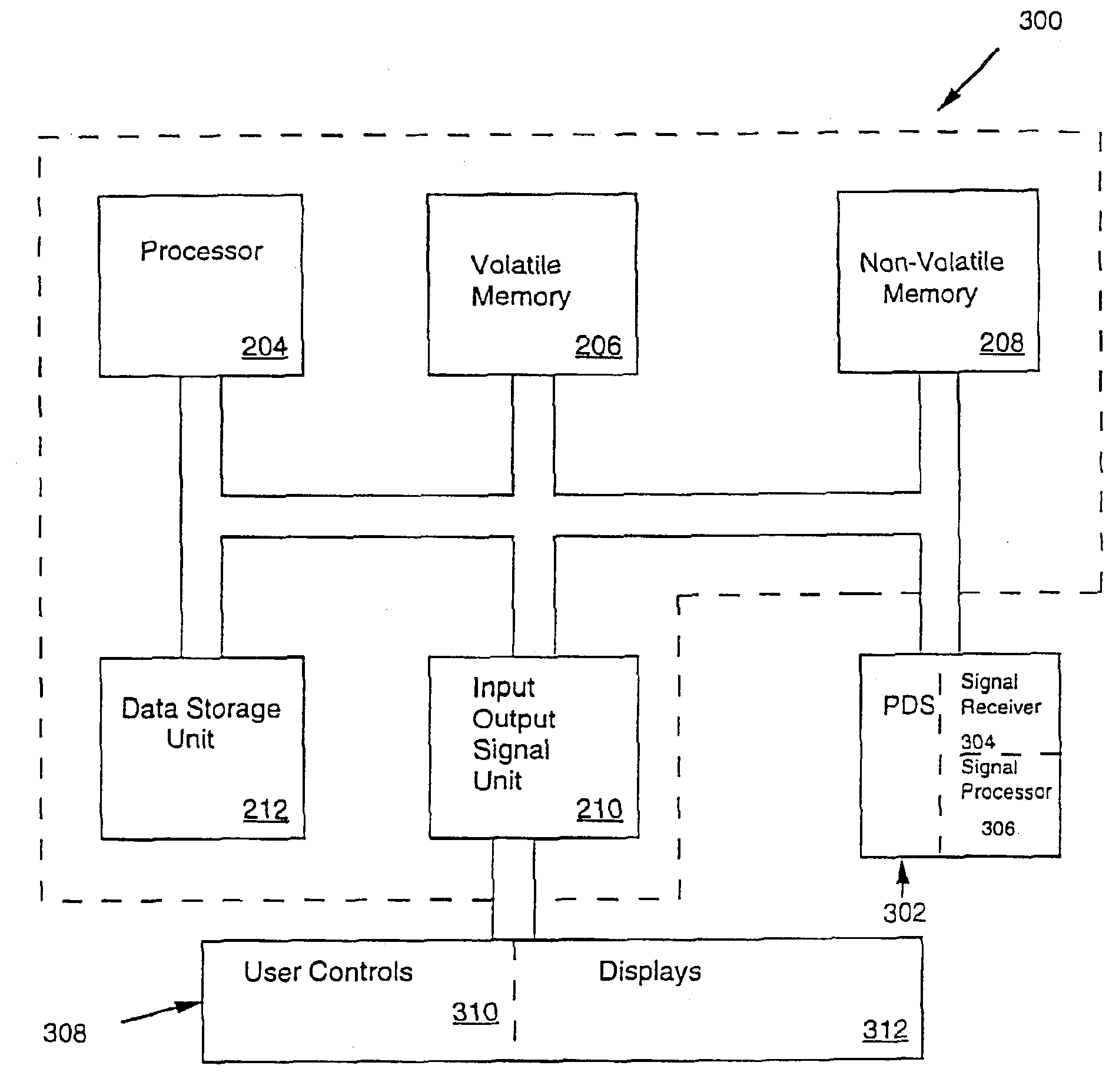
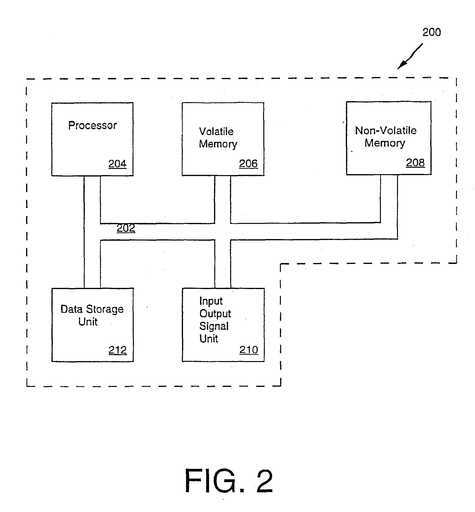
[0016]The present invention comprises a radio-navaid emulating GPS navigation system. More specifically, in one embodiment, the present invention includes a position determining system which accurately determines the position of an aircraft. The position determining system is a GPS based position determining system in the present embodiment. The present embodiment also includes a data storage device which is adapted to contain latitude and longitude information corresponding to radio navaid locations and the like. In the present embodiment, a processor is coupled to the position determining system. The processor calculates position and navigation information using data from the data storage device and the location information determined by the GPS based position determining system. In the present invention, a radio navaid emulating user interface then reports the position and navigation information to the pilot. In so doing, the present invention provides navigation information with GPS level accuracy in a well known and widely accepted radio navigation user interface. Thus, the present invention allows pilots to fully utilize the features and advantages of GPS navigation without requiring the pilot to spend an inordinate amount of time learning a new navigation system. The emulation process of the present invention is transparent to the pilot, as the pilot operates the present invention as though it was a conventional, and much less accurate, radio navigation based navaid.
[0017]In one embodiment, the pilot enters a desired navaid into the present radio navigation emulating GPS system by tuning or entering into the present system the frequency or three letter identifier associated with the navaid. Such entries are typically made when the pilot is planning the flight route. The present invention then accesses stored information to find the precise lat-long of the navaid whose frequency or three letter identifier the user selected. Thus, although the pilot tunes or selects a ground based transmitter when using the present invention, the pilot is actually selecting a virtual station. That is, instead of actually tuning in the frequency entered by the pilot, the present invention determines the lat-long information of the selected navaid. Therefore, the pilot operates the controls of the present invention in the same manner as a pilot would operate a radio navigation device. As a result, to the pilot, the present invention appears to be functioning the same as a radio navigation system functions. In the present embodiment, a display of the present invention will also display the letters identifying the station having the selected frequency. Additionally, the present embodiment also displays the lat-long of the selected navaid. The present invention uses the position information of the aircraft to calculate the bearing to the selected navaid from the present location of the aircraft. The bearing pointer will indicate exact bearing to the navaid selected by the pilot. Thus, the present invention calculates the bearing from the precise lat-long of the aircraft to the precise lat-long of selected navaid. Thus, the present invention provides satellite based accuracy levels in what appears to the pilot to be a radio navigation system. As yet another advantage, the present invention does not have the inherent range limitations associated with prior art radio navigation systems. That is, the present invention compares the lat-long of the navaid with the lat-long of the aircraft to indicate the bearing from the aircraft to the navaid. The present invention eliminates the need to receive radio signals from the navaid before a bearing can be calculated. Hence, the present invention is not limited by the radio signal range of a navaid. Therefore, the range of the present invention is not limited. Therefore, the present invention can accurately provide a bearing from the aircraft to a navaid located well beyond the range of radio signals. Consequently, the present invention provides direct routing over an unlimited distance. Thus, the benefit of direct routing will be retained in a system which appears to the pilot to be a radio navigation based system. All of the aforementioned benefits are realized without requiring re-training of the pilot.

Problems solved by technology

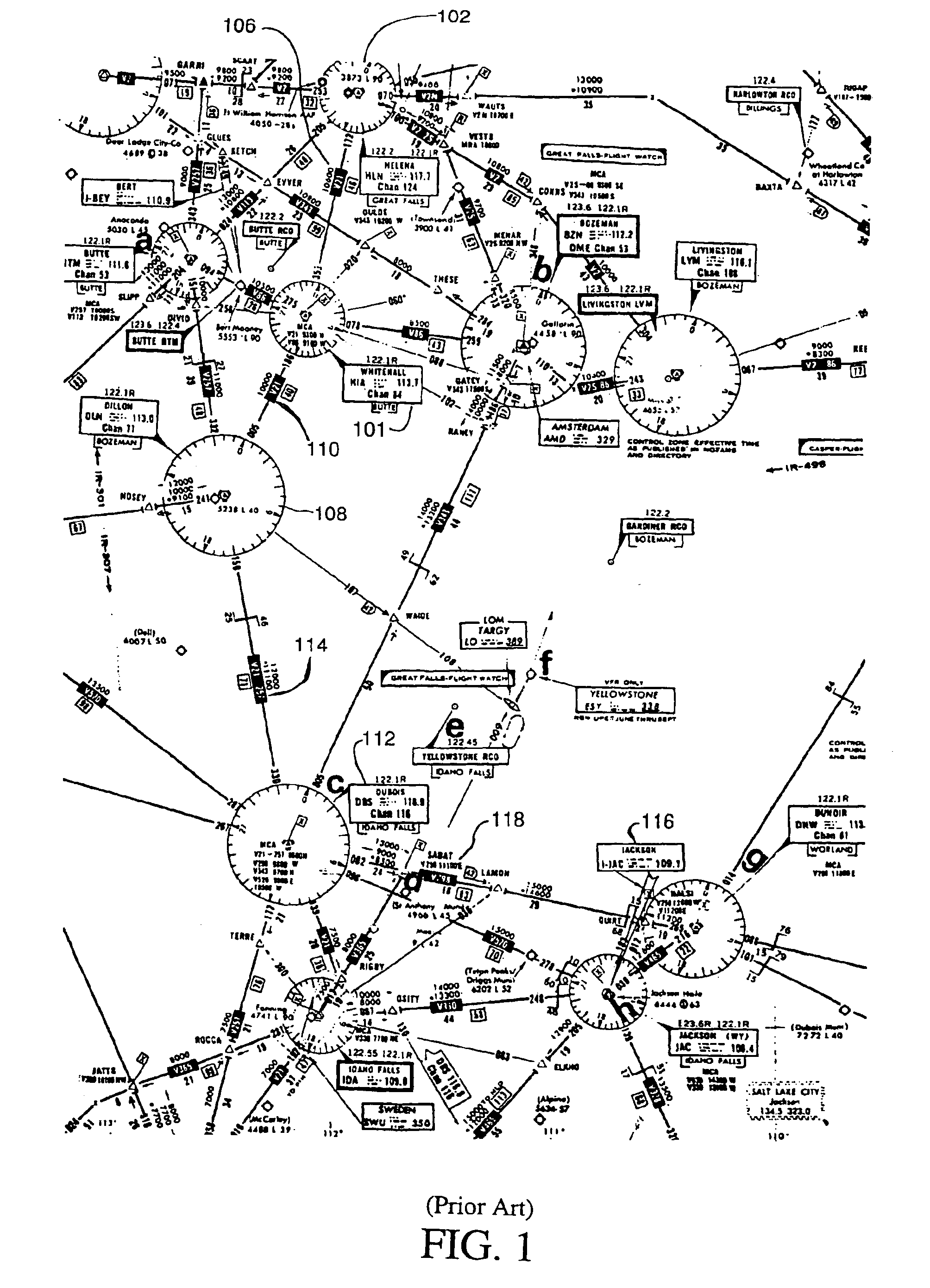
As a result, VOR range is typically limited to 130 nautical miles at best due to the curvature of the earth.
However, other obstructions can further limit the range of conventional VOR systems.
Additionally, intrinsic VOR system errors contribute substantial error to VOR readings.
As with VOR stations DME systems also suffer from significant error.
Furthermore, due to the interactive nature of DME systems, DME stations can become overloaded in congested airspace environments.
TACAN, like other radio navigation systems, has error associated therewith.
Additionally, NDB radio signals are subject to many propagational and atmospheric degradations which further reduce the accuracy of the NDB system.
Hence existing radio navigation systems have considerable errors and inaccuracies associated therewith.
Thus, even though conventional radio navigation systems may have errors and inaccuracies associated therewith many pilots are reluctant to give up familiar instrumentation devices.
As yet another drawback, in a radio navigation system, a pilot navigates the aircraft along a route which extends from one radio transmitter to another radio transmitter and so on, until the aircraft reaches the desired location.
As a result pilots are often forced to travel along a circuitous route to reach a desired destination.
Hence, there is great reluctance in the pilot community to use new GPS based navigation aids.
Training necessary to safely and properly operate these new GPS navaids is highly specialized and is very expensive.
Furthermore, very few flight instructors in the general aviation community have experience with the newer models of GPS navaids.
Thus, current GPS navigation products from avionics manufacturers are often difficult to use in the actual in-flight environment.
As a result, a very significant safety issue arises when attempting to transition pilots from conventional radio navigation to GPS based navigation.

Method used


Image

  • Radio navigation emulating GPS system
  • Radio navigation emulating GPS system
  • Radio navigation emulating GPS system

Examples


Embodiment Construction

[0028]Reference will now be made in detail to the preferred embodiments of the invention, examples of which are illustrated in the accompanying drawings. While the invention will be described in conjunction with the preferred embodiments, it will be understood that they are not intended to limit the invention to these embodiments. On the contrary, the invention is intended to cover alternatives, modifications and equivalents, which may be included within the spirit and scope of the invention as defined by the appended claims. Furthermore, in the following detailed description of the present invention, numerous specific details are set forth in order to provide a thorough understanding of the present invention. However, it will be obvious to one of ordinary skill in the art that the present invention may be practiced without these specific details. In other instances, well known methods, procedures, components, and circuits have not been described in detail as not to unnecessarily ob...


PUM


Abstract

The present invention provides a radio navigation emulating GPS device. In one embodiment, the radio navigation emulating GPS device receives an identifier associated with a conventional radio navaid. The present radio navigation emulating GPS device then retrieves latitude and longitude information corresponding to the received conventional radio navaid from a database. A satellite based position information system generates position information for the aircraft on which the present radio navigation emulating GPS device is disposed. The present radio navigation emulating GPS device then generates navigation information for the aircraft using the retrieved latitude and longitude information and the satellite based position information for the aircraft. The present radio navigation emulating GPS device then presents the navigation information in a manner which emulates the presentation of navigation information generated by a conventional radio navigation device. The entire emulation process is transparent to the user of the present radio navigation emulating GPS device.

Description

CROSS REFERENCE TO RELATED APPLICATIONS[0001]This is a continuation of U.S. patent application Ser. No. 09 / 705,116 filed on Nov. 1, 2000, now U.S. Pat. No. 6,606,559, which is hereby incorporated by reference to this specification.TECHNICAL FIELD[0002]The present relates to navigation aids. In particular, the present invention pertains to aviation navigation aids.BACKGROUND ART[0003]For the past 40 years, air navigation has primarily consisted of various forms of radio direction finding devices. With these devices, navigation information is transmitted from a fixed ground station and received by airborne aircraft equipped with the appropriate receivers. Each ground transmitter has a unique radio frequency associated therewith. To navigate an aircraft, the pilot dials or tunes a receiver to the frequency associated with the ground based transmitter, and then flies the aircraft towards the transmitter. Once the pilot reaches the transmitter, the pilot tunes in the frequency of the nex...

Claims


Application Information

Patent Timeline
IPC IPC(8): G01C21/00G01S1/00G01S1/08G06F7/78G06F7/76G01S5/14G01S19/14G01S19/48
CPCG01C21/005G01S1/08G01S19/42G01S19/15G01S19/13
Inventor BECKMANN, MARTINGUNDERSON, CHARLES M.
Owner TRIMBLE NAVIGATION LTD
Learn More