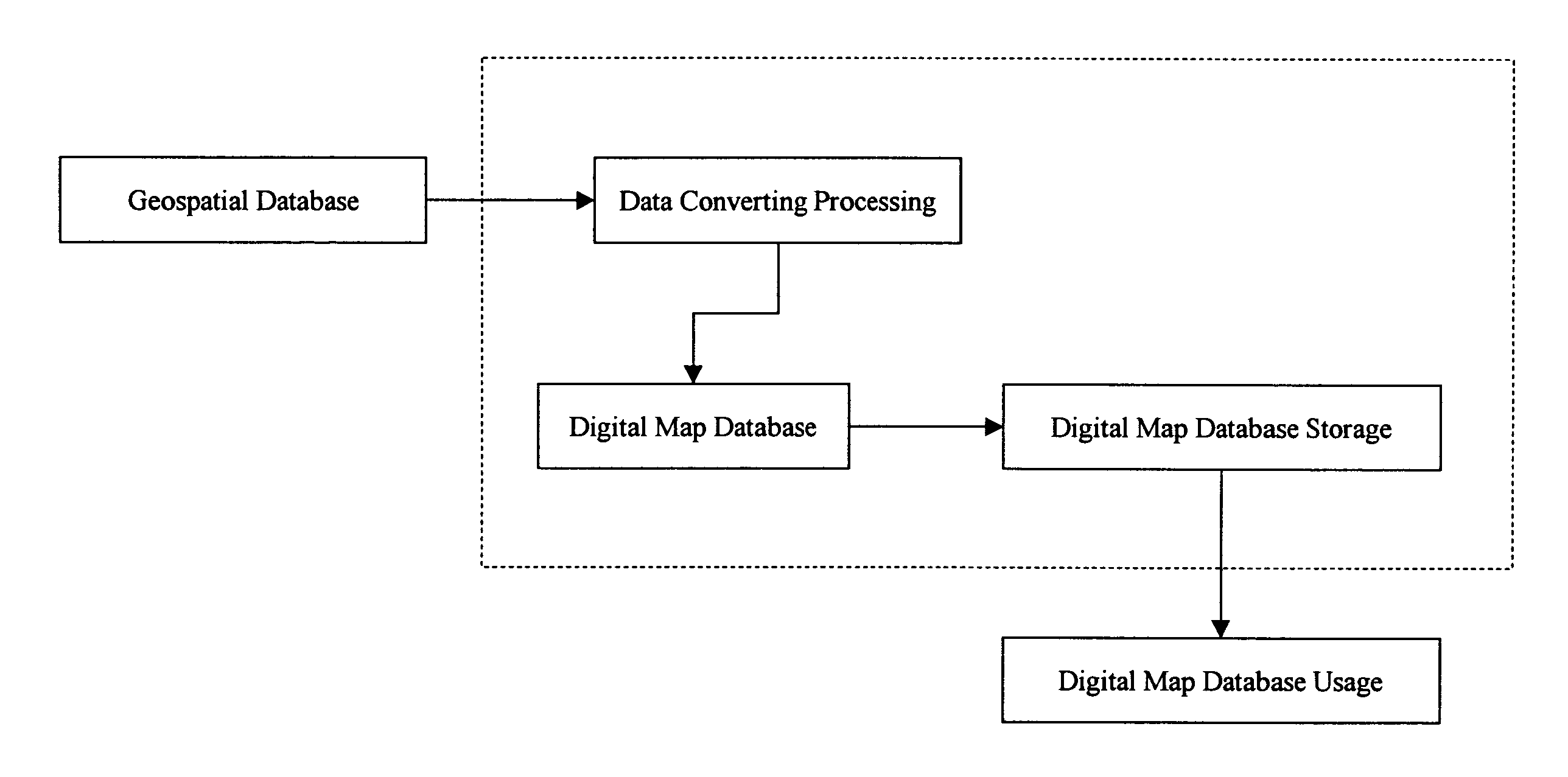
Method of converting geospatial database into compressive database for multiple dimensional data storage
a geospatial database and database technology, applied in the field of computer data converting process, can solve the problems of wasting limited resources but also breaking business budgets, unable to download databases to some application platforms with limited memory resources, and employing expensive data storage devices, so as to prolong application availability, reduce hardware requirements, and enhance application performance
- Summary
- Abstract
- Description
- Claims
- Application Information
AI Technical Summary
Benefits of technology
Problems solved by technology
Method used
Image


Examples
example 1
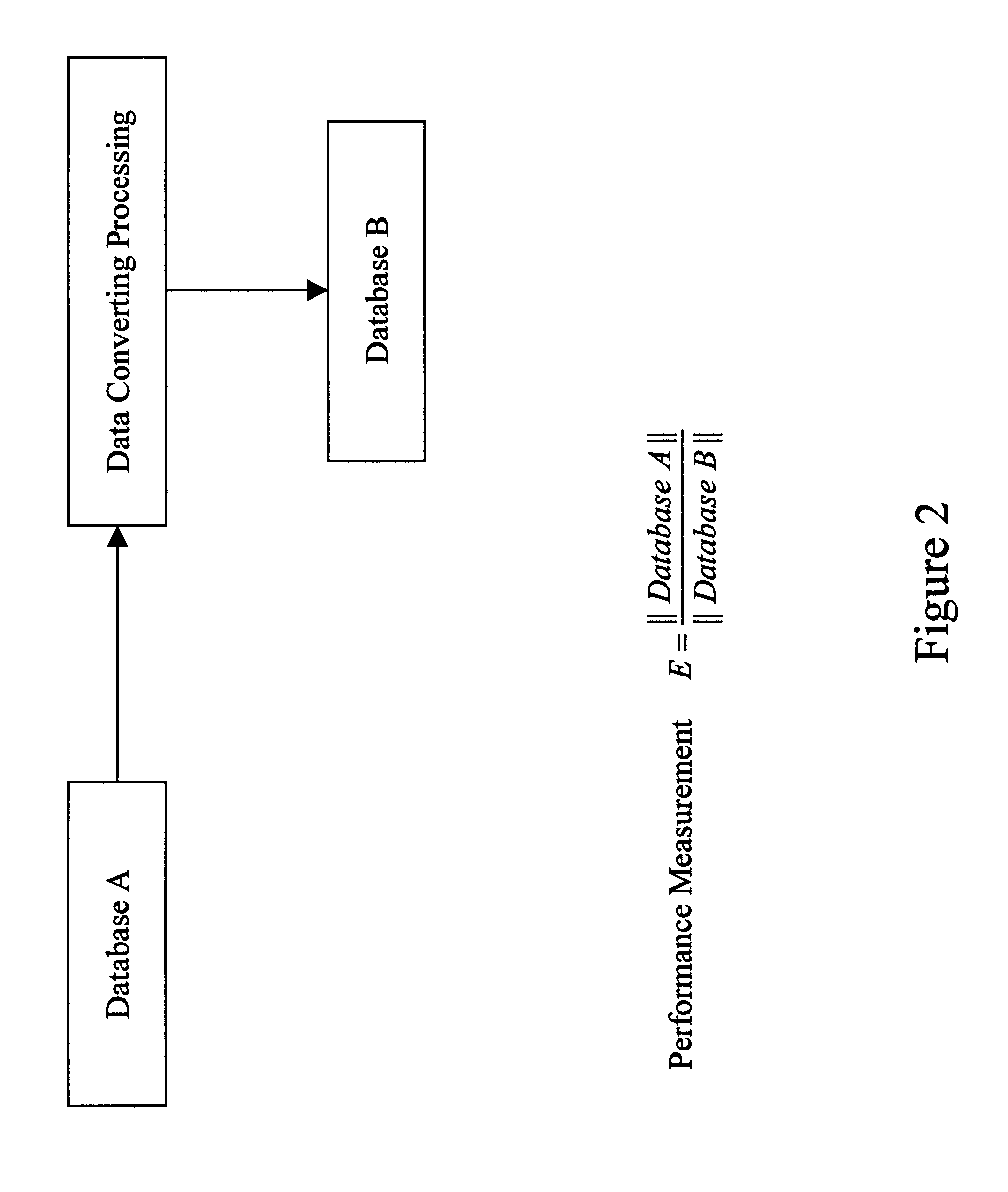
Consider a point B1 in a three dimensional Cartesian coordinate system. The point B1 has coordinate values (xb=[1 0 0]T) with respect to the coordinate system A. Assume that each element of the point coordinate values varies from 0 to 255. Only 3 bytes are needed to store the coordinate values of the point B1 in the coordinate system A. Further consider another coordinate system B. The coordinate system B has the coordinate origin point coincident with that of the coordinate system A, and is rotated by an angle of 30 degrees along the z-axis in a counterclockwise direction with respect to the coordinate system A. The coordinate values of the point B1 with respect to the coordinate system B are then expressed as x=[0.866025 0.5 0.0]T. 24 bytes are needed to store the coordinate values of the same point B1 as a double precision floating point number format without the precision loss of the coordinate value.
example 2
Consider a segment of a street record stored in an ESRI (Environment Systems Research Institute) shape file, which consists of a set of longitude and latitude coordinates. For example, it has three points: P1-(−180°05.0001′, 24°34.0502′), P2-(−180°05.0003′, 24°34.0512′), and P3-(−180°05.0006′, 24°34.0524′). For this street segment, 48 bytes are needed to store the data. If the first point P1 is selected as the reference point position, then the successive two points P2 and P3 can be expressed as RP1-(−0.0002′, 0.0010′), and RP2-(−0.0005′, 0.0022′) in the local coordinate system. If a scaling factor 10000 is introduced, then RP1 and RP2 can be expressed as (−2, 10), (−5, 22), which can be stored by using only 4 bytes. The total bytes used to store the street segment are 20 bytes, where 16 bytes are for the reference point position P1 and 4 bytes for the two local coordinate points (RP1 and RP2). As mentioned in steps (b) and (c), the street segment record may belong to a data segment...
PUM
 Abstract
Description
Claims
Application Information
 - R&D
- Intellectual Property
- Life Sciences
- Materials
- Tech Scout
- Unparalleled Data Quality
- Higher Quality Content
- 60% Fewer Hallucinations
Browse by: Latest US Patents, China's latest patents, Technical Efficacy Thesaurus, Application Domain, Technology Topic, Popular Technical Reports.
© 2025 PatSnap. All rights reserved.Legal|Privacy policy|Modern Slavery Act Transparency Statement|Sitemap|About US| Contact US: help@patsnap.com