
Information processing apparatus, information processing method, and storage medium

a technology of information processing apparatus and information processing method, applied in the direction of location information based service, navigation instruments, instruments, etc., can solve the problems of difficult to achieve highly accurate position and orientation estimation using map data (three-dimensional map information) subject to loop closing processing, and achieve high-quality position and orientation estimation

Pending Publication Date: 2022-09-15
CANON KK
View PDF0 Cites 0 Cited by
  • Summary
  • Abstract
  • Description
  • Claims
  • Application Information

AI Technical Summary

Benefits of technology

The present disclosure is about generating map data that can accurately estimate the position and orientation of a moving object. The technical effect of this patent is to provide more accurate location and orientation information for map data, which can be useful for various applications such as autonomous vehicles.

Problems solved by technology

Accordingly, the accuracy of the calculated relative position and orientation is not sufficient, which makes it difficult to achieve highly accurate position and orientation estimation using the map data (three-dimensional map information) subjected to loop closing processing.

Method used


Image

  • Information processing apparatus, information processing method, and storage medium
  • Information processing apparatus, information processing method, and storage medium
  • Information processing apparatus, information processing method, and storage medium

Examples


first exemplary embodiment

(Effects of First Exemplary Embodiment)

[0062]The above-described processing according to the present exemplary embodiment makes it possible to generate map data with which highly accurate position and orientation estimation can be achieved even in a case where a loop is detected between measurement points that are close to each other in the real space.

[0063]The first exemplary embodiment described above illustrates the example where the map data created by the moving object 302 having a sensor mounted thereon is corrected on the information processing apparatus 301 that is provided independently of the moving object 302. A second exemplary embodiment illustrates an example where a moving object having an information processing apparatus mounted thereon creates map data while traveling in an environment and the moving object performs map correction processing in parallel with measurement point generation processing on the map data. The second exemplary embodiment also illustrates an ...

second exemplary embodiment

(Effects of Second Exemplary Embodiment)

[0106]The above-described processing according to the present exemplary embodiment makes it possible to generate environment map data with which highly accurate position and orientation estimation can be achieved even in a case where map data creation processing and correction processing are performed in parallel.

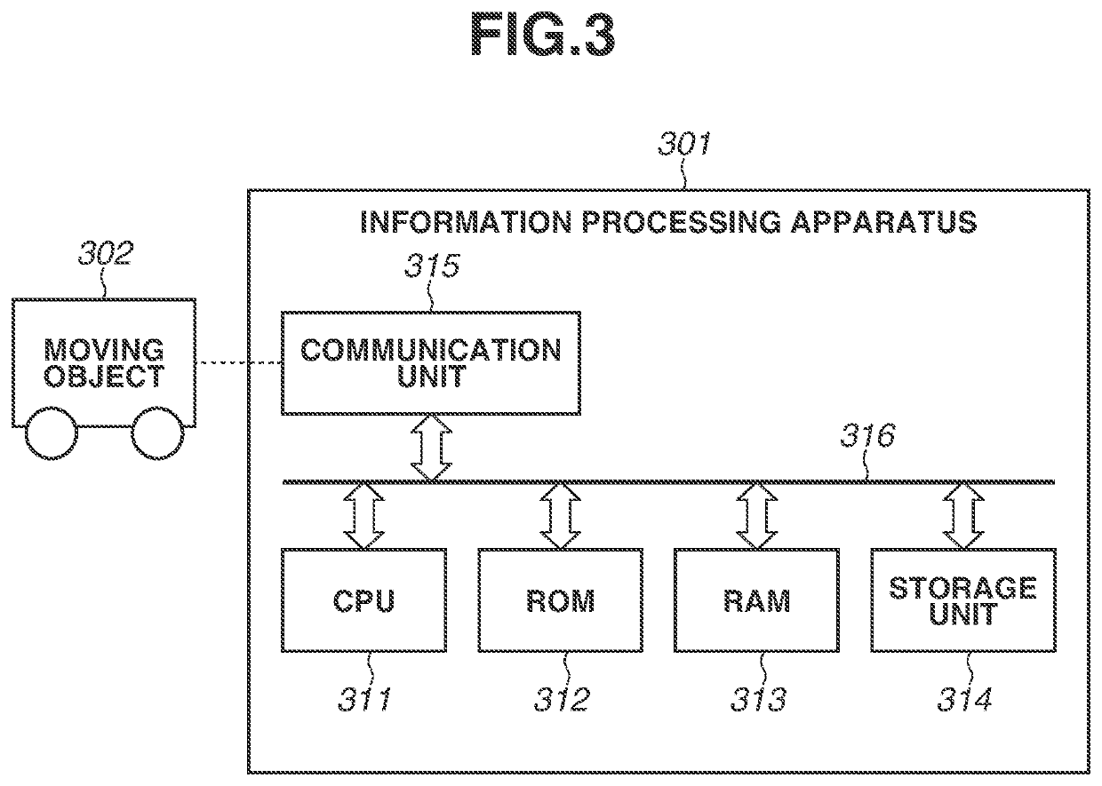
[0107]In the first and second exemplary embodiments, a grayscale camera is used as the sensor. However, the type of sensor to be used, the number of sensors to be used, and the fixation method for the sensor are not particularly limited. Any apparatus can be used as the sensor as long as the apparatus can continuously acquire luminance images or depth images of a surrounding environment of a moving object as digital data. For example, not only a grayscale camera, but also a camera for capturing color images, a depth camera, 2D-LIDAR, or 3D-LIDAR can be used. Further, a plurality of cameras may be arranged in different directions of th...


PUM


Abstract

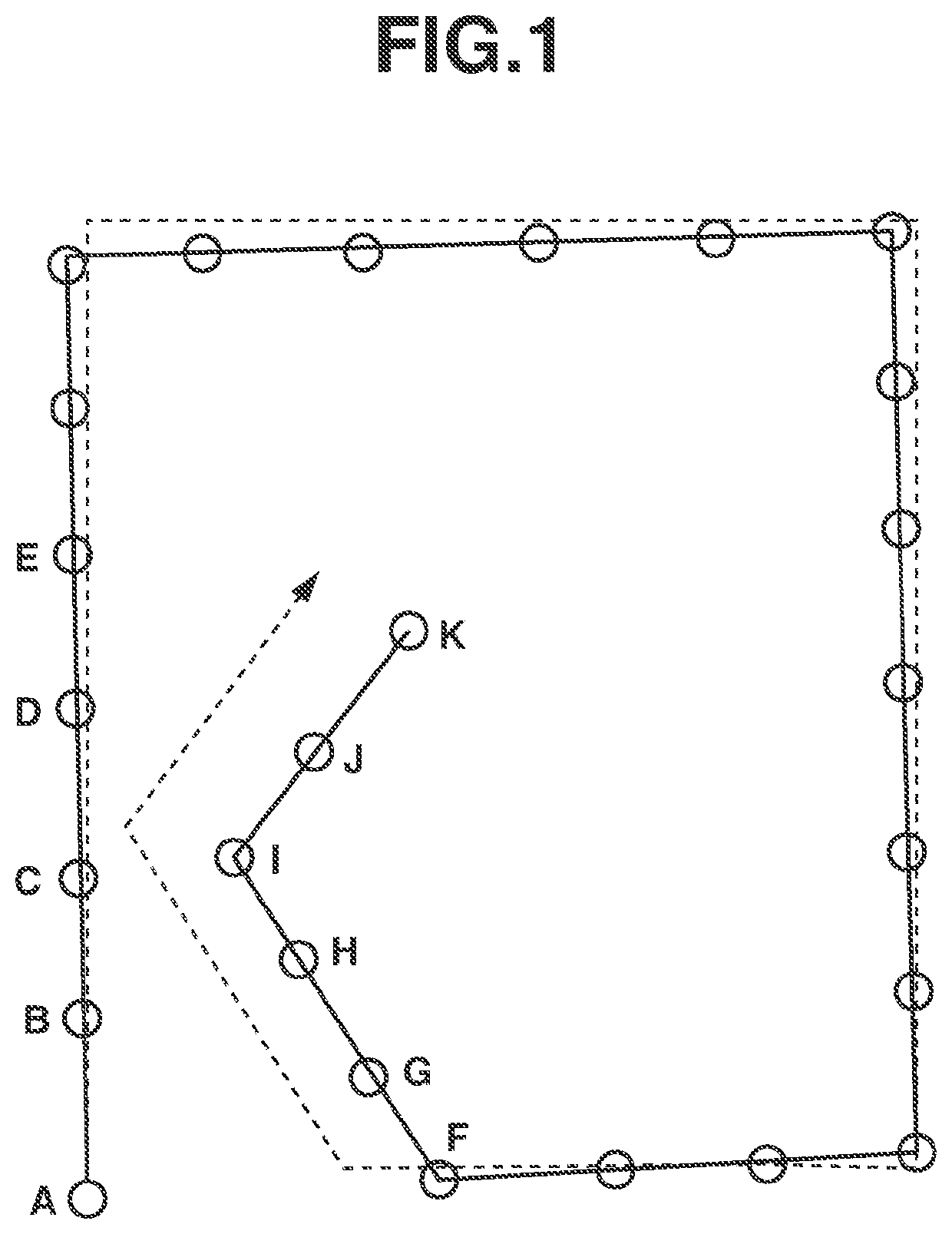
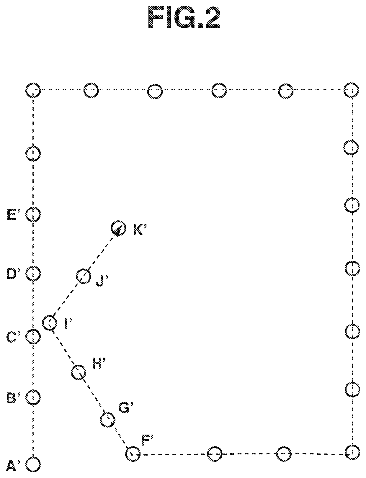
Provided is an information processing method for generating accurate map data by loop closing even when map elements where a loop is detected in a real space are close to each other. The method includes selecting a map elements group including at least one map element on each movement path, the at least one map element including sensor information included in each map element used to detect that the moving object has reached a location near a point a plurality of times, acquiring a relative position and orientation of at least one set of map elements in the map elements group, acquiring a relative position and orientation of the sensor between map elements corresponding to each movement path where the moving object has reached the location near the point the plurality of times, and correcting position and orientation information about the sensor included in each of the map elements.

Description

BACKGROUNDField of the Disclosure[0001]The present disclosure relates to a technique for creating three-dimensional map information about an environment in which a moving object moves.Description of the Related Art[0002]An autonomous moving object, such as an automated guided vehicle (AGV), is used in factories and distribution warehouses. A simultaneous localization and mapping (SLAM) technique using a camera or a laser range scanner (laser range finder, laser imaging detection and ranging (LIDAR)) as a sensor is known as a method for estimating a position and orientation of such an AGV and creating electronic map data used for estimation. The position and orientation estimation uses a three-dimensional map representing an environment in which image features detected from image information and three-dimensional positional information about the image features measured based on the image features are used as map elements.[0003]Mur-Artal, R., & Tardos, J. D. ORB-SLAM2: An Open-Source ...

Claims


Application Information

Patent Timeline
Patent Type & Authority Applications(United States)
IPC IPC(8): G01C21/36H04W4/029G01C21/00H04W4/02G01C21/30
CPCG01C21/3638H04W4/029G01C21/3844H04W4/025G01C21/30H04W4/38H04W4/026
Inventor IMAI, AYATO
Owner CANON KK
Learn More