
Map Updates from a Connected Vehicle Fleet

a connected vehicle and fleet technology, applied in the field of map updates, can solve the problems of data transfer placing an unwanted burden on the user device as well as the network, illustrations are merely representations, and may not be drawn to scal

Active Publication Date: 2017-09-28
HERE GLOBAL BV
View PDF3 Cites 92 Cited by
  • Summary
  • Abstract
  • Description
  • Claims
  • Application Information

AI Technical Summary

Benefits of technology

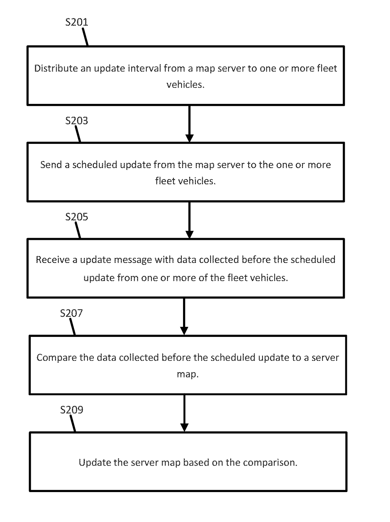
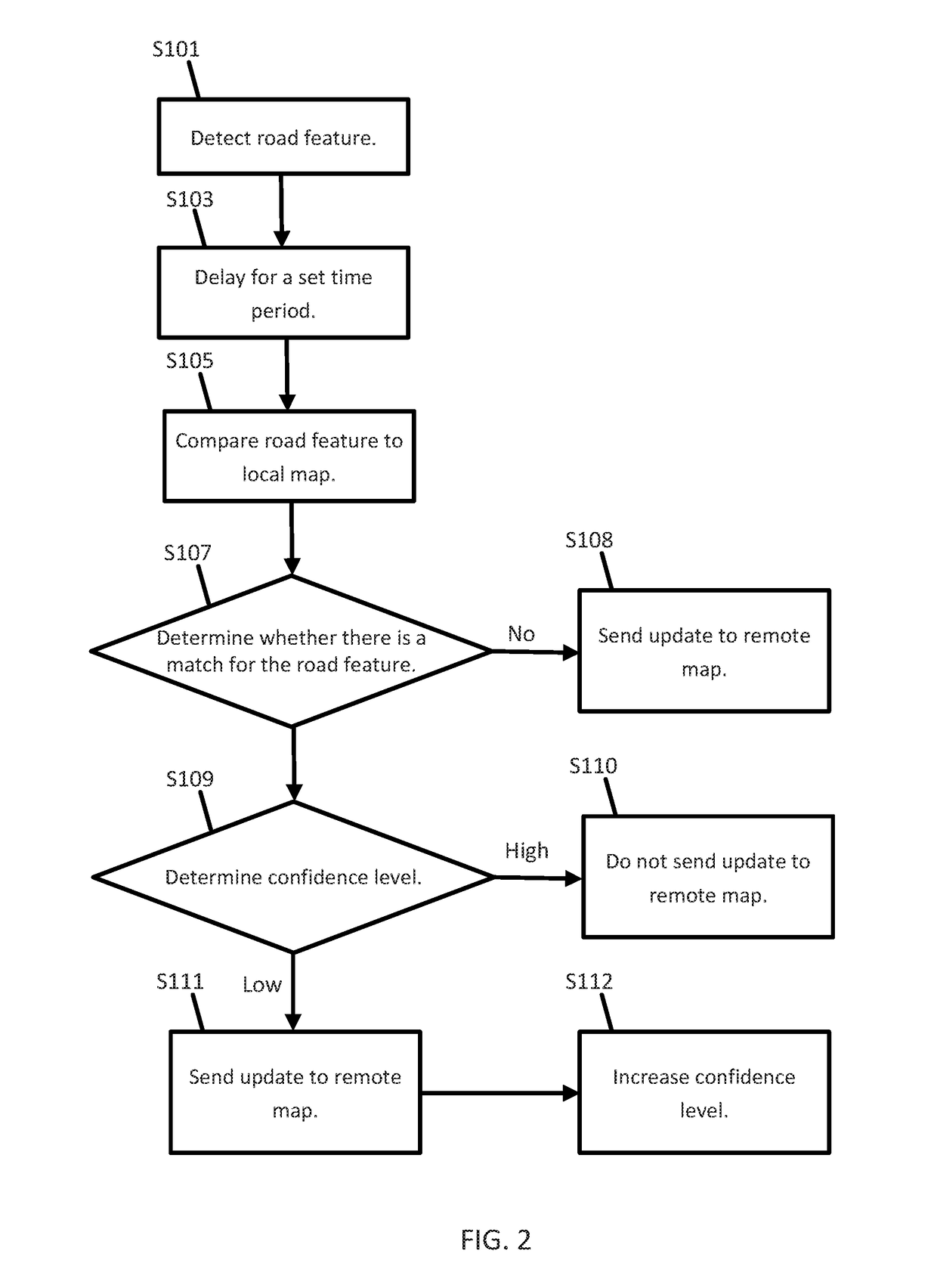
The patent describes a system for updating a remote database with sensor data about road objects, such as signs or potholes, at specific times. The system uses a sensor to collect data, a position detector to determine the location of the object, and a controller to compare the location to a local database and update the remote database accordingly. The system can also discard data if it is not confident in the information. The technical effect of this invention is to improve the accuracy and reliability of updating geographic databases with real-time sensor data.

Problems solved by technology

However, the data transfer may place an unwanted burden on the user devices as well as the network.
Hazard related traffic objects may include stalled vehicles, emergency vehicles, and road obstacles.
Additionally, the illustrations are merely representational and may not be drawn to scale.

Method used


Image

  • Map Updates from a Connected Vehicle Fleet
  • Map Updates from a Connected Vehicle Fleet
  • Map Updates from a Connected Vehicle Fleet

Examples


Embodiment Construction

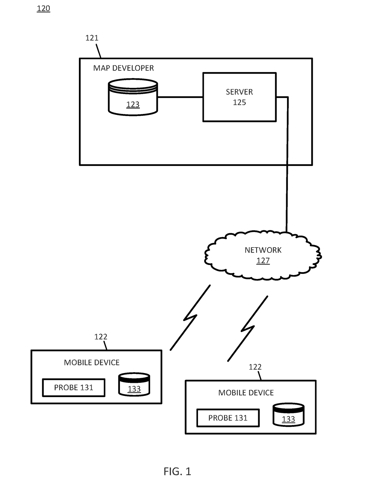
[0017]A connected vehicle includes a communication device and an environment sensor array. The connected vehicle may include an integrated communication device coupled with an in-dash navigation system. The connected vehicle may include an ad-hoc communication device such as a mobile device or smartphone in communication with a vehicle system. The communication device connects the vehicle to a network including at least one other vehicle and at least one server. The network may be the Internet or connected to the Internet.

[0018]The sensor array may include one or more sensors configured to detect surroundings of the vehicle, and more specifically, one or more road furniture items. The sensor array may include multiple sensors. Example sensors include an optical distance system such as light detection and ranging (LiDAR), an image capture system such as a camera, a sound distance system such as sound navigation and ranging (SONAR), a radio distancing system such as radio detection an...


PUM


Abstract

A road furniture item or another type of road object is detected by at least one sensor. An associated geographic position associated with the road furniture item or road object is determined. After a predetermined time is reached, the geographic position is compared to a local database. A remote database is updated after the predetermined time is reached and according to the comparison with the local database. In some examples, the data indicative of the road furniture item or the road object is deleted based on a confidence level in the local database.

Description

FIELD[0001]The following disclosure relates to map updates, and more particularly, map updates from a fleet of connected vehicles.BACKGROUND[0002]Map databases may be used to provide navigation based features such as routing instructions for an optimum route from an original location to a destination location and map based features such as section and display of maps to manually locate locations or points of interest. Map databases are used in driver assistance systems or driverless systems. Map databases are also used in systems that improve vehicle fuel economy, such as systems that optimize transmission gear selection taking into account upcoming slope and speed changes.[0003]Map attributes often change over time. As new roads are built, other roads are closed, speed limits change, or locations of business are changed, the geographic database should be updated. Real world observations may be indicative of the map attribute changes. Crowd sourcing may be used to receive update inf...

Claims


Application Information

Patent Timeline
IPC IPC(8): G06F17/30G01C21/32
CPCG01C21/32G06F17/30241H04L67/12G06F16/2365G06F16/23G06F16/29
Inventor GIURGIU, GAVRILSTENNETH, LEON
Owner HERE GLOBAL BV
Learn More