Government structures and neigbhorhood leads in a geo-spatial environment
a geo-spatial environment and government structure technology, applied in the field of communication, can solve problems such as lack of recognition, online community may suffer, and considerable setbacks
- Summary
- Abstract
- Description
- Claims
- Application Information
AI Technical Summary
Benefits of technology
Problems solved by technology
Method used
Image
Examples
Embodiment Construction
[0068]A method, apparatus and system of determining neighborhood and / or regional leads and forming government structures in an online geo-spatial social community are disclosed. In the following description, for the purposes of explanation, numerous specific details are set forth in order to provide a thorough understanding of the various embodiments. It will be evident, however to one skilled in the art that the various embodiments may be practiced without these specific details.
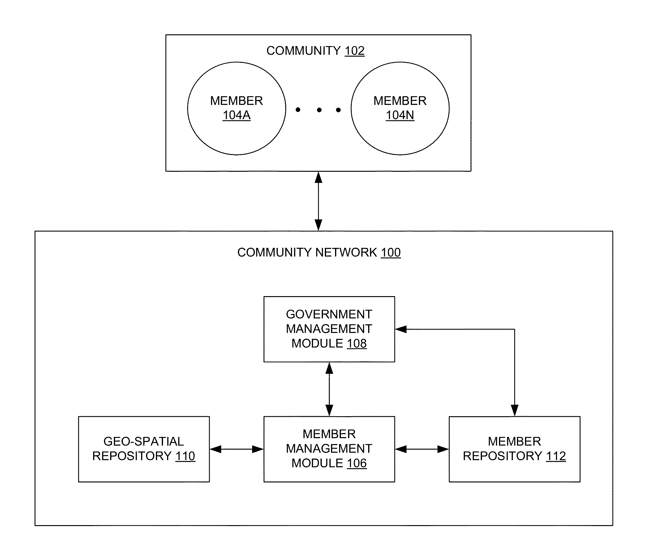
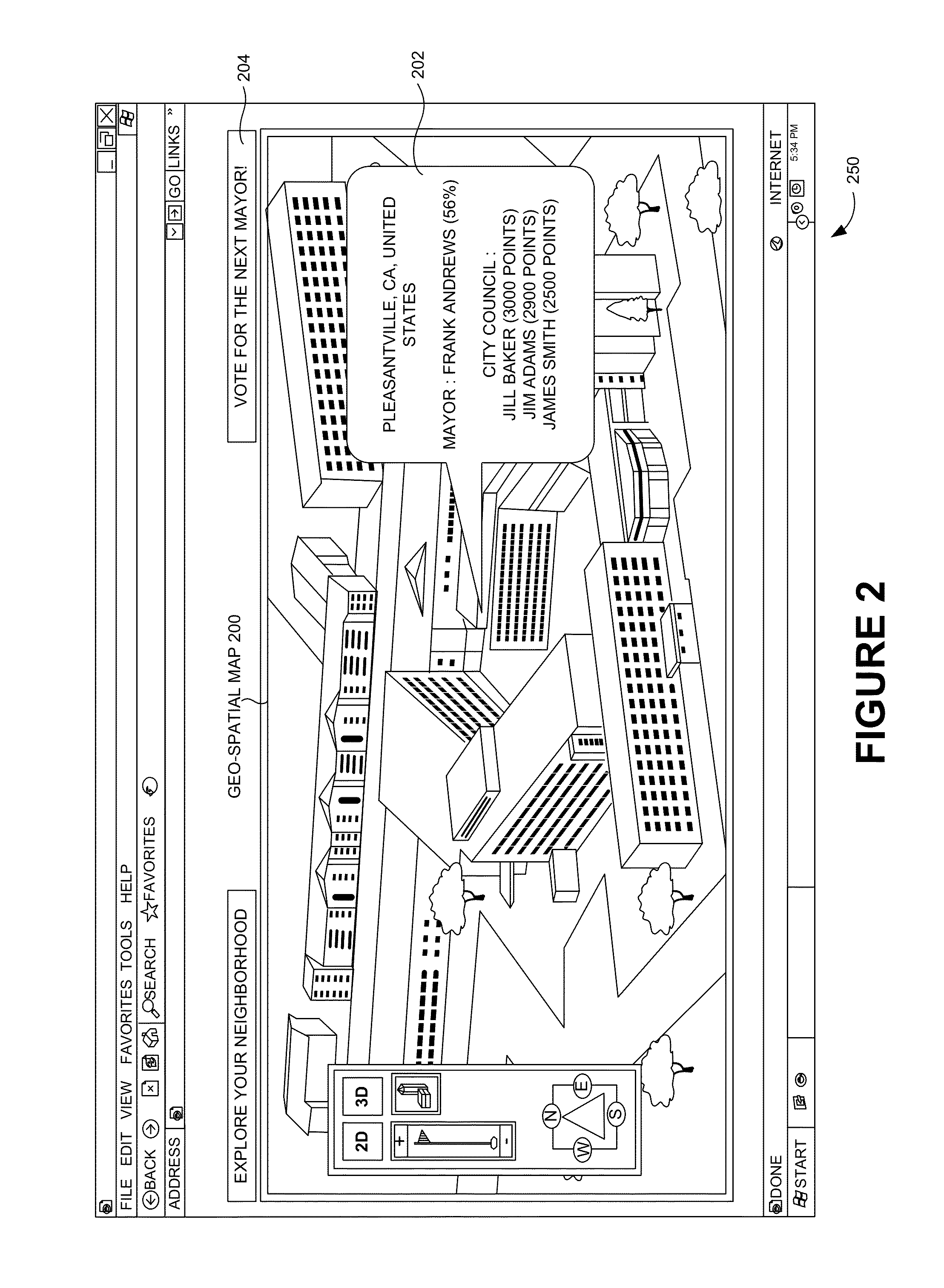
[0069]In one embodiment, a method of organizing a community network (e.g., the community network 100 of FIG. 1) includes obtaining (e.g., through the geo-spatial repository 110 of FIG. 1) a region on a geo-spatial map (e.g., the geo-spatial map 200 of FIGS. 2, 3, 4 and 5), obtaining (e.g., through the member repository 112 of FIG. 1) a first subset of members (e.g., the members 104A-N of FIG. 1) of the community network 100 associated with the region, determining a second subset of the members 104A-N with a...
PUM
 Abstract
Description
Claims
Application Information
 - R&D
- Intellectual Property
- Life Sciences
- Materials
- Tech Scout
- Unparalleled Data Quality
- Higher Quality Content
- 60% Fewer Hallucinations
Browse by: Latest US Patents, China's latest patents, Technical Efficacy Thesaurus, Application Domain, Technology Topic, Popular Technical Reports.
© 2025 PatSnap. All rights reserved.Legal|Privacy policy|Modern Slavery Act Transparency Statement|Sitemap|About US| Contact US: help@patsnap.com


