
Marine seismic surveys using clusters of autonomous underwater vehicles

a technology of autonomous underwater vehicles and seismic surveys, applied in the direction of measuring devices, instruments, scientific instruments, etc., can solve the problems of difficulty in maneuvering the streamer array around various obstacles, high cost of streamers, and high cost of traditional configuration

Active Publication Date: 2014-06-26
SEABED GEOSOLUTIONS
View PDF26 Cites 46 Cited by
  • Summary
  • Abstract
  • Description
  • Claims
  • Application Information

AI Technical Summary

Benefits of technology

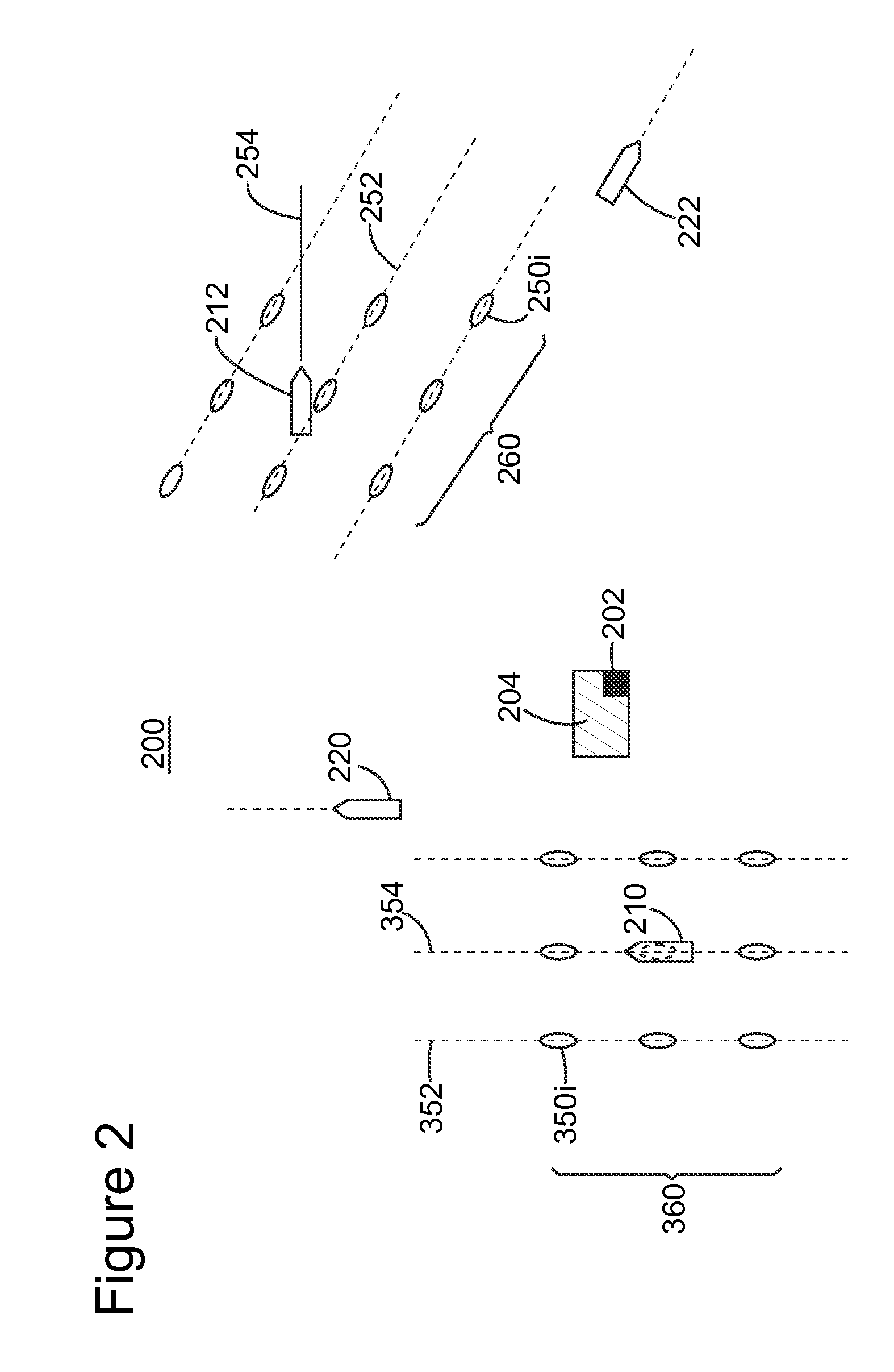
This patent describes a seismic survey system that includes first and second clusters of AUVs that follow their own paths, independent of each other. The system has a central control unit on a floating platform that remotely controls the first and second USVs. This results in a more efficient and effective seismic survey, as data can be recorded from both clusters simultaneously.

Problems solved by technology

While this profile does not provide an accurate location of oil and gas reservoirs, it suggests, to those trained in the field, the presence or absence of these reservoirs.
However, this traditional configuration is expensive because the cost of streamers is high.
Further, due to the great length of the streamers, e.g., 10 km, the streamer array is difficult to maneuver around various obstacles, e.g., an oil platform.
Even so, positioning the seismic sensors remains a challenge.
Although the ocean bottom nodes better handle the various obstacles present in the water, using them is still expensive and difficult because the sensors and corresponding pedestals are left on the seafloor.
Further, positioning the sensors is not straightforward.
However, many challenges remain with the use of a large number of AUVs for collecting seismic data.
One such challenge is the management of thousands of AUVs, maintaining the AUVs at desired positions while performing the survey, and / or retrieving all these AUVs.

Method used


Image

  • Marine seismic surveys using clusters of autonomous underwater vehicles
  • Marine seismic surveys using clusters of autonomous underwater vehicles
  • Marine seismic surveys using clusters of autonomous underwater vehicles

Examples


Embodiment Construction

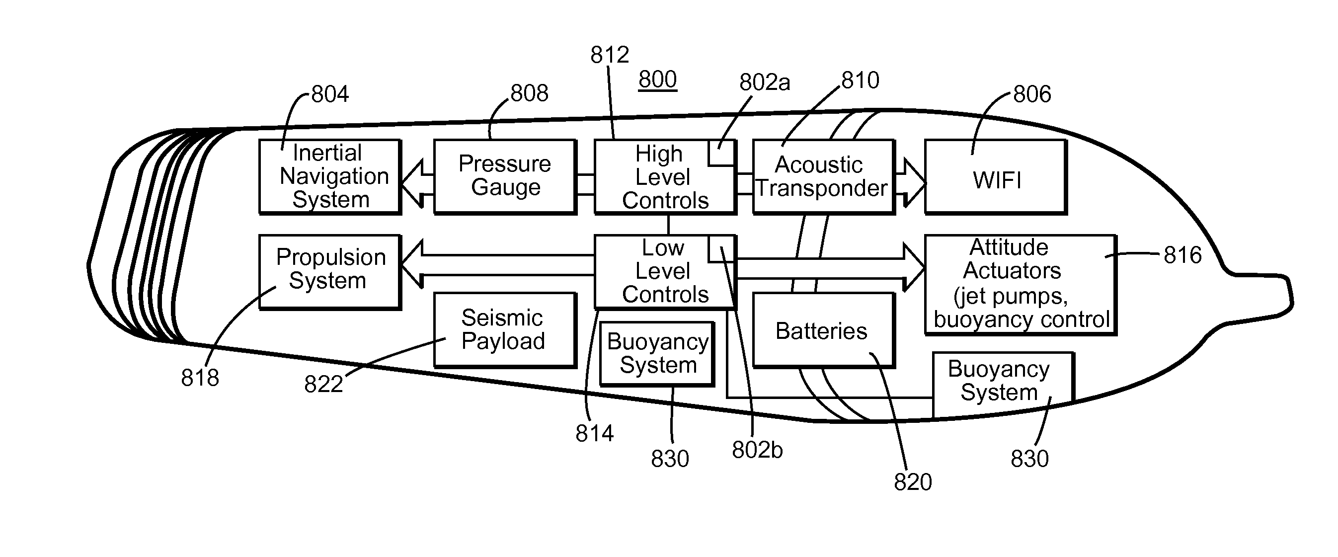
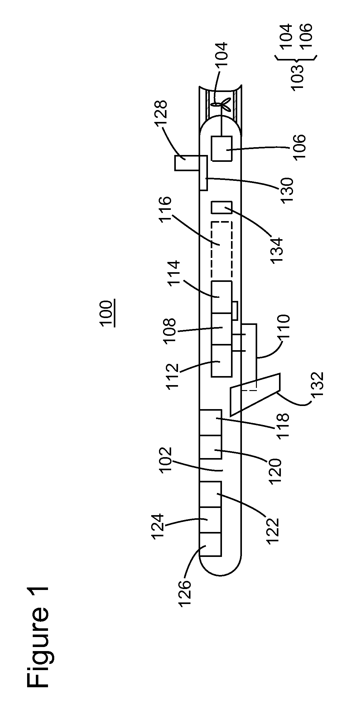
[0025]The following description of the exemplary embodiments refers to the accompanying drawings. The same reference numbers in different drawings identify the same or similar elements. The following detailed description does not limit the invention. Instead, the scope of the invention is defined by the appended claims. The following embodiments are discussed, for simplicity, with regard to the terminology and structure of an AUV having one or more seismic sensors. However, the embodiments to be discussed next are not limited to AUVs, but may be applied to other platforms (e.g., glider, buoy, etc.) that may carry seismic sensors.

[0026]Reference throughout the specification to “one embodiment” or “an embodiment” means that a particular feature, structure or characteristic described in connection with an embodiment is included in at least one embodiment of the subject matter disclosed. Thus, the appearance of the phrases “in one embodiment” or “in an embodiment” in various places thro...


PUM


Abstract

A seismic survey system records seismic signals during a marine seismic survey. The system includes first and second clusters, each including a set of autonomous underwater vehicles (AUVs); each cluster being associated with a corresponding first or second unmanned surface vehicle (USV); and a central control unit located on a floating platform and configured to control the first and second USVs. The first USV follows its own path and the first cluster follows the first USV independent of the second USV or the second cluster.

Description

CROSS REFERENCE TO RELATED APPLICATIONS[0001]The present application claims the benefit of priority under 35 U.S.C. §119(e) to U.S. Provisional Application Nos. 61 / 740,493 filed on Dec. 21, 2012 and 61 / 752,176 filed on Jan. 14, 2013. The entire contents of these documents are hereby incorporated by reference into the present application.BACKGROUND[0002]1. Technical Field[0003]Embodiments of the subject matter disclosed herein generally relate to methods and systems and, more particularly, to mechanisms and techniques for using clusters of autonomous underwater vehicles (AUVs) that carry seismic sensors for performing a marine seismic survey.[0004]2. Discussion of the Background[0005]Marine seismic data acquisition and processing generate a profile (image) of a geophysical structure under the seafloor. While this profile does not provide an accurate location of oil and gas reservoirs, it suggests, to those trained in the field, the presence or absence of these reservoirs. Thus, provi...

Claims


Application Information

Patent Timeline
Patent Type & Authority Applications(United States)
IPC IPC(8): G01V1/38
CPCG01V1/3808G01V1/3843
Inventor BRIZARD, THIERRY
Owner SEABED GEOSOLUTIONS
Learn More