
Target detecting, editing and rebuilding method and system by 3D image

a technology of target detection and editing, applied in the direction of distance measurement, instruments, optical elements, etc., can solve the problems of reducing the capacity and life of the dam, water pollution, and shortening the economic loss of domestic water

Inactive Publication Date: 2009-06-25
IND TECH RES INST
View PDF1 Cites 33 Cited by
  • Summary
  • Abstract
  • Description
  • Claims
  • Application Information

AI Technical Summary

Benefits of technology

[0033]The above contents and advantages of the present invention will become more readily apparent to those ordin

Problems solved by technology

The direct effect of the landslide is that the soil is scrubbed and glided along the gully, the valley and the river to the downstream area and aggregated in the bottom of the dam that makes the darn's capacity descended, makes the water pollution, makes the domestic water short and economic loss.
If the landslide area fails to be recovered quickly, the rain will scrub the surface soil and rock and further descend the capacity and the life of the dam.
The scene measurement and survey is the most precise and reliable manner, but it is ineffective, expensive, and easily affected by the terrain, the weather and traffic.
Using this technique can obtain the highly precise ground surface change in the small area, but needs lots of the manpower and the time and fails to rapidly and effectively provide the user with the relevant data for helping the survey and estimation of the disaster.
Accordingly, the detection criteria mentioned above are not so appropriate to be the necessary conditions of the automatic detection.
The technique of determining the landslide by using the satellite ortho-image is similar to that by using the aerial photos, but since the limitation of the space resolution of the satellite image, it more depends on the variation analysis in the different time.
After comparing these two techniques, it is found that the result of the landslide automatically detected by using the satellite image is less than that manually determined by using the aerial photos both in numbers and area, thus the automatic detection by using the satellite image is still not good enough for the engineering application.
However, since the satellite image has high time resolution and large shooting range that can quickly precede the ground surface survey after the disaster.
Moreover, there is no research using the airborne LiDAR to detect the range of the ground surface change automatically in the relevant references.
The accuracy of the LiDAR image in the elevation detection can reach to centimeter level even the millimeter level, but the accuracy of the LiDAR image in the plane position is lower in contrast, so the position accuracy of the ground surface boundary estimation is low.
Except the weather condition, the satellite image schedule and the data transporting time, the gain of the grounded remote detecting data is not easy to achieve the instantaneity, and the satellite image has higher time resolution than the aerial photos, so the satellite image has higher instantaneity in contrast.
However, the high level automation does not mean the high accuracy and the high reliability.
Although the subsequent manual determination cannot be avoided, the detecting ability of the algorithm highly reduces the level of the involved handwork.

Method used


Image

  • Target detecting, editing and rebuilding method and system by 3D image
  • Target detecting, editing and rebuilding method and system by 3D image
  • Target detecting, editing and rebuilding method and system by 3D image

Examples


Embodiment Construction

[0040]The present invention will now be described more specifically with reference to the following embodiments. It is to be noted that the following descriptions of preferred embodiments of this invention are presented herein for purposes of illustration and description only; it is not intended to be exhaustive or to be limited to the precise form disclosed.

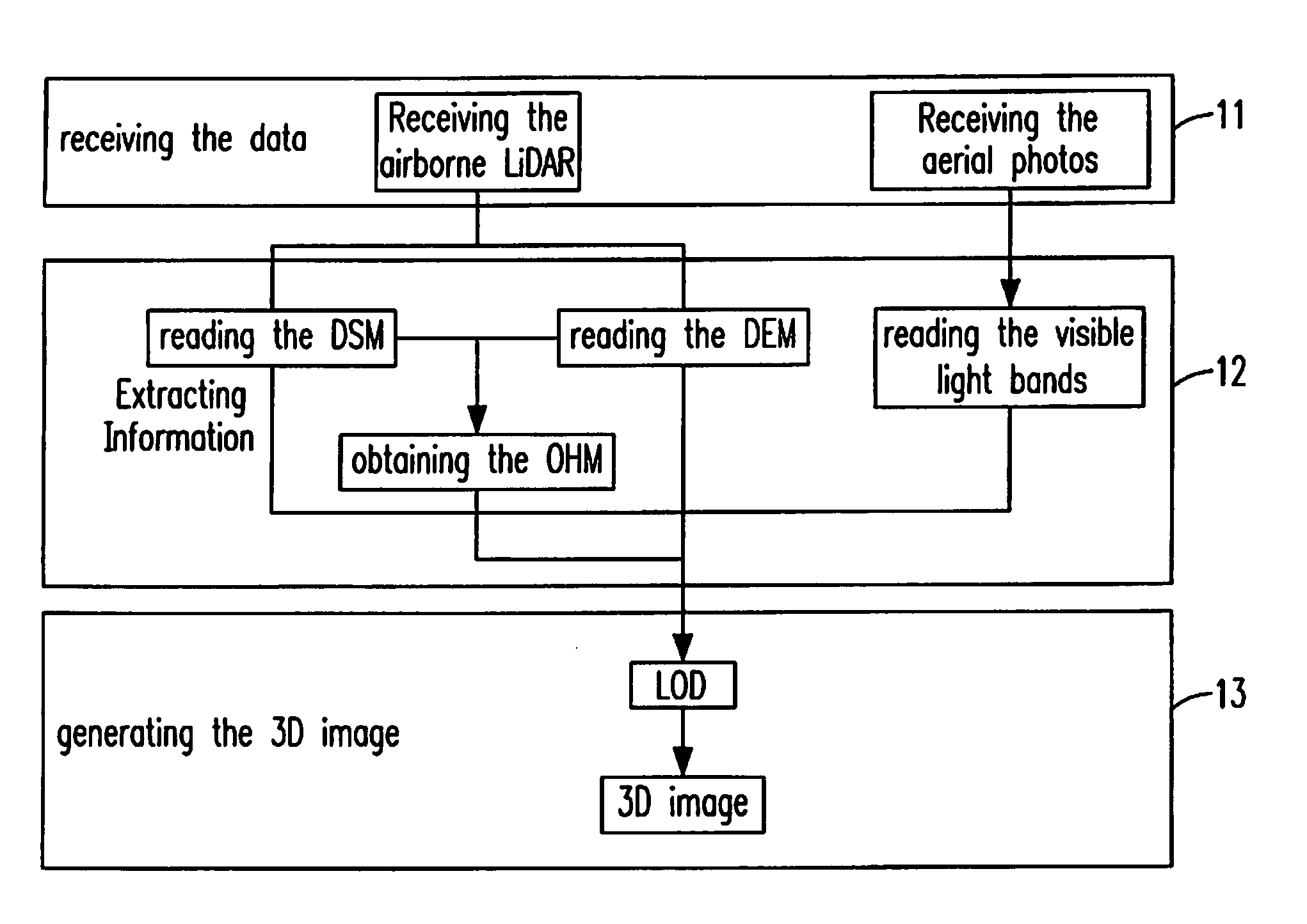
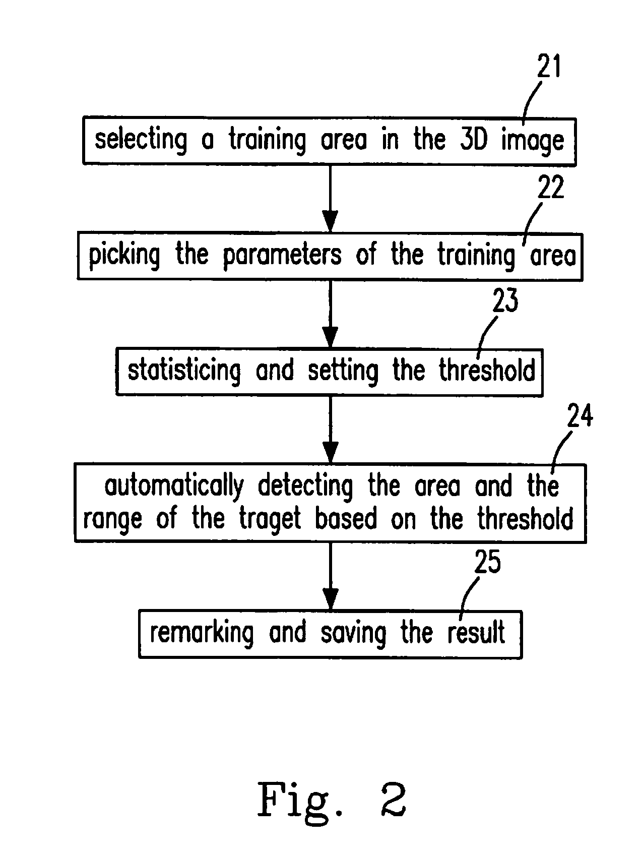
[0041]In the present invention, the sorted airborne LiDAR data are integrated into the color aerial photos to establish the automatic detecting technique through the 3D image simulation method that can raise the efficiency and the accuracy of the large scale investigation. However, during the automatic detecting, the omission and the commission are hardly avoided, so the present invention further develop a manual operation interface for manually determining and editing the result of the automatic detecting.

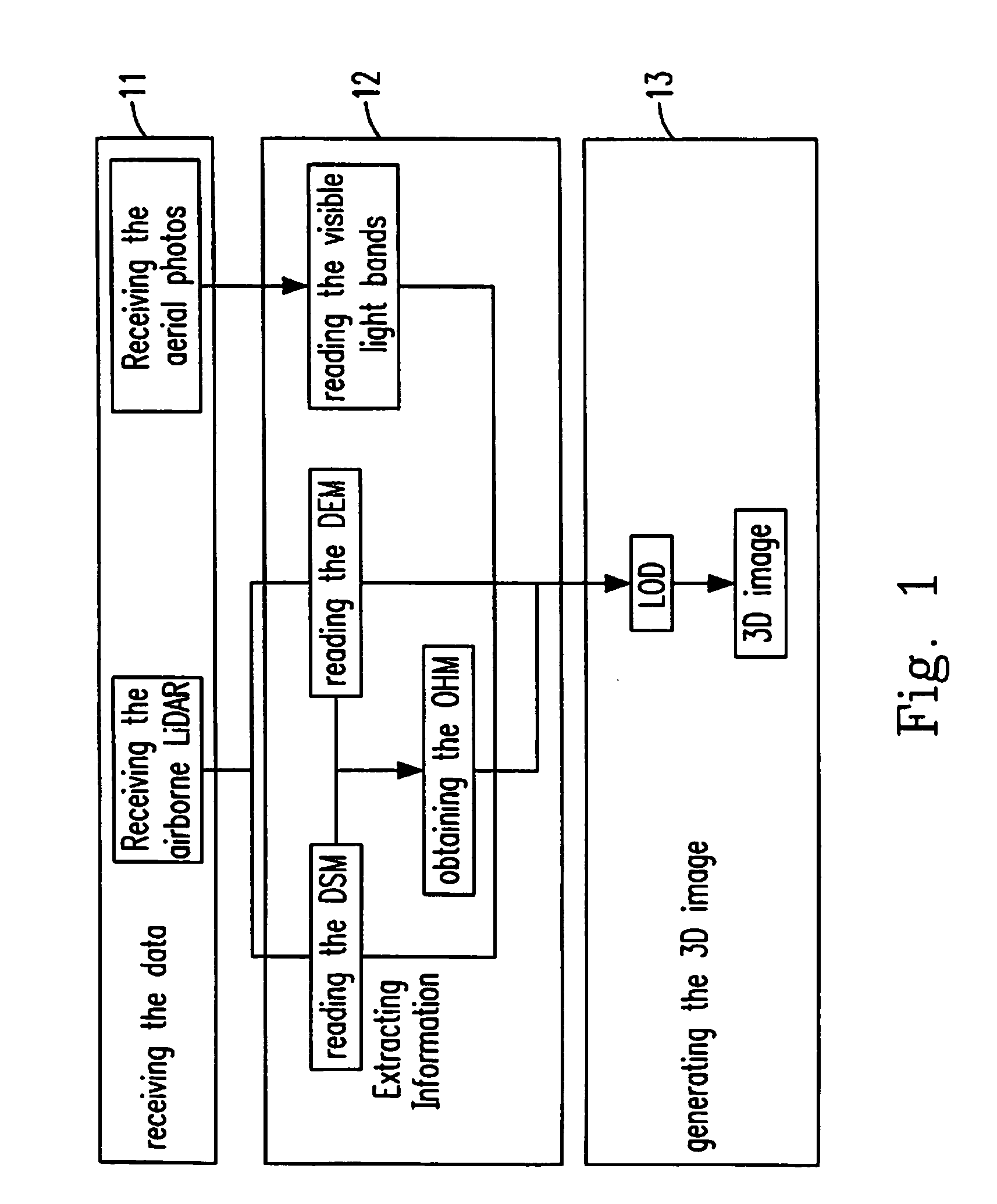
[0042]Please refer to FIG. 1, which is the flow chart of the first process of the 3D target detecting, editing and rebuildin...


PUM


Abstract

A method and system for target detecting, editing and rebuilding by 3D image is provided, which comprises an inputting and picking unit, a training and detecting unit, a displaying and editing unit and a rebuilding unit. The inputting and picking unit receives a digital image and a LiDAR data and picks up a first parameter to form a 3D image. The training and detecting unit selects a target, picks up a second parameter therefrom, calculates the second parameter to generate a threshold and detects the target areas in the 3D image according to the threshold. The displaying and editing unit sets a quick selecting tool according to the threshold and edits the detecting result. The rebuilding unit sets a buffer area surrounding the target, picks up a third parameter therefrom and calculates the original shape of the target by the Surface Fitting method according to the third parameter.

Description

FIELD OF THE INVENTION[0001]The present invention relates to a target detecting, editing and rebuilding system, and more particular to a target detecting, editing and rebuilding system by 3D image.BACKGROUND OF THE INVENTION[0002]More than 60% of the areas in Taiwan are referred to the mountain area and the mountainside area, especially, in the mountain area, the shape thereof is steep, the water flows therein are rapid, the structure thereof is complicated, the rock property therein is fragile and the soil therein are soft. Besides, the average rainfall in the mountain area reaches 2,500 millimeter per year, which is the three times of the average rainfall of the whole world. In particular, after the 921 Earthquake in 1999, the shallow layer of the soil becomes loose and every time when the typhoon or the torrential rain comes, it is very easy to trigger the landslide. The direct effect of the landslide is that the soil is scrubbed and glided along the gully, the valley and the riv...

Claims


Application Information

Patent Timeline
IPC IPC(8): G06K9/00
CPCG06K9/00637G06V20/176
Inventor LAU, CHI-CHUNGLIU, JIN-KINGHSIAO, KUO-HSINCHEN, TA-KORAU, JIANN-YEOUSHAO, YI-CHENCHEN, LIANG-CHIEN
Owner IND TECH RES INST
Learn More