
Map Display Device And Map Display Method

a map display and map technology, applied in surveying and navigation, navigation instruments, instruments, etc., can solve the problems of reducing the density of road name information, reducing the legibility of drawn road names, and providing insufficient address information, so as to improve the legibility of characters and maps, improve the display density of road names, and improve the legibility of maps

Active Publication Date: 2008-12-11
ALPINE ELECTRONICS INC
View PDF28 Cites 32 Cited by
  • Summary
  • Abstract
  • Description
  • Claims
  • Application Information

AI Technical Summary

Benefits of technology

[0010]The present invention has been made in view of the problems with the above conventional technique, and provides a map display device and a map display method which enhance the information density of the road names without decreasing legibility.(Map Display Method)

Problems solved by technology

However, reducing the character size would have an adverse effect on the legibility of the drawn road names.
As a result, the fewer road names drawn on the map image provide insufficient address information density (FIG. 9(b)).
However, the reduction in the predetermined number for higher legibility of the map image disadvantageously decreases the road name information density.

Method used


Image

  • Map Display Device And Map Display Method
  • Map Display Device And Map Display Method
  • Map Display Device And Map Display Method

Examples


first embodiment

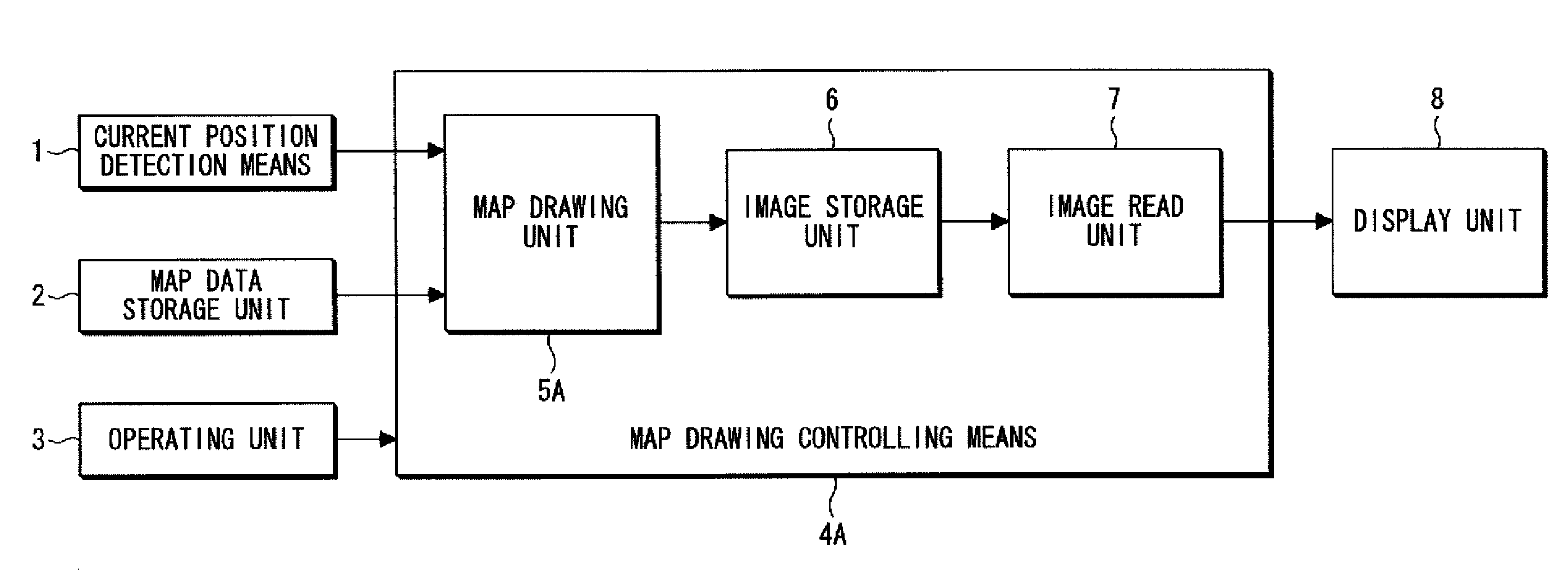
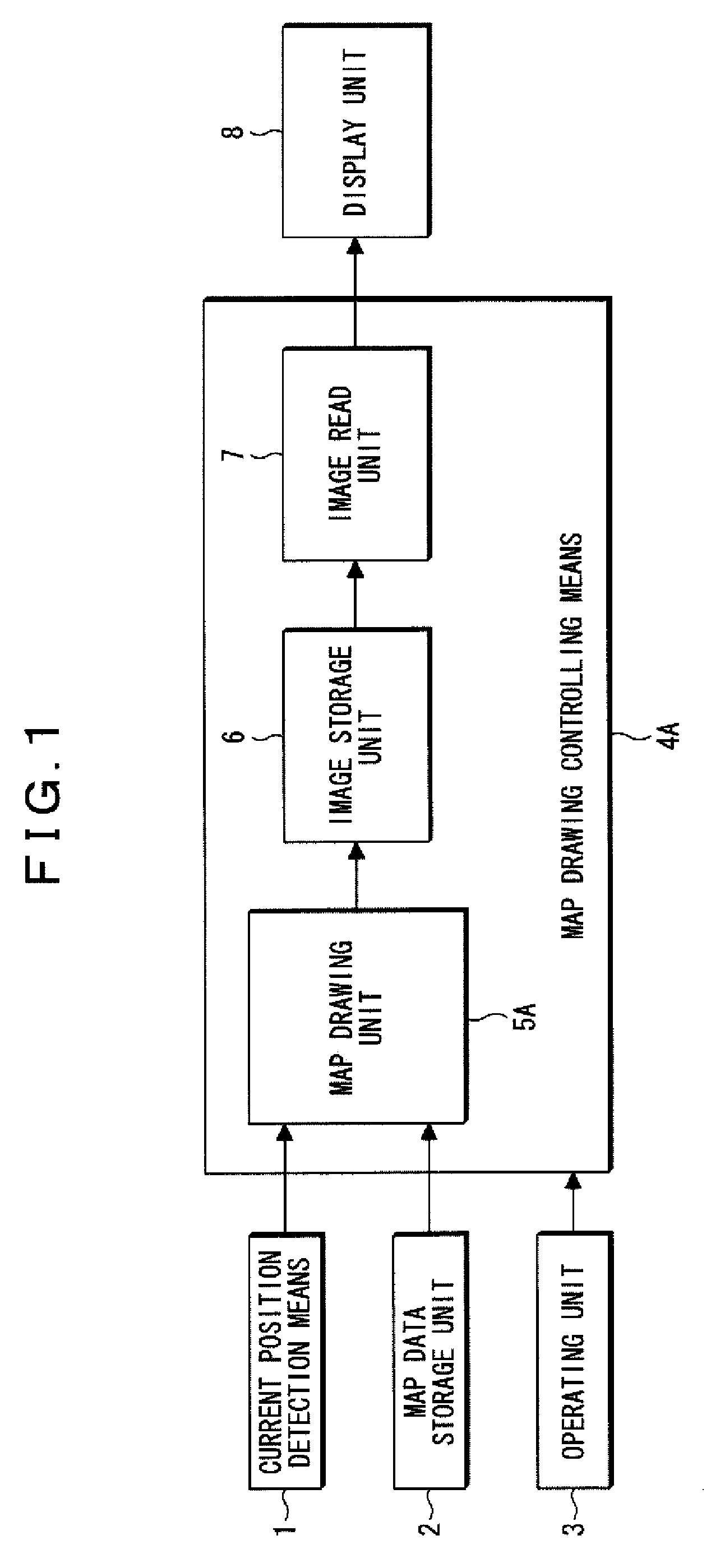
[0035]The first embodiment of the present invention will be described with reference to FIG. 1. FIG. 1 is a block diagram illustrating the construction of an on-vehicle navigation system that embodies the map display method according to the present invention, in which like components are given like numerals as in FIG. 7.

[0036]In FIG. 1, the numeral 1 represents a current position detection means that periodically detects a current position and direction of the vehicle by using satellite navigation and dead reckoning navigation in combination. The numeral 2 denotes a map data storage unit that stores map data used for drawing a map image, and the map data are classified into plural hierarchy levels corresponding to scale sizes, in an order that the larger the scale is, the more detailed a map can be displayed (refer to FIG. 6).

[0037]The map data of each hierarchy include a background layer for drawing roads, rivers, parks and so forth, and a character layer for drawing the map charac...


PUM


Abstract

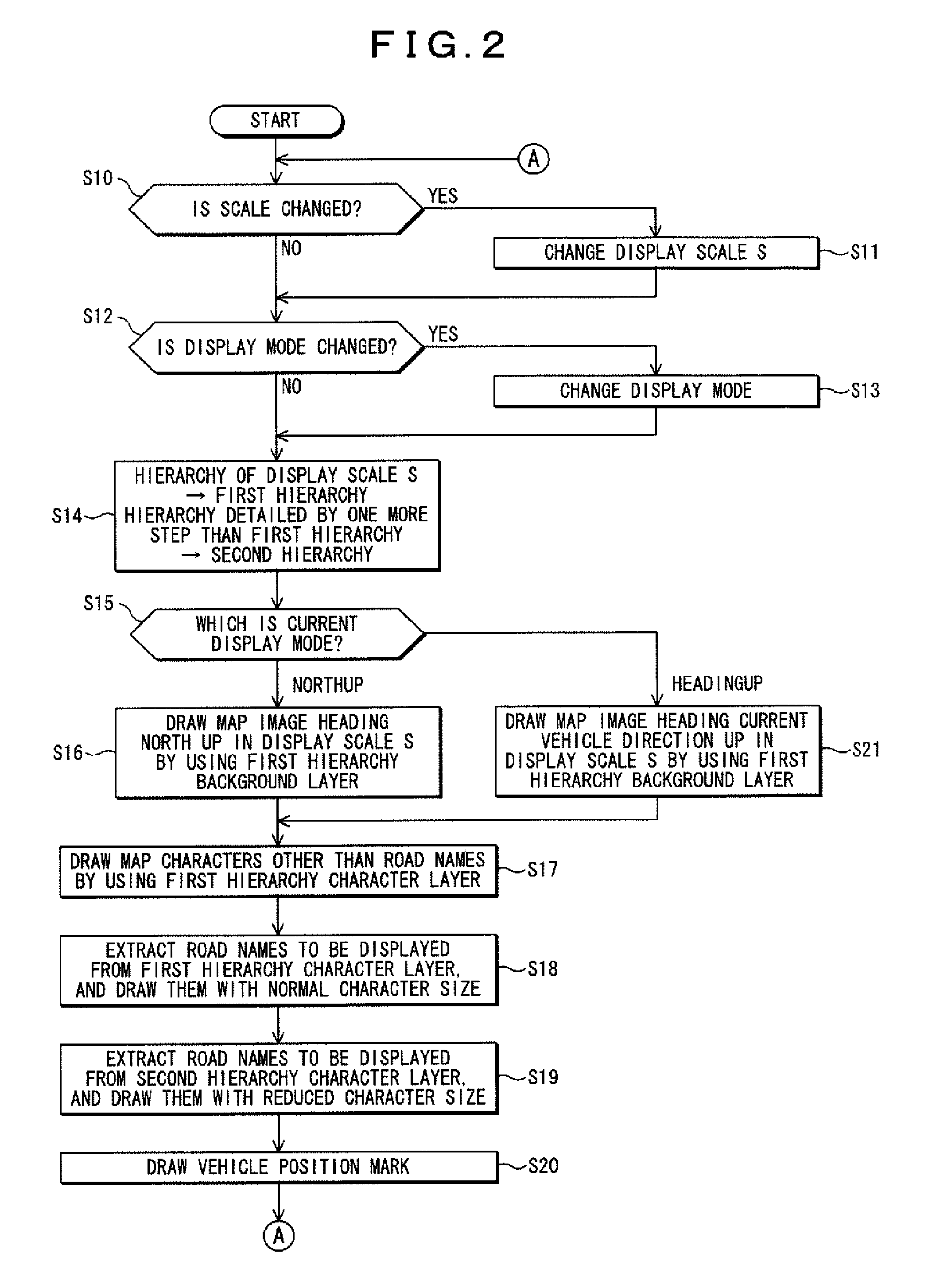
The invention provides a map display device and map display method that enhance the information density of displayed road names while maintaining legibility of a map image. First, the map drawing unit draws, to an image storage unit, a map image of roads and so forth in a desired scale, by using the background layer of a first hierarchy corresponding to the desired scale. Second, the map drawing unit draws place names and facility names by using the character layer of the first hierarchy to superimpose them on the map image. Third, the map drawing unit extracts the road names that do not overlap with the map characters of the place names and facility names on the map image by using the character layer of the first hierarchy, and superimposes them on the map image at the normal character size. Fourth, the map drawing unit extracts, by using the character layer of a second hierarchy corresponding to a scale level smaller by one step than the desired scale level, road names that do not overlap with the map characters of the other road names, place names, facility names and so forth on the map image, and superimposes them on the map image at a smaller character size. Finally, the map drawing unit superimposes the vehicle position mark on the map image.

Description

RELATED APPLICATION[0001]The present application claims priority to Japanese Patent Application Number 2007-150115, filed Jun. 6, 2007, the entirety of which is hereby incorporated by reference.FIELD OF THE INVENTION[0002]The present invention relates to a map display device and a map display method, specifically to a map display device and a map display method for displaying map images including road names.DESCRIPTION OF THE RELATED ART[0003]In a map display device such as an on-vehicle navigation system and a portable navigation system, the map data for drawing map images are classified into plural hierarchy levels according to the scale sizes, and the larger the scale is, the more detailed a map can be displayed (refer to FIG. 6). The map data of each hierarchy includes a background layer for drawing roads, rivers, parks, and so forth; and a character layer (map character data) for drawing road names, place names such as city names, plural items of facility names, and so forth by...

Claims


Application Information

Patent Timeline
Patent Type & Authority Applications(United States)
IPC IPC(8): G01C21/30
CPCG01C21/3673
Inventor YAMAZAKI, NOBORU
Owner ALPINE ELECTRONICS INC
Learn More