
Navigation system

a navigation system and navigation system technology, applied in the field of navigation systems, can solve problems such as inability to be carried, and achieve the effect of enhancing information, enhancing route calculation and recalculation functions

Active Publication Date: 2008-08-07
TOMTOM NAVIGATION BV
View PDF15 Cites 88 Cited by
  • Summary
  • Abstract
  • Description
  • Claims
  • Application Information

AI Technical Summary

Benefits of technology

Enables users to select the most fuel-efficient route, along with other optimized routes, and alerts when insufficient fuel is available for a destination, highlighting nearby fuel stations, thus enhancing route planning and reducing fuel costs.

Problems solved by technology

U.S. Pat. No. 5,742,922 describes an integrated vehicle navigation system and method of selecting a route for vehicle travel according to fuel consumption, such system being one which is installed in a vehicle at the time of manufacture, and is therefore not portable.

Method used


Image

  • Navigation system
  • Navigation system
  • Navigation system

Examples


Embodiment Construction

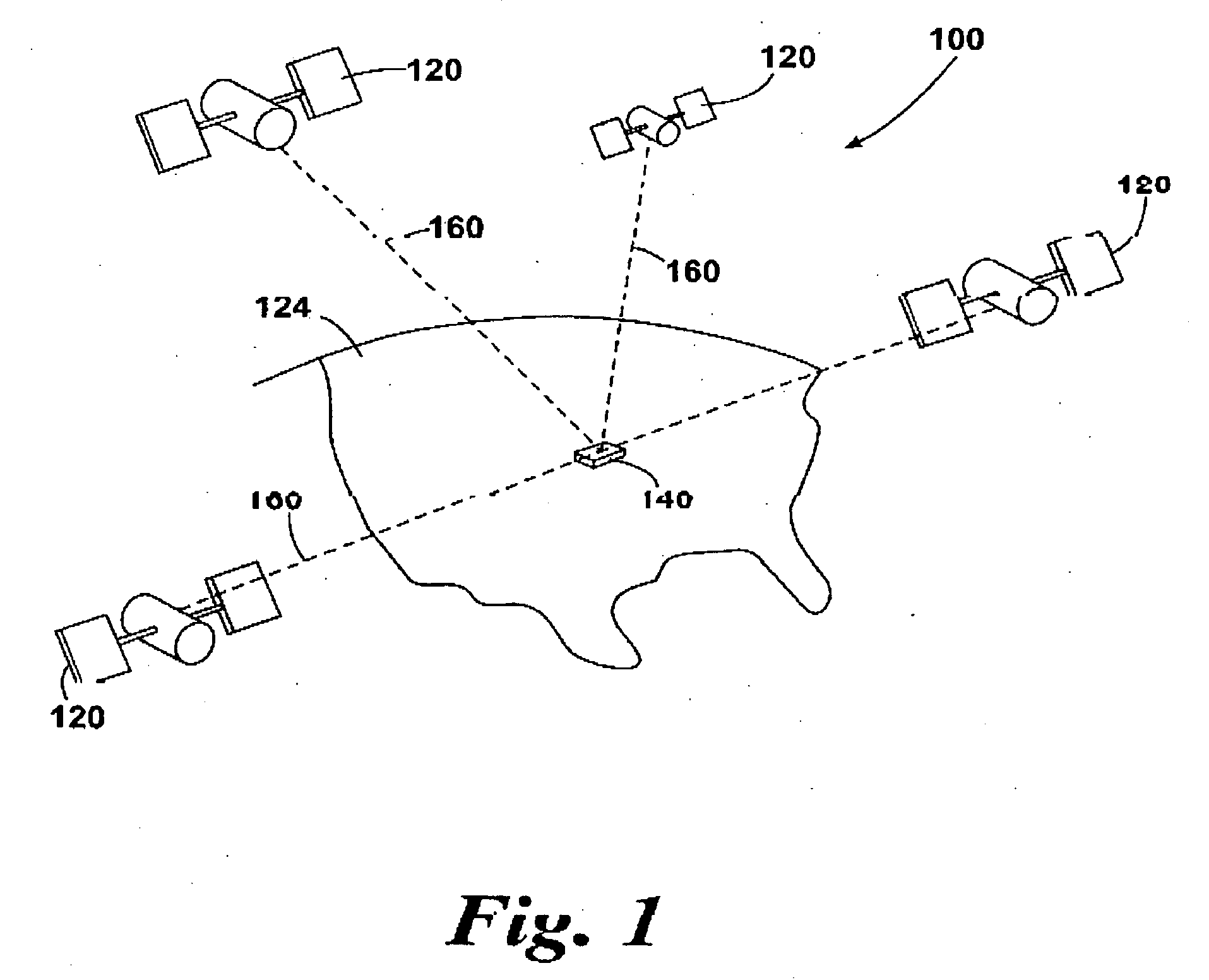
[0028]FIG. 1 illustrates an example view of Global Positioning System (GPS), usable by navigation devices. Such systems are known and are used for a variety of purposes. In general, GPS is a satellite-radio based navigation system capable of determining continuous position, velocity, time, and in some instances direction information for an unlimited number of users.

[0029]Formerly known as NAVSTAR, the GPS incorporates a plurality of satellites which work with the earth in extremely precise orbits. Based on these precise orbits, GPS satellites can relay their location to any number of receiving units.

[0030]The GPS system is implemented when a device, specially equipped to receive GPS data, begins scanning radio frequencies for GPS satellite signals. Upon receiving a radio signal from a GPS satellite, the device determines the precise location of that satellite via one of a plurality of different conventional methods. The device will continue scanning, in most instances, for signals u...


PUM


Abstract

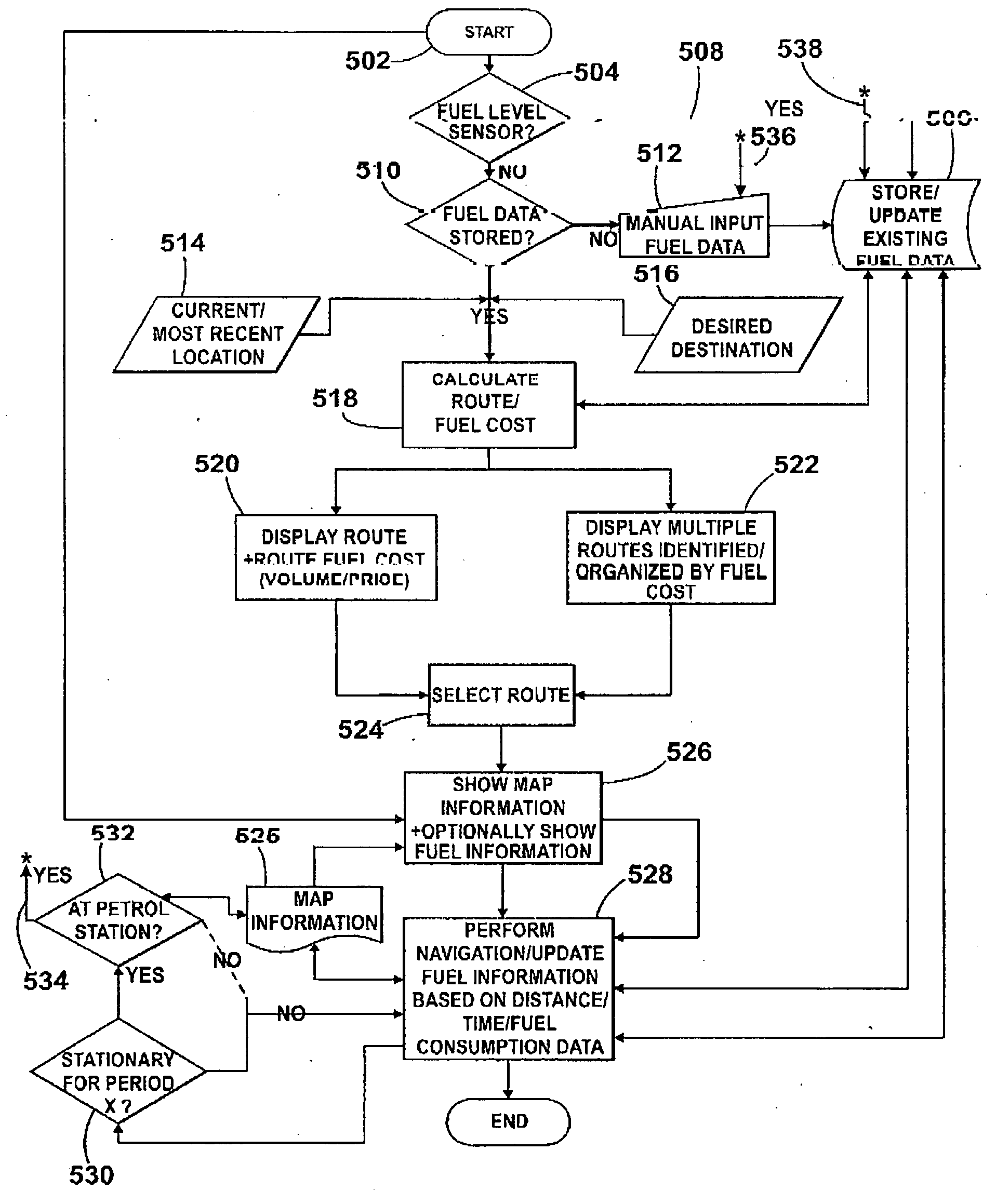
A portable navigation device is set out for calculating fuel related parameters and returning related data to the user of the device. The related data may include fuel cost of a particular calculated route. Additional data may include particular displays of information including a theoretical calculated volumetric amount of fuel used by a vehicle in traveling along a calculated route before, during or after completion of travel. Other displayed data includes a theoretical calculated financial cost of fuel used by the vehicle in traveling along the calculated route before, during or after completion of travel. Still further displayed data may include an optimal calculated route chosen from many possible calculated routes, the optimization occurring on account of the relative fuel cost of each of the calculated routes.

Description

CROSS REFERENCE TO RELATED APPLICATIONS[0001]The present application hereby claims priority under 35 U.S.C. § 119(e) on each of U.S. Provisional Patent Application Nos. 60 / 879,523 filed Jan. 10, 2007, 60 / 879,549 filed Jan. 10, 2007, 60 / 879,553 filed Jan. 10, 2007, 60 / 879,577 filed Jan. 10, 2007, 60 / 879,599 filed Jan. 10, 2007, 60 / 879,529 filed Jan. 10, 2007, 60 / 879,601 filed Jan. 10, 2007, the entire contents of each of which is hereby incorporated herein by reference. The content of the aforementioned are herein incorporated by reference.BACKGROUND OF THE INVENTION[0002]This invention relates to an improved navigation system, such system including processing means, a graphical display, memory, map data stored in said memory, and signal reception means for receiving one or more wireless signals by means of which the processor can determine a present location of the system. Specifically, this invention is concerned with an improved portable navigation device including all these featu...

Claims


Application Information

Patent Timeline
Patent Type & Authority Applications(United States)
IPC IPC(8): G01C21/36G01S19/48
CPCG01C21/3655G01C21/3697G08G1/096791G08G1/096741G08G1/096716
Inventor GEELEN, PIETERGODDLIN, HAROLDRIBBINK, ALEXANDER
Owner TOMTOM NAVIGATION BV
Learn More