
Method for regulating shaded-relief style effect in computer shaded-relief drawing

An adjustment method and computer technology, which are applied in computing, image data processing, 3D image processing and other directions, can solve the problems of unsatisfactory drawing effects and inability to fully reflect the three-dimensional visual effect of mountains, and achieve simple methods, improved quality, and effects. obvious effect

Inactive Publication Date: 2007-04-11
WUHAN UNIV
View PDF0 Cites 3 Cited by
  • Summary
  • Abstract
  • Description
  • Claims
  • Application Information

AI Technical Summary

Problems solved by technology

[0004] At present, many GIS software provide the function of computer shading mapping, but the mapping effect is not ideal enough, especially the three-dimensional visual effect of the mountain cannot be fully reflected

Method used


Image

  • Method for regulating shaded-relief style effect in computer shaded-relief drawing
  • Method for regulating shaded-relief style effect in computer shaded-relief drawing
  • Method for regulating shaded-relief style effect in computer shaded-relief drawing

Examples


Embodiment Construction

[0020] 1. Theoretical basis

[0021] Geomorphic shading method is a common method for three-dimensional representation of landforms on maps. It uses the principle of shadow and light and shade changes to establish three-dimensional landforms on a plane. The basic principle of computer terrain shading is to divide the continuous surface of the ground three-dimensional model into many units, and then calculate the amount of light received by each unit according to the relationship between the unit plane and the incident light, determine its color value, and project it onto the plane to achieve Simulate the effect of terrain relief. Calculating the gray value of each terrain grid unit is the basis of computer terrain shading. The gray value of the grid unit is determined by the amount of light received. The smaller the amount of light received, the greater the gray value. When the amount of light received is 0, the gray value reaches the minimum.

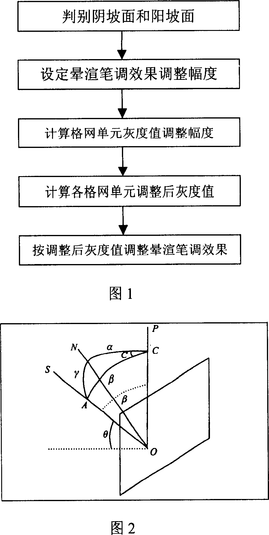
[0022] As shown in Figure 2, ...


PUM


Abstract

The invention discloses an adjusting method of shading style effects for computer shading mapping. The method judges the night side and sun side of landform automatically by calculating, and then according to the angle formed by the light source and every micro-unit in the model of landform, changes the gray values of the night side and sun side slope, to adjust the contrast of light and shade, realize the tone adjustment of pen softness and rigidity, improve the3D visual effects of Shading Map, and enhance the quality of Shading Map by computer.

Description

technical field [0001] The invention relates to a method for adjusting the effect of shading strokes in computer shading drawing, which belongs to the technical field of digital map drawing. More specifically, the present invention relates to a method for improving the quality of computer topography shading mapping products. Background technique [0002] Shaded topography is a map that uses corresponding shades of color or ink to render shadows along the slope according to the intensity of shadows produced by the assumed light source on the ground, showing the three-dimensional effect of the topography and showing the ups and downs of the topography. product. It can vividly and intuitively reflect the surface topography and is widely used in various map products. [0003] Computer terrain shading is automatic shading in the computer environment. The drawing method is to simulate the shadow strength and brightness of the light source on the ground by controlling the illumin...

Claims


Application Information

Patent Timeline
Patent Type & Authority Applications(China)
IPC IPC(8): G06T15/50
Inventor 李霖姜文亮朱海虹王红胡静妍乔俊军
Owner WUHAN UNIV
Learn More