


Quick Research
Generate reliable direction feasibility study reports for your R&D in just a few steps.

Technical Q&A
Discover and master advanced knowledge NOW. Basics, ideas, possibilities, all at once.

Find Solutions
As an expert in R&D theories, this can generate solutions to your technical problems instantly.

Evaluate Feasibility
Analyze your overall solution with one click, know your potential R&D risks in advance.

Monitor Landscape
Get weekly tech updates, stay abreast of the latest tech innovations and key insights.
Unmanned aerial vehicle surveying and mapping route planning method, system, equipment and medium
A technology of unmanned aerial vehicle and flight direction, which is applied in the field of unmanned aerial vehicle surveying and mapping route planning, which can solve the problems that unmanned aerial vehicles cannot ensure smooth turning, and achieve the effect of not easy overshoot, smooth turning, and improved efficiency
- Summary
- Abstract
- Description
- Claims
- Application Information
AI Technical Summary
Problems solved by technology
Method used
Image

Examples
Embodiment 1
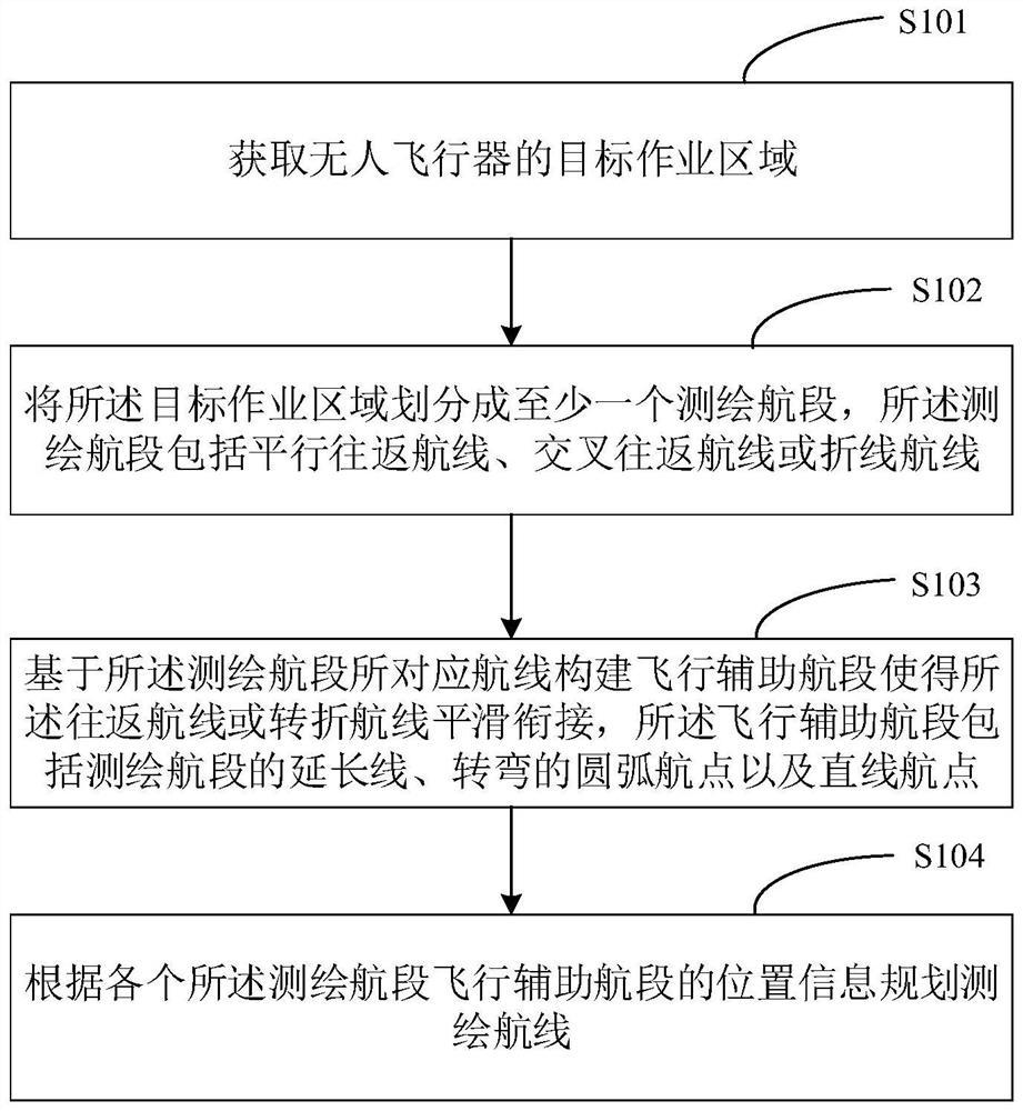
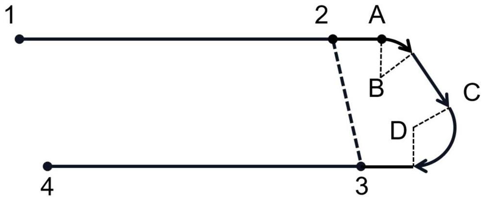
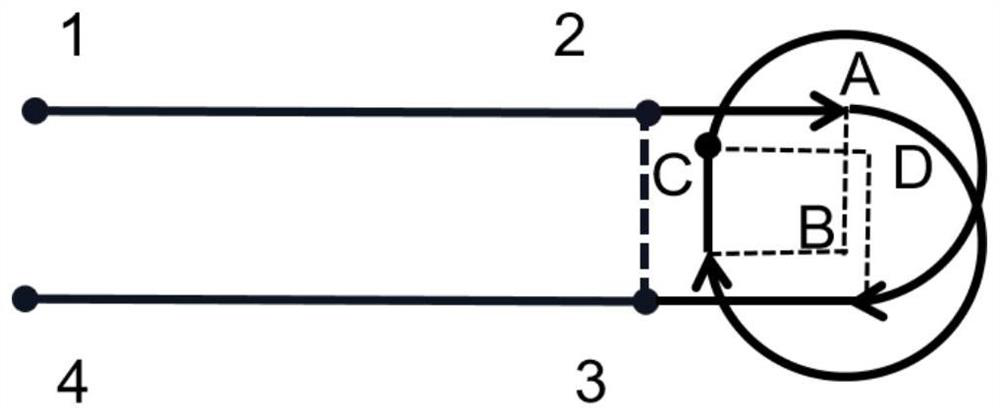
[0050] In view of the above technical problems, embodiments of the present invention provide a method for planning a surveying and mapping route for an unmanned aerial vehicle. The method divides a target operation area into at least one surveying and mapping flight segment, wherein the surveying and mapping flight segment includes a parallel round-trip route, a cross round-trip route or a A polyline route, a flight auxiliary segment is constructed based on the route corresponding to the surveying and mapping segment so that the routes are smoothly connected, and the flight assistance segment includes an extension of the surveying and mapping segment, a turning arc waypoint and a straight waypoint, The surveying and mapping route is planned according to the position information of the flight auxiliary flight segment of each surveying and mapping flight segment, and the flight auxiliary flight segment is used to realize smooth turning, the turning slope is small, and the turning tr...
Embodiment 2
[0144] see Image 6 , the present invention also provides a structural block diagram of an unmanned aerial vehicle surveying and mapping route planning control device 600, including:
[0145] an acquisition module 601, used for acquiring the target operation area of the unmanned aerial vehicle;
[0146] an area division module 602, configured to divide the target operation area into at least one surveying and mapping flight segment, wherein the surveying and mapping flight segment is a parallel round-trip route, a cross-round round-trip route or a polyline route;
[0147] The flight assistance module 603 is to construct a flight assistance segment based on the route corresponding to the surveying and mapping segment so that the round-trip route or the polyline route can be smoothly connected, and the flight assistance segment includes the extension line of the surveying and mapping segment and the turning arc waypoint. and straight-line waypoints;
[0148] Wherein, the fli...
PUM
 Abstract
Description
Claims
Application Information
 - R&D Engineer
- R&D Manager
- IP Professional
- Industry Leading Data Capabilities
- Powerful AI technology
- Patent DNA Extraction
Browse by: Latest US Patents, China's latest patents, Technical Efficacy Thesaurus, Application Domain, Technology Topic, Popular Technical Reports.
© 2024 PatSnap. All rights reserved.Legal|Privacy policy|Modern Slavery Act Transparency Statement|Sitemap|About US| Contact US: help@patsnap.com