General aircraft longitude and latitude route network construction and operation control method
A general-purpose aircraft and route technology, applied in the field of general aviation, can solve the problems of aircraft routes, unfixed headings, high tension of pilots, and mutual flight interference.
- Summary
- Abstract
- Description
- Claims
- Application Information
AI Technical Summary
Problems solved by technology
Method used
Image
Examples
Embodiment 1
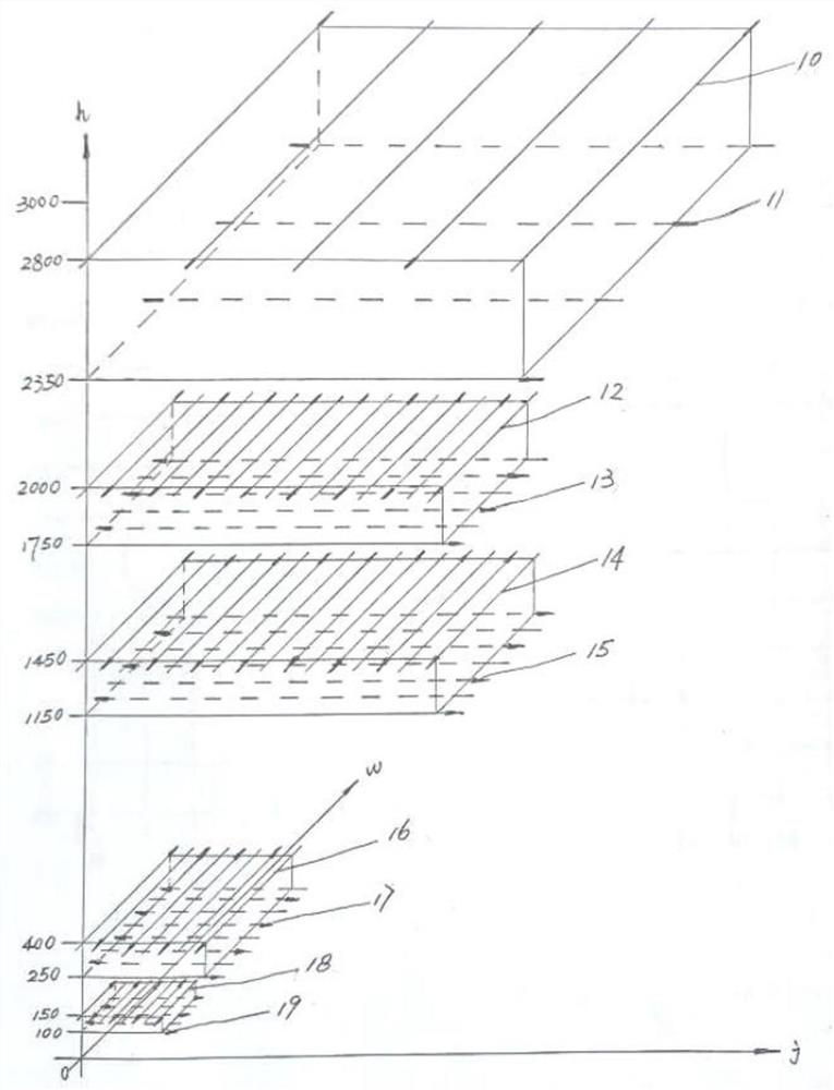
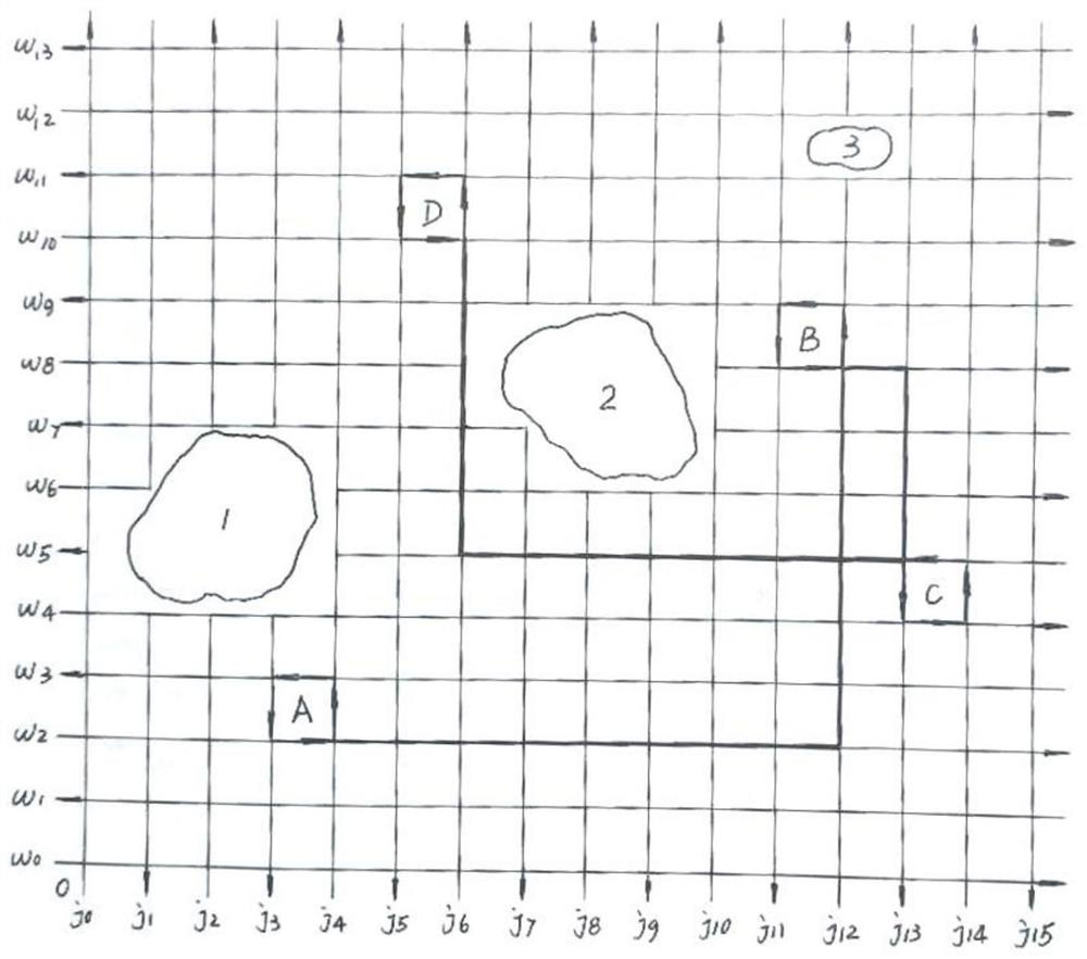
[0068] In this example, see figure 1 , a general aircraft longitude and latitude route network construction and operation control method, according to the fixed-wing aircraft, helicopter, autogyro, electric multi-axis manned helicopter or miniature electric multi-axis UAV, the real height of the aircraft is 0 to 3000 meters to monitor the airspace and report airspace allocation is divided into 5 cruising level airspaces; the cruising level airspace of the same type of general aircraft is further divided into the upper level and the lower level; The lower layout of the airspace sets the latitude routes with distance intervals; or, the upper layout of the same cruising layer airspace sets the latitude routes with distance intervals, and the lower layout of the same cruising layer airspace sets the meridian routes with distance intervals; Airspace and reporting airspace define a series of longitudes as the flight routes of aircraft from north to south or from south to north; and ...
Embodiment 2
[0080] This embodiment is basically the same as Embodiment 1, especially in that:
[0081] In this embodiment, in the grid route with the meridian above and the latitude below, an airport with fixed-wing aircraft or autogyro left-rotating double independent take-off and landing disks is set, and an airport is built in the center of the route grid, with two landing runways and two take-off The runways are separated independently, and the double-separated route design of the rectangular flight track of the disk descent and the rectangular flight trajectory of the disk lift is independently separated, so that the two landing runways and the rectangular flight track of the disk descent form an independent subsystem. The two independent subsystems are isolated from each other, and the operation does not interfere with each other. The airport terminal building is established at the center of the selected route grid, and the distances from the terminal building are set on the east and...
Embodiment 3
[0084] This embodiment is basically the same as the previous embodiment, and the special features are:
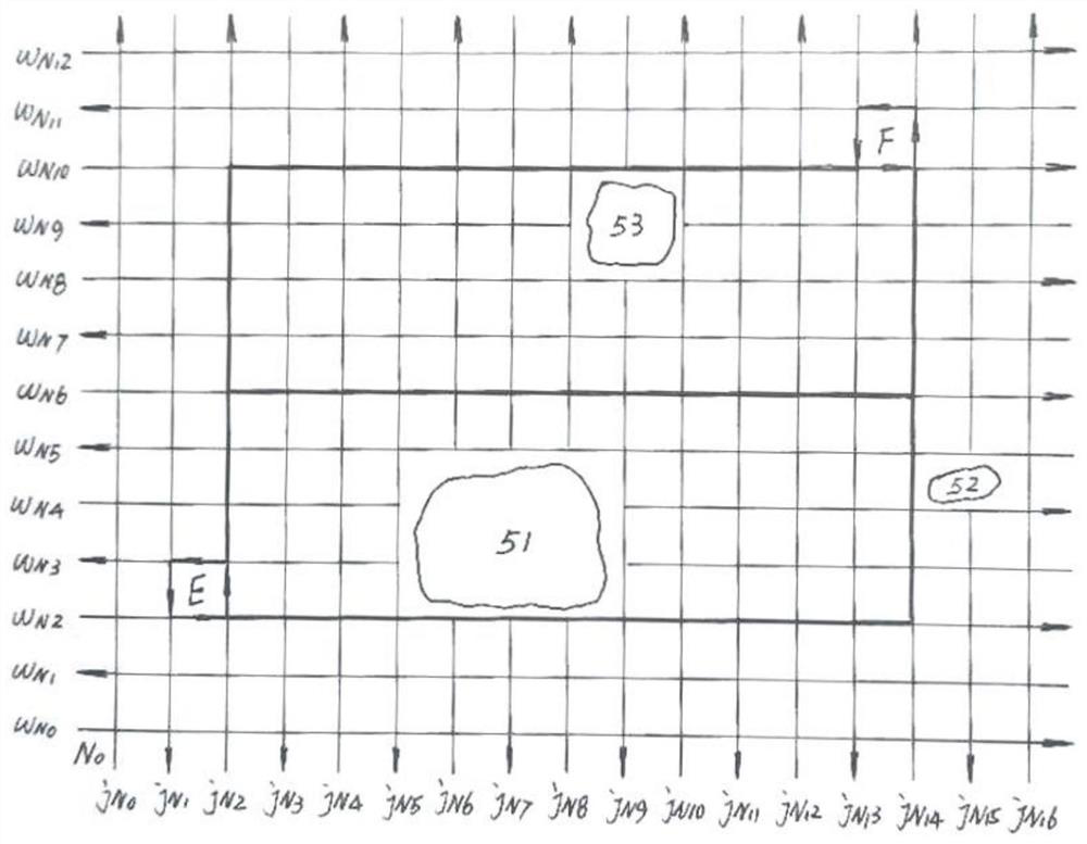
[0085] In this embodiment, in the grid route where the latitude line is above and the meridian line is below, an airport with fixed-wing aircraft or autogyro left-rotating double independent take-off and landing discs is set, and an airport is built in the center of the route grid, with two landing runways and two take-off The runways are separated independently, and the double-separated route design of the rectangular flight track of the disk descent and the rectangular flight trajectory of the disk lift is independently separated, so that the two landing runways and the rectangular flight track of the disk descent form an independent subsystem. The two independent subsystems are isolated from each other, and the operation does not interfere with each other. The airport terminal building is established at the center of the selected route grid, and the distances from the ter...
PUM
 Abstract
Description
Claims
Application Information
 - R&D Engineer
- R&D Manager
- IP Professional
- Industry Leading Data Capabilities
- Powerful AI technology
- Patent DNA Extraction
Browse by: Latest US Patents, China's latest patents, Technical Efficacy Thesaurus, Application Domain, Technology Topic, Popular Technical Reports.
© 2024 PatSnap. All rights reserved.Legal|Privacy policy|Modern Slavery Act Transparency Statement|Sitemap|About US| Contact US: help@patsnap.com


