An Intelligent Geographic Information Measuring and Drawing System

A geographic information and intelligent technology, applied in the field of field information measurement and mapping, achieves the effects of simple operation, guaranteed stability, and low maintenance cost

Active Publication Date: 2022-04-05
WUHAN SURVEYING GEOTECHN RES INST OF MCC
View PDF0 Cites 0 Cited by
  • Summary
  • Abstract
  • Description
  • Claims
  • Application Information

AI Technical Summary

Problems solved by technology

[0005] Aiming at the above technical problems, the present invention provides an intelligent geographic information surveying and mapping system, which combines two surveying and mapping methods, can satisfy both ground surveying and high-altitude surveying, ensures the accuracy of geographic information surveying and mapping, and the whole system is easy to move, and It can ensure the endurance time of the drone, and the invention can also be used normally in some poor geographical environments

Method used


Image

  • An Intelligent Geographic Information Measuring and Drawing System
  • An Intelligent Geographic Information Measuring and Drawing System
  • An Intelligent Geographic Information Measuring and Drawing System

Examples


Embodiment Construction

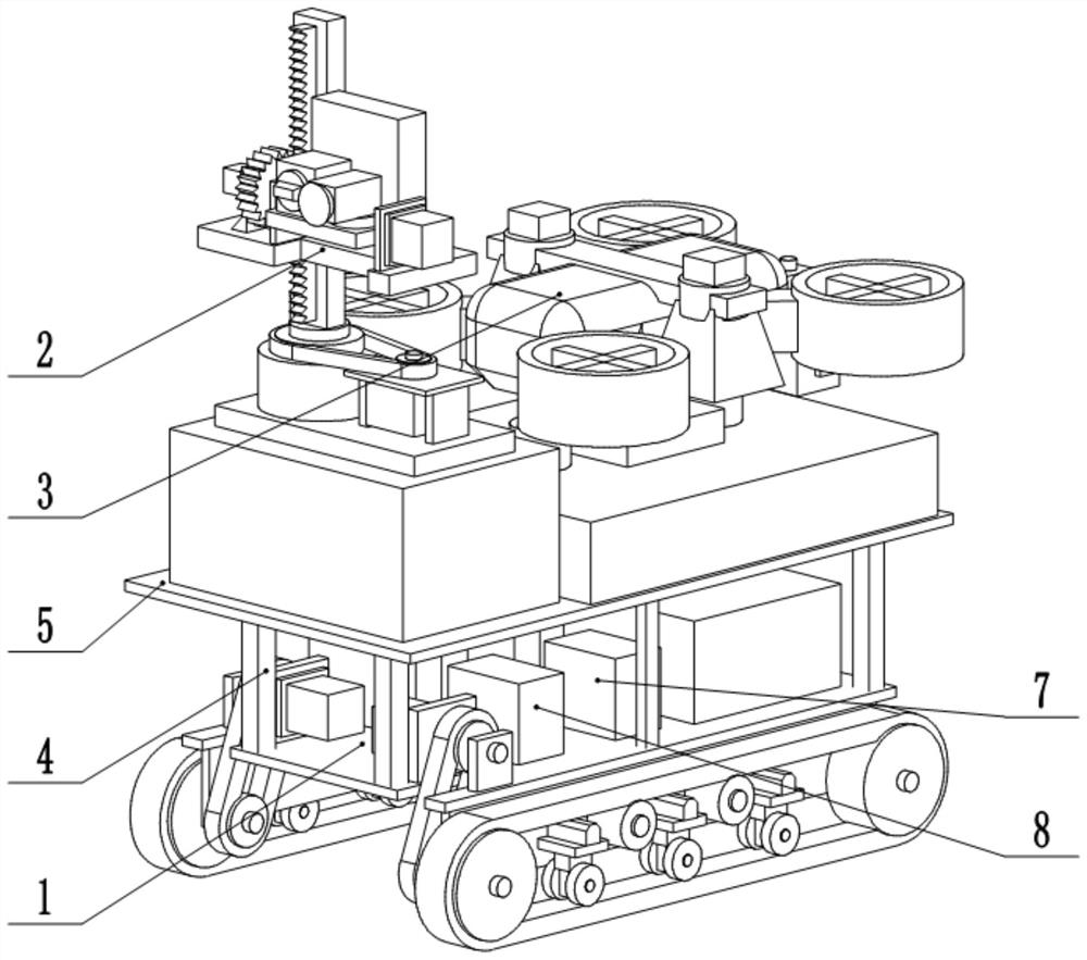
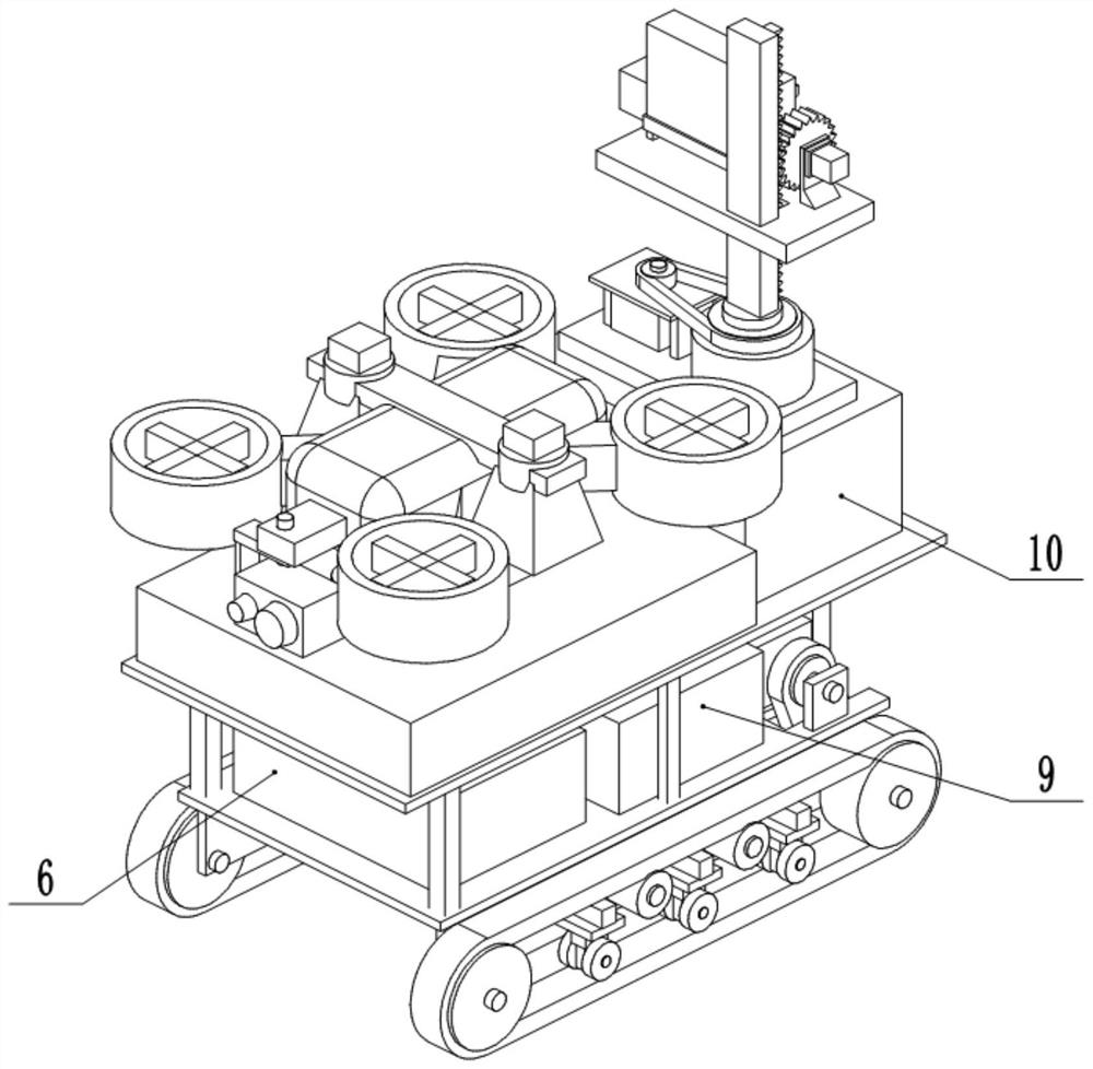
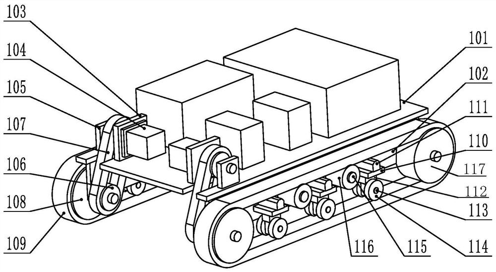
[0033] The present invention will be further described below in conjunction with drawings and embodiments. attached Figure 1 to Figure 7 All are drawings of embodiments, drawn in a simplified manner, and are only used for the purpose of clearly and concisely illustrating the embodiments of the present invention. The following technical solutions shown in the drawings are specific solutions of the embodiments of the present invention, and are not intended to limit the scope of the claimed invention. Based on the embodiments of the present invention, all other embodiments obtained by persons of ordinary skill in the art without creative efforts fall within the protection scope of the present invention.

[0034] In the description of the present invention, it should be understood that the orientations or positional relationships indicated by the terms "upper", "lower", "inner", "outer", "left", "right" etc. are based on those shown in the accompanying drawings. Orientation or ...


PUM


Abstract

The invention provides an intelligent geographic information measurement and drawing system. The geographic information surveying and drawing system includes an all-terrain sports chassis, a support platform, a lift-type ground environment survey device and a high-altitude geographical environment monitoring device. A power supply system and a hydraulic station are arranged on the all-terrain sports chassis. The support platform passes through multiple The pillars are erected above the all-terrain sports chassis, and the lifting ground environment survey device and the high-altitude geographical environment monitoring device are installed on the supporting platform; the power supply system provides power for the entire system, and the hydraulic station provides hydraulic power for the entire system . The invention can accurately survey and map the surrounding environment by itself. At the same time, it can use the high-altitude geographic environment monitoring device drawing system that comes with the system to perform high-altitude accurate mapping. Human labor operation.

Description

technical field [0001] The invention relates to the technical field of field information measurement and mapping, in particular to an intelligent physical information measurement and mapping system. Background technique [0002] Geographic information is the various states of the earth's surface in digital form for people's research reference and construction basis, so the accuracy of geographic information data plays a very important role. Geographical information surveying and mapping is widely used in economic construction and national defense construction. In urban and rural construction planning, land resource utilization, environmental protection, etc., land surveying and surveying and mapping of various maps must be carried out for planning and management. In geological exploration In the construction of mining, mineral development, water conservancy, transportation, etc., it is necessary to carry out control survey, mine survey, route survey and draw topographic maps...

Claims


Application Information

Patent Timeline
Patent Type & Authority Patents(China)
IPC IPC(8): G01C15/00G01C11/00F16M11/42F16M11/18F16M11/08F16M11/04
CPCG01C15/00G01C11/00F16M11/42F16M11/046F16M11/18F16M11/08
Inventor 吴琪常永兴程万宁
Owner WUHAN SURVEYING GEOTECHN RES INST OF MCC
Why Eureka
Try Eureka