
Method for measuring urban space function compactness

A compact and urban technology, applied in the field of urban space measurement, it can solve the problems that the land use mix cannot fully reflect the degree of functional compactness, consumes a lot of manpower, material resources and time, and cannot reflect the functional compactness.

Active Publication Date: 2020-07-10
INST OF URBAN ENVIRONMENT CHINESE ACAD OF SCI
View PDF2 Cites 5 Cited by
  • Summary
  • Abstract
  • Description
  • Claims
  • Application Information

AI Technical Summary

Problems solved by technology

It is not difficult to find that the above-mentioned methods for measuring the compactness of urban spatial functions are applicable to different research scales. The data required for I and II generally come from questionnaires or field surveys, which require a lot of manpower, material resources and time, and are applicable to blocks, communities, etc. Smaller-scale research; method III is generally based on land use data obtained from remote sensing interpretation, which is suitable for larger-scale research, but cannot reflect local functional compactness
Moreover, the functional compactness of urban space indicates the intensity of human activities on different land types, and the land use mix cannot fully reflect the functional compactness.

Method used


Image

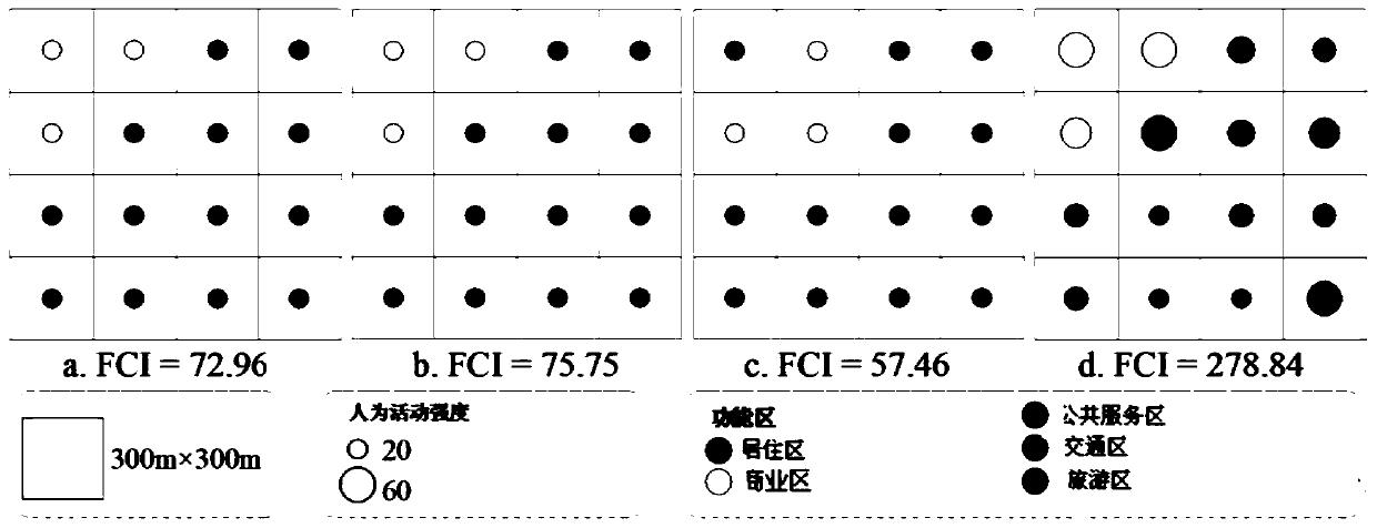
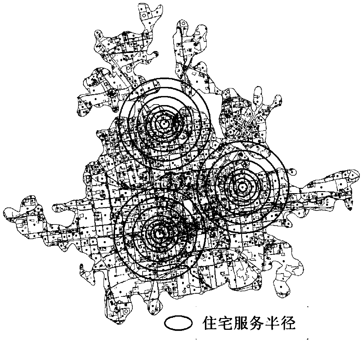
  • Method for measuring urban space function compactness
  • Method for measuring urban space function compactness
  • Method for measuring urban space function compactness

Examples


Embodiment 1

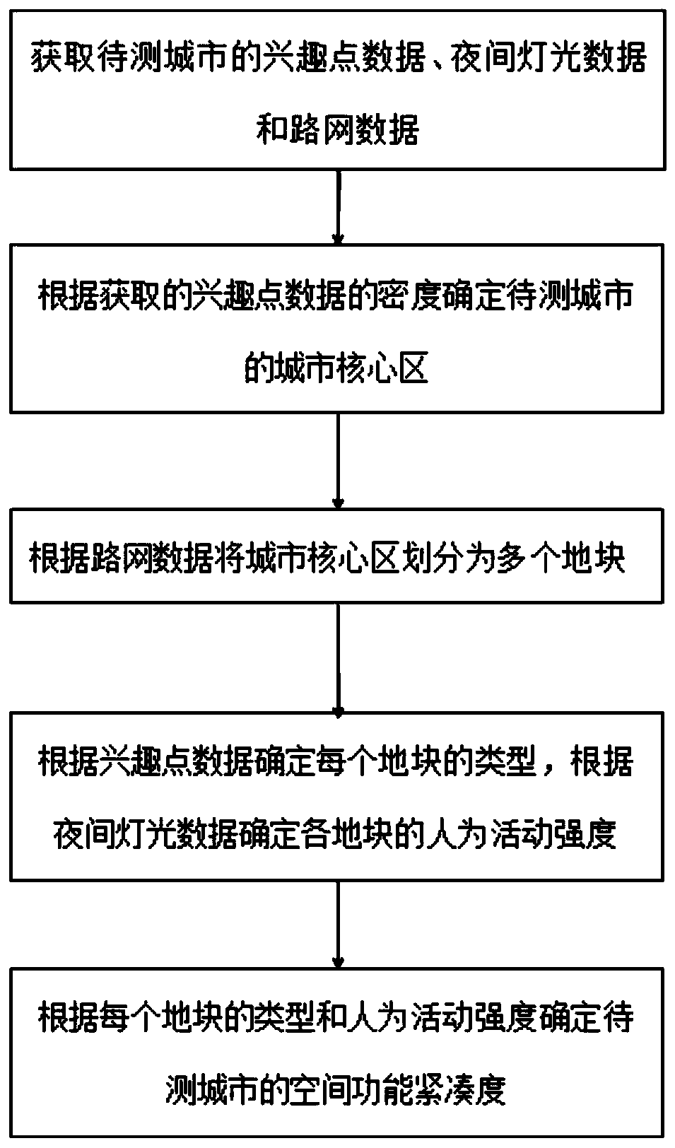
[0037] The embodiment of the present invention provides a method for measuring the compactness of urban space functions, such as figure 1 shown, including the following steps:

[0038] S1: Obtain Points of Interest (POIs) data, night light data and road network data of the city to be tested.

[0039] Points of interest refer to zero-dimensional features that refer to specific locations or real-world geospatial entities, such as historical sites, landmarks, public service facilities, shops, schools, restaurants, etc. The point-of-interest data acquired in this embodiment comes from Amap, and each point-of-interest data contains information such as name, category, latitude and longitude, and address. The obtained POI data includes a total of 14 major categories, namely catering services, shopping services, science, education and cultural services, scenic spots, public facilities, companies and enterprises, transportation facilities services, financial insurance services, commerci...

Embodiment 2

[0105] The present invention also provides a terminal device for measuring the functional compactness of urban space, including a memory, a processor, and a computer program stored in the memory and operable on the processor, and the processor executes the computer program The steps in the above method embodiment of Embodiment 1 of the present invention are realized at the same time.


PUM


Abstract

The invention relates to a method for measuring urban space function compactness. The method comprises the steps of S1, obtaining interest point data, night light data and road network data of a to-be-measured city; S2, determining the urban core area of the to-be-detected city according to the distribution density of the acquired interest point data in the to-be-detected city; S3, dividing the urban core area into a plurality of land parcels according to the road network data; S4, determining the type of each land parcel according to the interest point data, and determining the human activityintensity of each land parcel according to the night light data; and S5, determining the space function compactness of the to-be-detected city according to the types of all land parcels in the city core area of the to-be-detected city and the human activity intensity. According to the method, the dimension which cannot be expressed by the urban form compactness can be reflected, the reasonabilityof urban layout is evaluated functionally, and a new view angle is provided for urban compactness measurement.

Description

technical field [0001] The invention relates to the field of urban space measurement, in particular to a method for measuring the compactness of urban space functions. Background technique [0002] Over the past few decades, the urban population has continued to increase and urban construction land has expanded rapidly, resulting in urban sprawl and a series of social and environmental problems. In order to solve these problems, scholars, government personnel, and planners and designers have put forward many concepts and methods, and compact development is one of them. In 1973, the concept of a compact city was first proposed. Subsequently, scholars conducted research on the concept, characteristics, functions, feasibility, and the relationship between compact development and sustainable development of compact cities. Among them, how to measure urban compactness has always been one of the hotspots and difficulties of scholars. [0003] The research on compact city has bee...

Claims


Application Information

Patent Timeline
IPC IPC(8): G06Q10/06G06Q50/26G06F16/9537G06F16/29
CPCG06Q10/0639G06Q50/26G06F16/9537G06F16/29Y02A30/60
Inventor 唐立娜蓝婷徐智邦孙朗
Owner INST OF URBAN ENVIRONMENT CHINESE ACAD OF SCI
Learn More