Method and device for establishing spatial grid system and remote sensing image processing system
A grid system and remote sensing image technology, which is applied in the fields of electrical digital data processing, special data processing applications, geographic information databases, etc., can solve the problems of ineffective remote sensing image data and processing
- Summary
- Abstract
- Description
- Claims
- Application Information
AI Technical Summary
Problems solved by technology
Method used
Image
Examples
Embodiment Construction
[0046] In order to make the above objects, features and advantages of the present application more obvious and understandable, the embodiments of the present application will be further described in detail below in conjunction with the accompanying drawings and specific implementation methods.
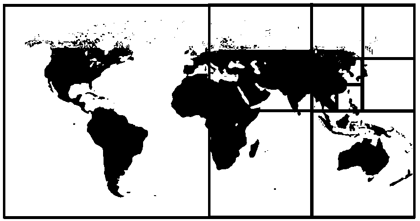
[0047] In the existing technology, the commonly used remote sensing image data scheduling method is to first preprocess the remote sensing image into multi-level tile data, see figure 1 As shown, the tile data segmentation method is usually in the longitude-latitude coordinate system, the Middle East Hemisphere region and the Western Hemisphere region of the global remote sensing image are each used as a top-level grid, and then the top-level grid is divided into quadtrees step by step, In this way, the remote sensing image is divided into multi-level tile data, and tile data of the appropriate level within the current browsing range are transmitted when requesting to browse a certain a...
PUM
 Abstract
Description
Claims
Application Information
 - R&D
- Intellectual Property
- Life Sciences
- Materials
- Tech Scout
- Unparalleled Data Quality
- Higher Quality Content
- 60% Fewer Hallucinations
Browse by: Latest US Patents, China's latest patents, Technical Efficacy Thesaurus, Application Domain, Technology Topic, Popular Technical Reports.
© 2025 PatSnap. All rights reserved.Legal|Privacy policy|Modern Slavery Act Transparency Statement|Sitemap|About US| Contact US: help@patsnap.com


