GNSS local positioning error space modeling method

A positioning error and modeling method technology, applied in the field of navigation and positioning, can solve the problems of slow transmission update speed and large data volume on the network side and terminal side, and achieve the effect of easy transmission update and small model data volume

Active Publication Date: 2019-08-09
ACAD OF OPTO ELECTRONICS CHINESE ACAD OF SCI
View PDF7 Cites 0 Cited by
  • Summary
  • Abstract
  • Description
  • Claims
  • Application Information

AI Technical Summary

Problems solved by technology

[0005] However, the existing GIS and navigation technology based on crowdsourced data mainly have technical problems such as the need for additional equipment as support for the navigation terminal, and the slow transmission and update speed between the network side and the terminal side due to the large amount of model data.

Method used


Image

  • GNSS local positioning error space modeling method
  • GNSS local positioning error space modeling method
  • GNSS local positioning error space modeling method

Examples


Embodiment Construction

[0031] Examples are given below to describe the present invention in detail.

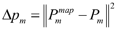
[0032] The invention provides a GNSS local positioning error space modeling method, the basic idea of ​​which is: use the available road vector map information as position reference information, and use the public vehicle positioning data obtained through mobile phone APP or public vehicle management platform Perform error calculation, that is, calculate the vertical distance between the user positioning point in the crowd source data and the line between the road nodes in the vector map, and then calculate the positioning error of the user positioning point in the horizontal direction of the road based on the vertical distance, and calculate its statistical parameters As a model variable on the spatial unit, the discrete model of the error distribution on the road space of the entire urban area is obtained, so that the model can be used to predict the positioning performance of GNSS in different roa...


PUM


Abstract

The invention discloses a GNSS local positioning error space modeling method. Error extraction and analysis are carried out through position data generated by a user daily, the navigation terminal canthus recognize an urban GNSS non-visible area without additional equipment support, and the error statistical experience parameters of the corresponding position are given. When the model is used, aslong as the approximate position of the current user is known, the current GNSS local error statistical parameter value can be queried, the model has a small amount of data, and transmission and updating between the network side and the terminal side is facilitated.

Description

technical field [0001] The invention belongs to the technical field of navigation and positioning, and in particular relates to a GNSS local positioning error space modeling method. Background technique [0002] Satellite navigation system GNSS (Global Navigation Satellite System, GNSS), as a widely used means of positioning and navigation, has the advantages of all-weather, all-time, wide-area, but also has its inherent disadvantages, mainly reflected in the fact that satellite navigation relies on navigation satellite broadcasting Under the influence of complex urban building environment, it will cause multipath and non-line-of-sight interference of navigation signals, which will cause the decline of terminal positioning performance. These disturbances are closely related to the local building layout in the city, which is called GNSS local errors here. For the multipath and non-line-of-sight problems of GNSS in complex urban environments, the current main solutions includ...

Claims


Application Information

Patent Timeline
Patent Type & Authority Applications(China)
IPC IPC(8): G01S19/23
CPCG01S19/23
Inventor 李雯王强魏东岩来奇峰李祥红纪新春申戈陆一袁洪
Owner ACAD OF OPTO ELECTRONICS CHINESE ACAD OF SCI
Why Eureka
Try Eureka