
Distributed remote sensing satellite system

A remote sensing satellite, distributed technology, applied in the field of satellite remote sensing system, can solve the problems affecting efficiency, transmission efficiency data cannot be obtained, etc., to achieve the effect of ensuring transmission efficiency and improving transmission efficiency

Active Publication Date: 2019-05-21
SPACETY CO LTD (CHANGSHA)
View PDF4 Cites 5 Cited by
  • Summary
  • Abstract
  • Description
  • Claims
  • Application Information

AI Technical Summary

Problems solved by technology

[0006] However, with the development of technology, as the accuracy of images collected by remote sensing satellites is getting higher and higher, its remote sensing data is getting bigger and bigger. get, which affects the efficiency

Method used


Image

  • Distributed remote sensing satellite system
  • Distributed remote sensing satellite system
  • Distributed remote sensing satellite system

Examples


Embodiment 1

[0037] This embodiment discloses a remote sensing system, or a distributed remote sensing system, or a distributed remote sensing satellite system. In the case of no conflict or contradiction, the whole of the preferred implementations of other embodiments and / or Or part of the content can be used as a supplement to this embodiment. The system is suitable for executing each method step described in the present invention, so as to achieve the expected technical effect.

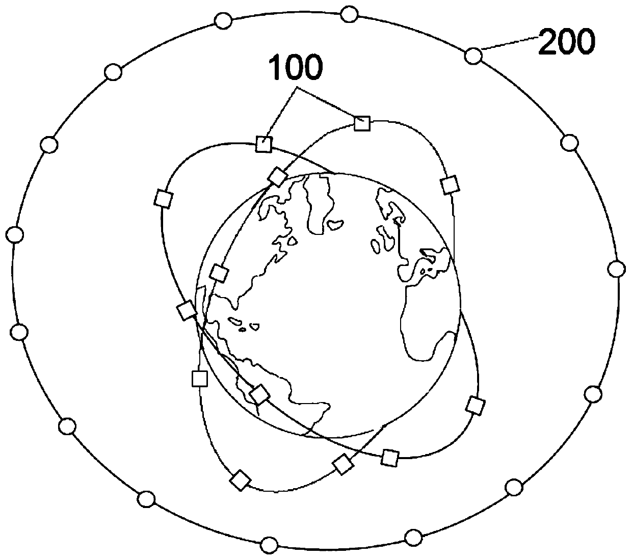
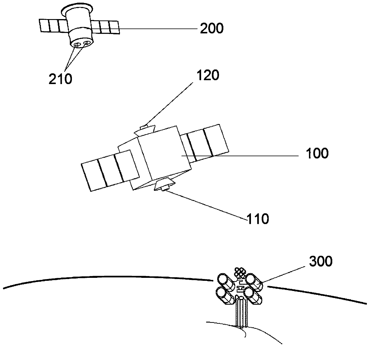
[0038] According to a preferred embodiment, the system may comprise several first satellites 100 and several second satellites 200 . The plurality of first satellites 100 may be low-orbit remote sensing satellites and are distributed on at least two orbital planes different from each other. There may be at least three first satellites 100 on each of the at least two orbital planes. The second satellite 200 may be a satellite in geosynchronous orbit. Remote sensing images and / or remote sensing data collected ...


PUM


Abstract

The invention relates to a distributed remote sensing satellite system. The system comprises a plurality of first satellites and a plurality of second satellites, the plurality of first satellites arelow-orbit remote sensing satellites and are distributed on at least two orbit planes; wherein each of the at least two orbit planes is provided with at least three first satellites, the second satellite is a geosynchronous orbit satellite, and remote sensing data collected by the first satellite can be directly transmitted to a ground station or indirectly transmitted to the ground station through the corresponding second satellite. High-definition remote sensing images are collected through the low-orbit remote sensing satellites, remote sensing data can be transmitted to the ground stationby means of the synchronous orbit satellites, and the transmission efficiency of the remote sensing data is greatly improved and guaranteed.

Description

technical field [0001] The invention relates to a satellite remote sensing system, in particular to a distributed remote sensing satellite system. Background technique [0002] The term remote sensing comes from the English "Remote Sensing", which literally translates as "distant perception". After a long time, people simply translated it as remote sensing. Remote sensing is a comprehensive technology for earth observation developed in the 1960s. Since the 1980s, remote sensing technology has been greatly developed, and the application of remote sensing technology is becoming more and more extensive. With the continuous progress of remote sensing technology and the continuous deepening of remote sensing technology application, the future remote sensing technology will play an increasingly important role in my country's national economic construction. There are usually two interpretations of the scientific meaning of remote sensing: broad sense and narrow sense: broad sense...

Claims


Application Information

Patent Timeline
Patent Type & Authority Applications(China)
IPC IPC(8): G01N21/31G06K9/00
CPCG01N21/25H04B10/118G06V20/13Y02A90/10H04B7/18513H04B7/18567
Inventor 任维佳杨峰杜志贵陈险峰
Owner SPACETY CO LTD (CHANGSHA)
Learn More