A method and device for displaying massive points in an electronic map

An electronic map and massive technology, applied in the Internet field, can solve the problems of browser crash, reduce browser performance, unable to display points of interest, etc., and achieve the effect of reducing the number of uses and improving performance

Active Publication Date: 2022-03-04
BEIJING KINGSOFT CLOUD NETWORK TECH CO LTD +1
View PDF7 Cites 0 Cited by
  • Summary
  • Abstract
  • Description
  • Claims
  • Application Information

AI Technical Summary

Problems solved by technology

[0006] It can be seen that in the prior art, either it is impossible to display all the points of interest in the mass points, and to display all the points of interest will seriously reduce the performance of the browser, and even cause the browser to crash

Method used


Image

  • A method and device for displaying massive points in an electronic map
  • A method and device for displaying massive points in an electronic map
  • A method and device for displaying massive points in an electronic map

Examples


Embodiment Construction

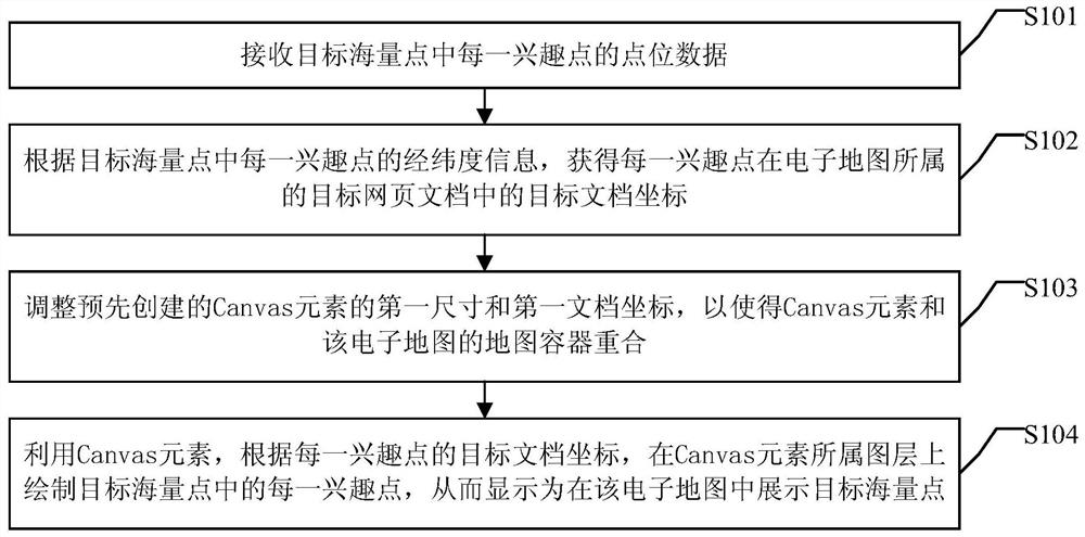
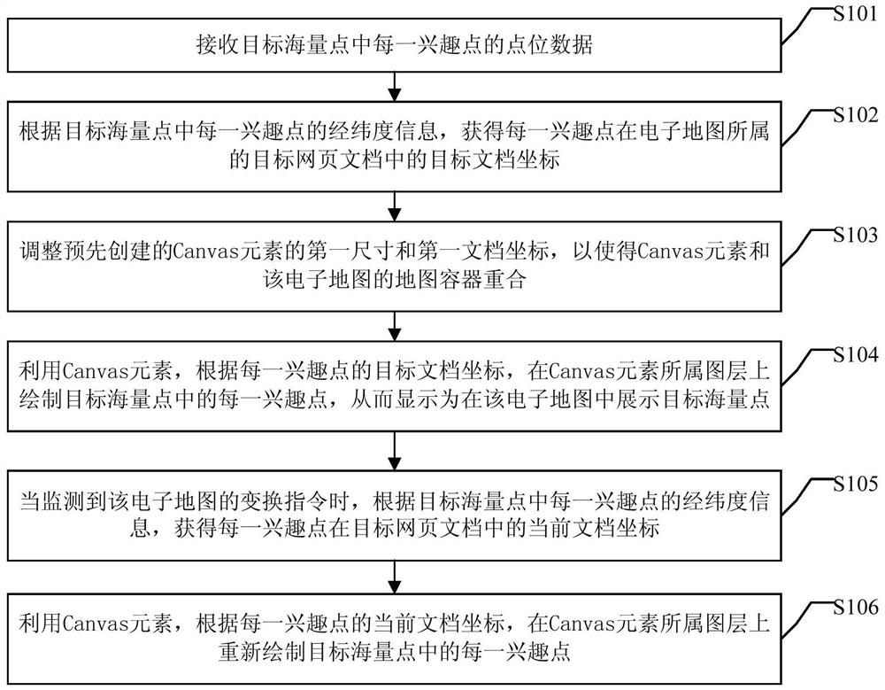
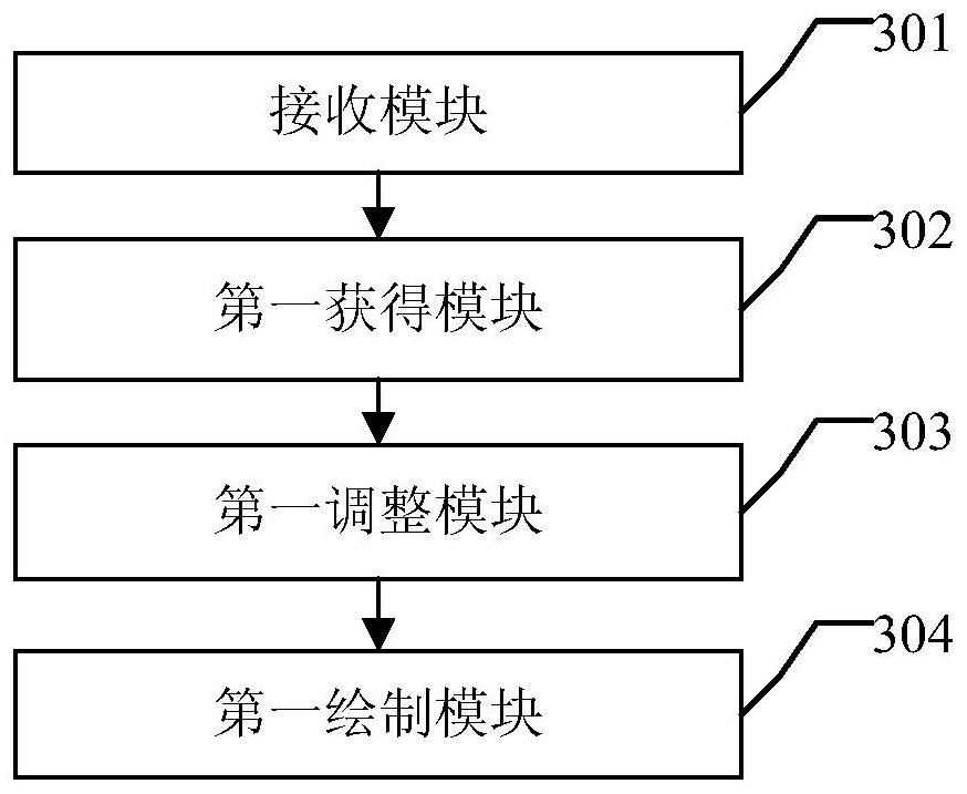
[0076] The following will clearly and completely describe the technical solutions in the embodiments of the present invention with reference to the accompanying drawings in the embodiments of the present invention. Obviously, the described embodiments are only some, not all, embodiments of the present invention. Based on the embodiments of the present invention, all other embodiments obtained by persons of ordinary skill in the art without making creative efforts belong to the protection scope of the present invention.

[0077] In order to display all the points of interest in the massive points and improve the performance of the browser, the embodiments of the present invention provide a method and device for displaying the massive points in the electronic map.

[0078] In the following, a method for displaying massive points in an electronic map provided by an embodiment of the present invention will be firstly introduced.

[0079] Such as figure 1 As shown, the embodiment ...


PUM


Abstract

Embodiments of the present invention provide a method and device for displaying massive points in an electronic map. The method includes: receiving point data of each point of interest in the target mass points, wherein the point data at least includes latitude and longitude information; and obtaining the position of each point of interest in the electronic map according to the longitude and latitude information of each point of interest in the target mass point. The target document coordinates in the target webpage document of Coordinates, draw each point of interest in the target mass point on the layer to which the Canvas element belongs, so as to display the target mass point in the electronic map. Through the technical solution, all interest points concerned in the massive points can be displayed, and the performance of the browser can be improved.

Description

technical field [0001] The invention relates to the technical field of the Internet, in particular to a method and device for displaying massive points in an electronic map. Background technique [0002] At present, WebGIS (Network Geographic Information System) has been widely used, covering almost all fields including transportation, regional planning, military technical investigation, commercial finance, electric power and water conservancy, etc.; and its application methods are also diverse, including Geolocation, route planning, location query, real-time display, real-time traffic, etc. [0003] In some application scenarios, such as the background monitoring system of shared bicycles, it is necessary to monitor a large number of shared bicycles in real time, so it is necessary to display the abstract points of interest of all shared bicycles in the electronic map; another example is some LBS (Location Based Service , location-based service) system, it is necessary to ...

Claims


Application Information

Patent Timeline
Patent Type & Authority Patents(China)
IPC IPC(8): G06F16/29
Inventor 李传庆
Owner BEIJING KINGSOFT CLOUD NETWORK TECH CO LTD
Why Eureka
Try Eureka