
A planning method for unmanned aerial vehicle aerial photography operations

A UAV and aerial photography technology, applied in navigation calculation tools, camera devices, etc., can solve the problems of extensive planning and lack of rationality, and achieve the effect of improving the quality of aerial surveys and the efficiency of aerial photography operations.

Active Publication Date: 2021-05-25
CHENGDU JOUAV AUTOMATION TECH
View PDF0 Cites 0 Cited by
  • Summary
  • Abstract
  • Description
  • Claims
  • Application Information

AI Technical Summary

Problems solved by technology

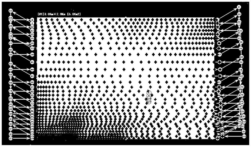
[0003] In order to solve the technical problems such as extensive planning and lack of rationality in the existing technology, the present invention proposes a planning method for UAV aerial photography operation, which optimizes the aerial photography route under the constraint of real overlap rate and takes DEM into consideration Adjustment and determination of aerial photography exposure points to achieve precise, automated and adaptive aerial photography task planning

Method used


Image

  • A planning method for unmanned aerial vehicle aerial photography operations
  • A planning method for unmanned aerial vehicle aerial photography operations
  • A planning method for unmanned aerial vehicle aerial photography operations

Examples


Embodiment

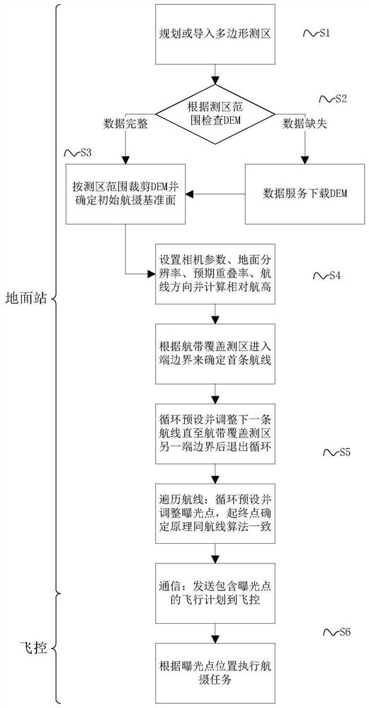
[0033] Such as figure 1 As shown, a kind of unmanned aerial vehicle aerial photography operation planning method of the present invention, it specifically comprises the following technical characteristics:

[0034] S1, the user plans or imports a polygon survey area through the UAV ground station software;

[0035] S2, the ground station checks whether the local DEM data is complete according to the scope of the survey area. If the local DEM data cannot completely cover the current survey area, download the required DEM data from the specified data service, and then perform step S3; if the DEM data is complete, continue Execute step S3;

[0036] S3, cut the DEM according to the scope of the survey area, and calculate the average elevation of the survey area as the initial aerial photography datum elevation;

[0037] S4. According to the aerial photography task, the user sets the aerial photography task parameters such as camera parameters, ground resolution, expected overlap...


PUM


Abstract

The invention discloses a planning method for unmanned aerial vehicle aerial photography operations. Under the constraints of the real overlap rate, the method iteratively adjusts the route and the position of the exposure point to obtain a more optimized and reliable exposure point, generates a flight plan according to the exposure point, and communicates After the flight control system receives the flight plan, it will execute the aerial photography task according to the position of the exposure point in the plan. The present invention designs a convergent iterative adjustment algorithm and DEM elevation query technology by considering terrain fluctuations and DEM under the constraints of the real overlap rate, which can realize self-adaptation and optimal adjustment of air routes and exposure point positions, and guarantee The aerial photography plan is more in line with expectations, and the aerial survey quality and aerial photography operation efficiency are improved.

Description

technical field [0001] The invention relates to the field of low-altitude digital photogrammetry, in particular to a planning method for aerial photography operations of unmanned aerial vehicles. Background technique [0002] As an important means of modern remote sensing surveying and mapping technology, UAV aerial photography is playing an increasingly important role in surveying and mapping work due to its advantages of flexibility and rapid deployment. Important content, its accuracy, degree of automation and design speed will directly affect the quality and benefits of aerial photography; the main work of aerial photography task planning requires the completion of aerial photography divisions, optimization and adjustment of routes, laying of exposure points, and the design results Send it to the flight control system of the UAV in a certain format, and the UAV will complete the aerial photography task. Obviously, the quality of the design results such as the division o...

Claims


Application Information

Patent Timeline
Patent Type & Authority Patents(China)
IPC IPC(8): G01C11/02G01C21/20G01C21/22
CPCG01C11/02G01C21/20G01C21/22
Inventor 刘夯郭有威任斌王陈陈鹏
Owner CHENGDU JOUAV AUTOMATION TECH
Learn More