
Outdoor comprehensive surveying and mapping device for military topography

A surveying and mapping device and topographical technology, applied in the field of military topography, can solve the problems of time-consuming and laborious measurement accuracy, slow erection, inconvenient carrying, etc., and achieve the effects of ensuring levelness, convenient measurement, and improving measurement accuracy

Pending Publication Date: 2017-05-24
朱志亨
View PDF7 Cites 4 Cited by
  • Summary
  • Abstract
  • Description
  • Claims
  • Application Information

AI Technical Summary

Problems solved by technology

[0002] In the teaching and training of traditional military topography on-site maps, drawing boards are usually combined with simple equipment for teaching and measurement. The teaching process is time-consuming and laborious, and the measurement accuracy is not high. At the same time, traditional teaching equipment also has defects such as inconvenient to carry, slow to set up, and complicated operations. , which is not conducive to the teaching and training of on-site maps for military topography

Method used


Image

  • Outdoor comprehensive surveying and mapping device for military topography
  • Outdoor comprehensive surveying and mapping device for military topography
  • Outdoor comprehensive surveying and mapping device for military topography

Examples


Embodiment Construction

[0024] The principles and features of the present invention are described below in conjunction with the accompanying drawings, and the examples given are only used to explain the present invention, and are not intended to limit the scope of the present invention.

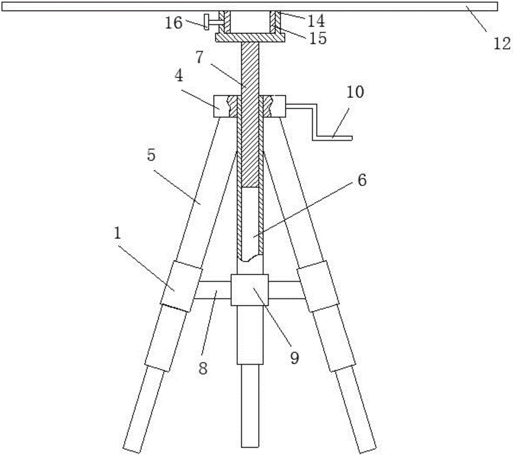
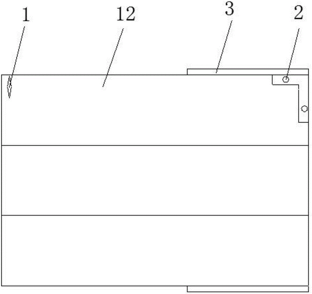
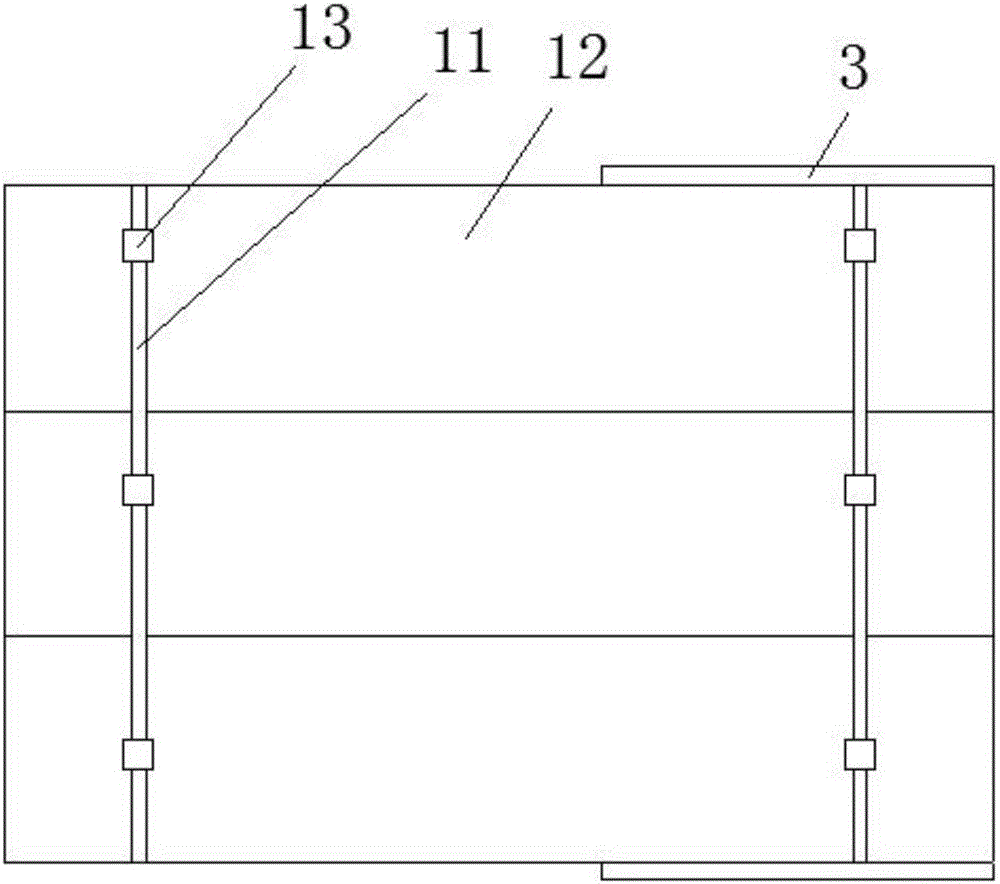
[0025] Such as figure 1 Shown, a kind of field comprehensive surveying and mapping device of military topography comprises support frame, lifting mechanism and surveying and mapping platform, the top of described supporting frame is provided with described lifting mechanism, and the upper end of described lifting mechanism is detachably connected with described surveying and mapping platform. The surveying and mapping platform is provided with a magnetic direction pointer 1 for pointing north and a bubble 2 for correcting the horizontality of the surveying and mapping platform. Both sides of the surveying and mapping platform are hinged with a measuring ruler 3 that is used to measure the distance between the target...


PUM


Abstract

The invention relates to an outdoor comprehensive surveying and mapping device for military topography. The device comprises a support frame, a lifting mechanism and a surveying and mapping platform, wherein the lifting mechanism is arranged at the top of the support frame, the upper end of the lifting mechanism is detachably connected with the surveying and mapping platform, and a magnetic direction pointer and bubbles used for correcting the horizontal degree of a surveying and mapping platform are arranged on the surveying and mapping platform; measuring rulers used for measuring the distance between a target and measuring points are hinged on two sides of the surveying and mapping platform, and scales for measuring the included angle between the highest point of the target and the measuring point connecting line and between the lowest point of the target and the measuring point connecting line by vertically arranging the measuring rulers are formed in the measuring rulers. The outdoor comprehensive surveying and mapping device has the benefits as follows: a map is placed in a full sheet on the surveying and mapping platform for operation according to the magnetic direction pointer, consistency of the map direction and the field direction is guaranteed, meanwhile, the horizontal degree of the surveying and mapping platform is guaranteed by observing bubbles, and finally, the measuring accuracy is improved; the surveying and mapping platform height can be adjusted steplessly, and measurement is convenient.

Description

technical field [0001] The invention relates to the field of military topography, in particular to a field comprehensive surveying and mapping device for military topography. Background technique [0002] In the teaching and training of traditional military topography on-site maps, drawing boards are usually combined with simple equipment for teaching and measurement. The teaching process is time-consuming and laborious, and the measurement accuracy is not high. , It is not conducive to the teaching and training of on-the-spot maps for military topography. Contents of the invention [0003] To sum up, in order to overcome the deficiencies of the prior art, the technical problem to be solved by the present invention is to provide a comprehensive field surveying and mapping device for military topography. [0004] The technical solution of the present invention to solve the above-mentioned technical problems is as follows: a field comprehensive surveying and mapping device ...

Claims


Application Information

Patent Timeline
IPC IPC(8): G01C3/22
CPCG01C3/22
Inventor 朱伟张湘君朱志亨王明清陈森
Owner 朱志亨
Learn More