Attribute matching method based on geographic ontology in land utilization spatial data processing
A technology of spatial data and geographic ontology, applied in the field of attribute matching based on geographic ontology, can solve the problems of matching errors and limited scope of application, and achieve the effect of preventing matching errors.
- Summary
- Abstract
- Description
- Claims
- Application Information
AI Technical Summary
Problems solved by technology
Method used
Image
Examples
Embodiment Construction
[0032] An attribute matching method based on geographic ontology in land use spatial data processing, which is realized by the following steps:
[0033] 1) construct geographic ontology; Described geographic ontology includes ontology class storehouse, ontology relation storehouse, knowledge base; Concrete construction steps include:
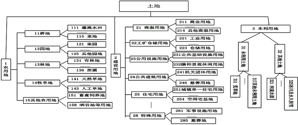
[0034] 1.1) Build ontology class library; Described ontology class library includes land classification, administrative division, spatial coordinate system, element type; Concrete construction steps include:
[0035] 1.1.1) Construct land classification;
[0036] 1.1.2) Construct administrative divisions;
[0037] 1.1.3) Construct a space coordinate system;
[0038] 1.1.4) Build element types;
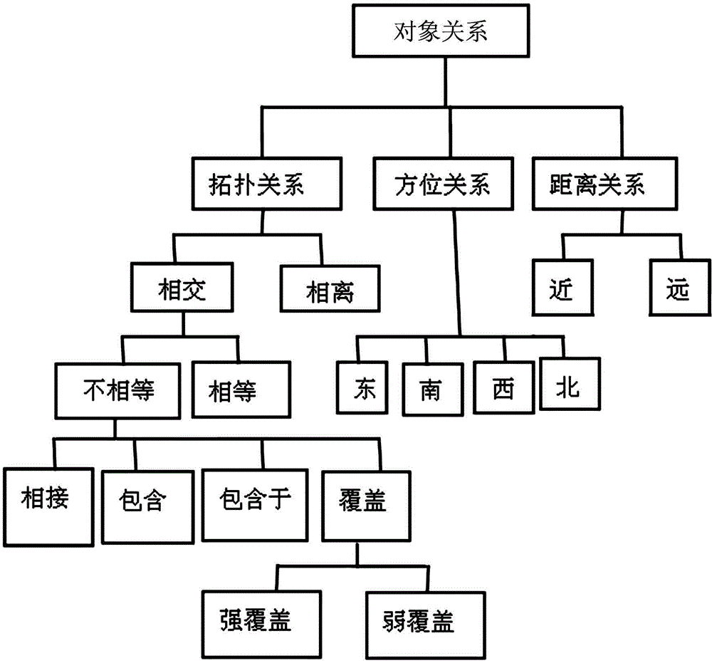
[0039] 1.2) Build ontology relational library: described ontology relational library includes object relational library, numerical value relational library; Concrete construction steps include:
[0040] 1.2.1) Build an object relational library;
[...
PUM
 Abstract
Description
Claims
Application Information
 - R&D Engineer
- R&D Manager
- IP Professional
- Industry Leading Data Capabilities
- Powerful AI technology
- Patent DNA Extraction
Browse by: Latest US Patents, China's latest patents, Technical Efficacy Thesaurus, Application Domain, Technology Topic, Popular Technical Reports.
© 2024 PatSnap. All rights reserved.Legal|Privacy policy|Modern Slavery Act Transparency Statement|Sitemap|About US| Contact US: help@patsnap.com


