
Method for optimizing navigation line of long-distance freight vehicle

A technology of vehicle navigation and optimization method, which is applied in the field of vehicle navigation, and can solve problems such as vehicle violation accidents, failure to consider impact, and danger

Inactive Publication Date: 2015-04-15
北京中交兴路车联网科技有限公司
View PDF11 Cites 6 Cited by
  • Summary
  • Abstract
  • Description
  • Claims
  • Application Information

AI Technical Summary

Problems solved by technology

[0003] The existing long-distance freight vehicle navigation method is only based on the starting point and end point input by the user combined with the existing road data for path matching
It does not consider the impact of real-time weather conditions on long-distance freight vehicles
And because many roads have restrictions on freight vehicles, the existing long-distance freight vehicle navigation method does not have the influence of road restriction information data on the route, which will lead to vehicle violations and accidents.

Method used


Image

  • Method for optimizing navigation line of long-distance freight vehicle

Examples


Embodiment Construction

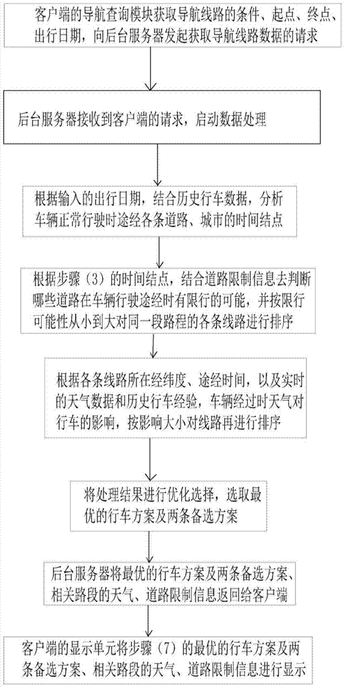
[0016] like figure 1 As shown, the optimization method of this long-distance freight vehicle navigation route, the navigation system includes a client and a background server, the client includes a navigation query module and a display unit, and the method includes the following steps:

[0017] (1) The navigation query module of the client side obtains the conditions, starting point, end point, and travel date of the navigation route (default is the system time of the device at the time of query), and initiates a request for obtaining navigation route data to the background server;

[0018] (2) The background server receives the client's request and starts data processing;

[0019] (3) According to the input travel date, combined with the historical driving data, analyze the time nodes of the roads and cities that the vehicle passes through during normal driving;

[0020] (4) According to the time node in step (3), combined with the road restriction information, it is judged ...


PUM


Abstract

The invention discloses a method for optimizing navigation lines of long-distance freight vehicles. The method comprises the following steps: (1) acquiring conditions, starting point, destination and departure date of a navigation line by a navigation query module and sending request to a background server; (2) receiving the request and starting data processing by the background server; (3) according to the input data, analyzing time nodes of the vehicle passing through the roads and cities under normal running; (4) based on the time nodes, combining road limit information and sorting various lines in a same journey by the possibility of traffic control from low to high; (5) according to the latitude, longitude lines and passing time of various lines and the real-time weather data, historical driving experience and impact of weather on the traffic when the vehicle passes, sorting the lines again according to the level of impact; (6) optimizing the results and selecting an optimal travel scheme and two alternatives; (7) returning the travel scheme to a user by the background server; and (8) displaying the background on a client terminal.

Description

technical field [0001] The invention relates to the technical field of vehicle navigation, in particular to a method for optimizing the navigation route of long-distance freight vehicles. Background technique [0002] With the development and progress of human society, people's demand for long-distance transportation of goods is increasing, and long-distance freight vehicles are growing rapidly. However, many new drivers are not familiar with driving routes, so there is an urgent need for navigation systems to help them drive freight vehicles from the starting point to the destination smoothly and safely. [0003] Existing navigation methods for long-distance freight vehicles only do path matching according to the starting point and end point input by the user in combination with existing road data. It does not consider the impact of real-time weather conditions on long-distance freight vehicles. And because many roads have restrictions on freight vehicles, existing long-d...

Claims


Application Information

Patent Timeline
Patent Type & Authority Applications(China)
IPC IPC(8): G01C21/34
CPCG01C21/3407
Inventor 褚宪明杨健邓伟
Owner 北京中交兴路车联网科技有限公司
Learn More