
Inter-city road network index and matching method

A technology of inter-city road network and road network, which is applied in the field of inter-city road network indexing and matching, and can solve problems such as not being able to meet calculation requirements

Active Publication Date: 2013-03-27
北京千方城市信息科技有限公司
View PDF6 Cites 73 Cited by
  • Summary
  • Abstract
  • Description
  • Claims
  • Application Information

AI Technical Summary

Problems solved by technology

At present, the grid size within the 6th ring road in Beijing is 2,000*1,500, while the grid of the same size needs to be 230,000*130,000 across the country. Even if the intercity road network is partitioned, it cannot meet the calculation requirements

Method used


Image

  • Inter-city road network index and matching method
  • Inter-city road network index and matching method
  • Inter-city road network index and matching method

Examples


Embodiment Construction

[0022] In order to make the object, technical solution and advantages of the present invention clearer, the present invention will be further described in detail below in conjunction with the accompanying drawings.

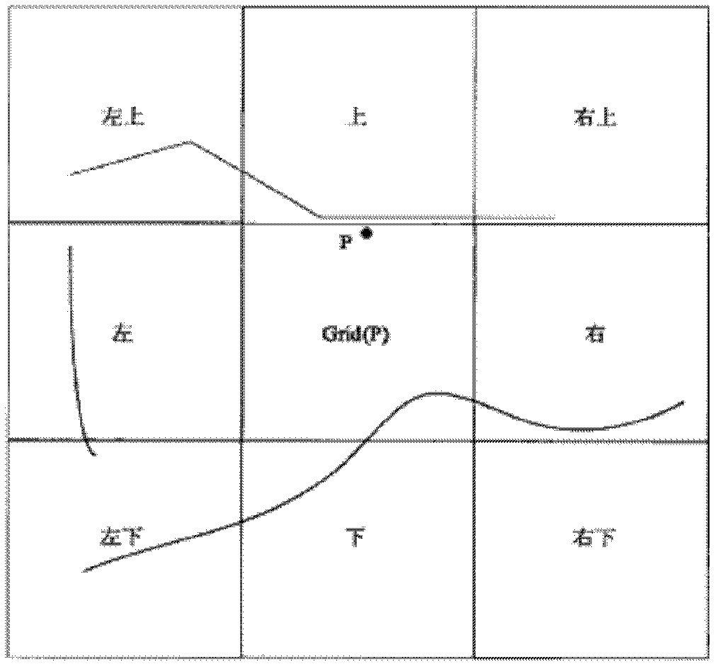
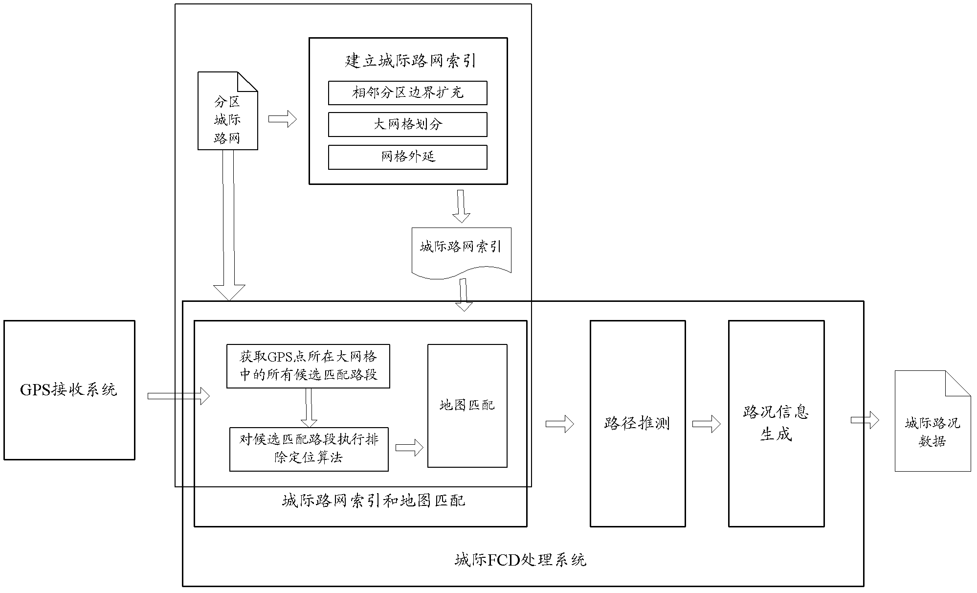
[0023] The embodiment of the present invention aims at the problem that the current grid index algorithm is inapplicable due to the large range of the intercity road network, and proposes a map matching algorithm with GPS points as the calculation center. By partitioning the intercity road network, large grid Indexing, as well as running exclusion positioning algorithms in large grids, efficiently solve the problem of intercity road network indexing and matching.

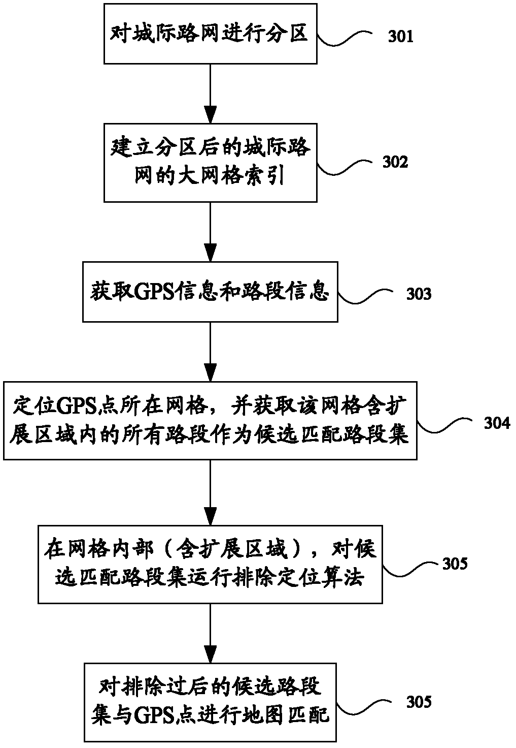
[0024] figure 2 is a schematic diagram of the intercity road network indexing and matching method provided by the embodiment of the present invention. Based on this figure, the flow of the indexing and matching method is as follows image 3 shown, including:

[0025] Step 301, partitioning the interc...


PUM


Abstract

The invention discloses an inter-city road network index and a matching method. The invention belongs to the field of intelligent transportation. The method comprises the steps that: an inter-city road network is partitioned; a large-grid index of the partitioned inter-city road network is established, such that road section sets contained in the large-grids of the regions after partitioning can be acquired; GPS information is received from a GPS receiving system; the grid in which the GPS information exists is positioned, and a candidate matching set of road sections is acquired; an exclusion positioning method is operated in the grid; and the candidate matching set obtained after exclusion is subjected to map matching with the GPS information, such that a matching road section is found. According to the invention, the inter-city road network is partitioned, the large-grid index is established, and an algorithm is operated in the large-grid, such that inter-city road network index and matching problems are solved with high efficiency.

Description

technical field [0001] The invention relates to the field of intelligent transportation, in particular to an intercity road network indexing and matching method. Background technique [0002] In the field of intelligent transportation, real-time dynamic traffic information services can provide efficient and feasible traffic guidance and travel planning information for public travel, transportation, etc., so as to save time, reduce costs, and low-carbon environmental protection. At present, the traffic information service in the city has become increasingly in-depth and affects people's travel life. [0003] With the rapid economic growth and convenient transportation, the connection between cities has become closer. Intercity road transportation has formed a scale and has become an important form of people flow and logistics. Intercity roads, like inner city roads, face challenges Increasing volume pressure. In this context, providing real-time and dynamic traffic informa...

Claims


Application Information

Patent Timeline
Patent Type & Authority Applications(China)
IPC IPC(8): G01C21/30G01S19/39
Inventor 李平郭胜敏张高峰
Owner 北京千方城市信息科技有限公司
Learn More