Self-adaption interpolating method for real ground-surface ray tracking
A technology of ray tracing and interpolation method, which is applied in the field of oil and gas seismic exploration, and can solve the problems of insignificant practical operation in complex areas, unsuitable for complex structural imaging, and single function of calculation methods.
- Summary
- Abstract
- Description
- Claims
- Application Information
AI Technical Summary
Problems solved by technology
Method used
Image
Examples
Embodiment Construction
[0018] Embodiments of the invention will now be described in detail, examples of which are illustrated in the accompanying drawings, wherein like reference numerals refer to like parts throughout. The embodiments are described below in order to explain the present invention by referring to the figures.
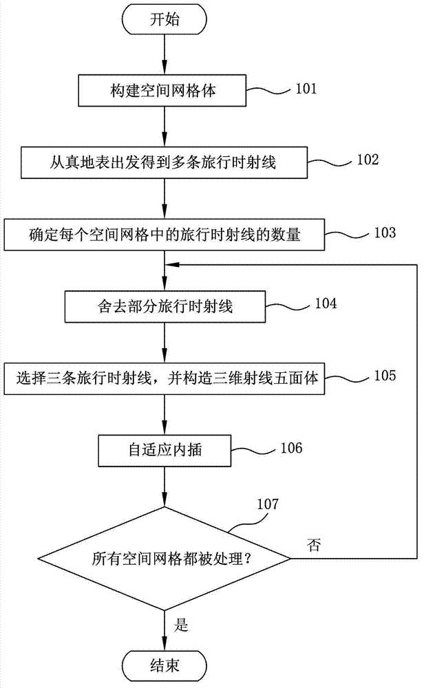
[0019] figure 1 is a flow chart showing the true-surface ray tracing adaptive interpolation method according to the present invention.
[0020] refer to figure 1 , in step 101, divide the space where travel-time ray tracing needs to be performed into spatial grids in the depth domain composed of multiple spatial grids, wherein the side length of each spatial grid may be 5 meters, that is, each A spatial grid is 5m x 5m x 5m. However, the present invention is not limited thereto, and the side lengths of the spatial grid can be set differently according to actual needs.
[0021] In step 102, a ray tracing calculation is performed starting from the real surface to obtain mult...
PUM
 Abstract
Description
Claims
Application Information
 - R&D Engineer
- R&D Manager
- IP Professional
- Industry Leading Data Capabilities
- Powerful AI technology
- Patent DNA Extraction
Browse by: Latest US Patents, China's latest patents, Technical Efficacy Thesaurus, Application Domain, Technology Topic, Popular Technical Reports.
© 2024 PatSnap. All rights reserved.Legal|Privacy policy|Modern Slavery Act Transparency Statement|Sitemap|About US| Contact US: help@patsnap.com


