Satellite retrieval method for night rainfall probability
A satellite and inversion technology, applied in the field of atmospheric science research, can solve problems such as increasing the difficulty of inversion at night, and achieve good application advantages and good consistency
- Summary
- Abstract
- Description
- Claims
- Application Information
AI Technical Summary
Problems solved by technology
Method used
Image

Examples
Embodiment Construction
[0030] The accompanying drawings disclose non-restrictive schematic diagrams of preferred embodiments involved in the present invention; the technical solutions of the present invention will be described in detail below in conjunction with the accompanying drawings.
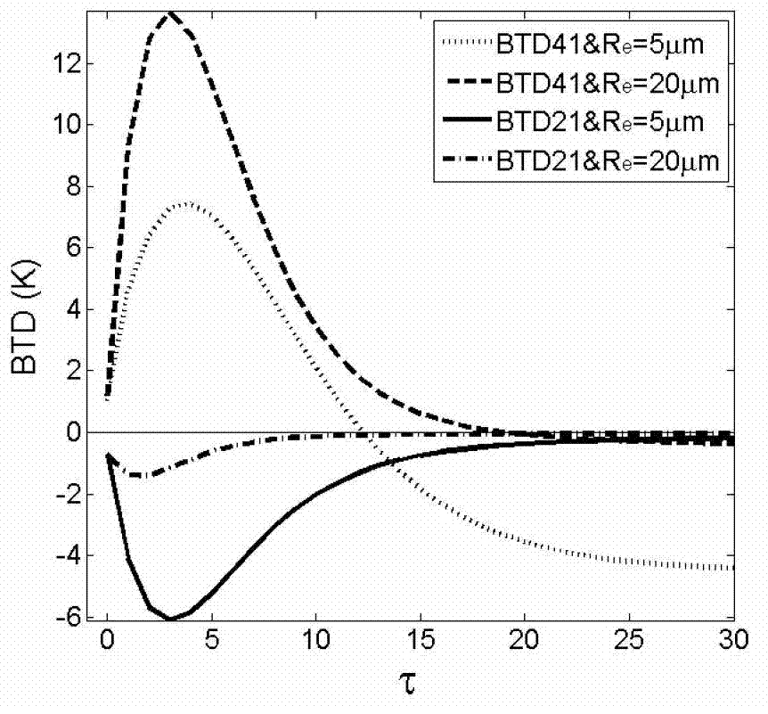
[0031] The spectral data used in this paper comes from the new generation of geostationary meteorological satellite multifunctional transport satellite (MTSAT)-2 in Japan, and the definitions of channels or brightness temperature difference (BTD) involved are shown in Table 1. The satellite images are all projected in the same longitude and latitude, and the resolution of longitude and latitude is 0.05°. There are satellite images every half hour from July to September 2010 for research, the images in August are used to form the algorithm, and the images in the other two months are used for algorithm evaluation 。
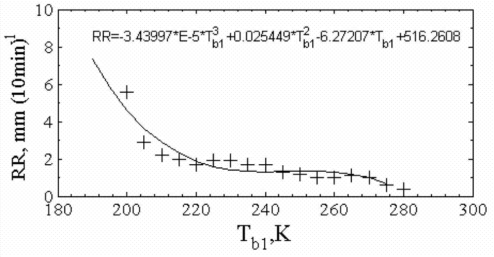
[0032] This paper uses the ground data recorded by more than 300 automatic station rain gauges in ...
PUM
 Abstract
Description
Claims
Application Information
 - Generate Ideas
- Intellectual Property
- Life Sciences
- Materials
- Tech Scout
- Unparalleled Data Quality
- Higher Quality Content
- 60% Fewer Hallucinations
Browse by: Latest US Patents, China's latest patents, Technical Efficacy Thesaurus, Application Domain, Technology Topic, Popular Technical Reports.
© 2025 PatSnap. All rights reserved.Legal|Privacy policy|Modern Slavery Act Transparency Statement|Sitemap|About US| Contact US: help@patsnap.com