2-dimensional (2-d) radar error registration two-step algorithm under earth centered earth fixed (ECEF) coordinate system
An error registration and coordinate system technology, applied in the field of two-coordinate radar error registration, can solve the problem of low accuracy of system deviation estimation
- Summary
- Abstract
- Description
- Claims
- Application Information
AI Technical Summary
Problems solved by technology
Method used
Image
Examples
Embodiment Construction
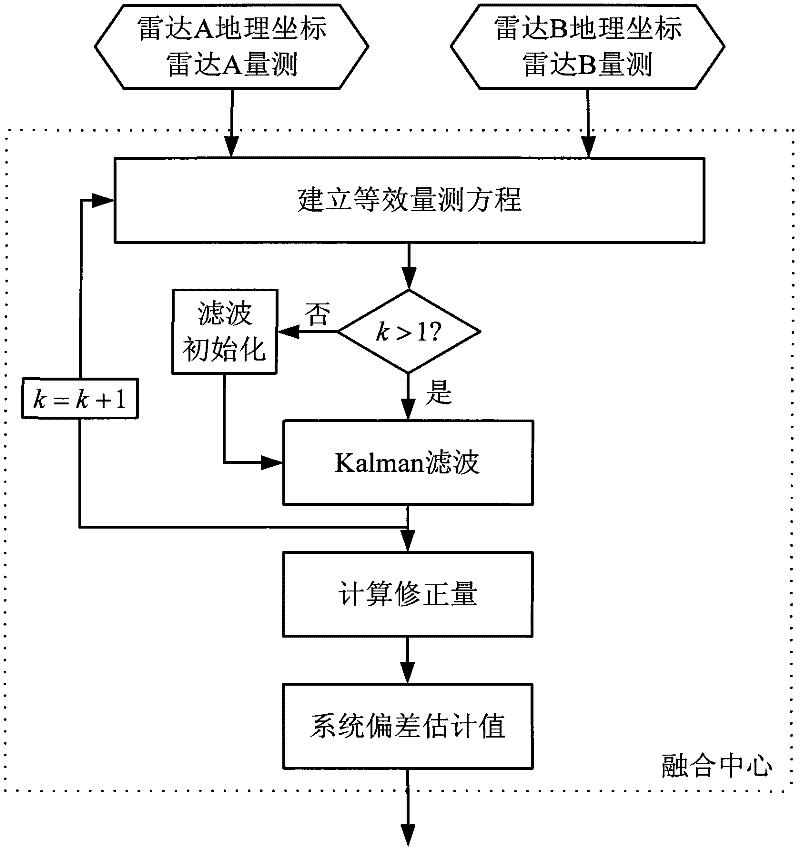
[0074] The two-coordinate radar error registration method based on the ECEF coordinate system of the present invention will be described in detail below with reference to the accompanying drawings.
[0075] Assume that radars A and B are fixed radars, and their geographic coordinates are [40°113°100m] and [40.5°113.5°300m] respectively. The target moves in a straight line at a uniform speed, and its initial state in the coordinate system with radar A as the fusion center is: [-80km 200m / s 25km 05km 0], and the process noise on the x, y, and z axes is 1m / s respectively 2 、1m / s 2 , 0. The measurement noise standard deviation of the two radars is the same, distance: 200m, azimuth: 0.5°. The system deviations of the two radars are the same, set the distance deviation as 1500m, and the azimuth deviation as 0.04rad. The geometric relationship between the relative position of the radar and the target is as attached figure 2 shown. Set the radar sampling period to 5s, simulate 2...
PUM
 Abstract
Description
Claims
Application Information
 - R&D
- Intellectual Property
- Life Sciences
- Materials
- Tech Scout
- Unparalleled Data Quality
- Higher Quality Content
- 60% Fewer Hallucinations
Browse by: Latest US Patents, China's latest patents, Technical Efficacy Thesaurus, Application Domain, Technology Topic, Popular Technical Reports.
© 2025 PatSnap. All rights reserved.Legal|Privacy policy|Modern Slavery Act Transparency Statement|Sitemap|About US| Contact US: help@patsnap.com


