Sea-sky mergence real-time simulation method
A real-time simulation and sky technology, applied in the field of sea level simulation, can solve problems such as the inability to simulate the infinitely vast sea surface, and achieve the effect of solving obvious boundary problems
- Summary
- Abstract
- Description
- Claims
- Application Information
AI Technical Summary
Problems solved by technology
Method used
Image
Examples
Embodiment Construction
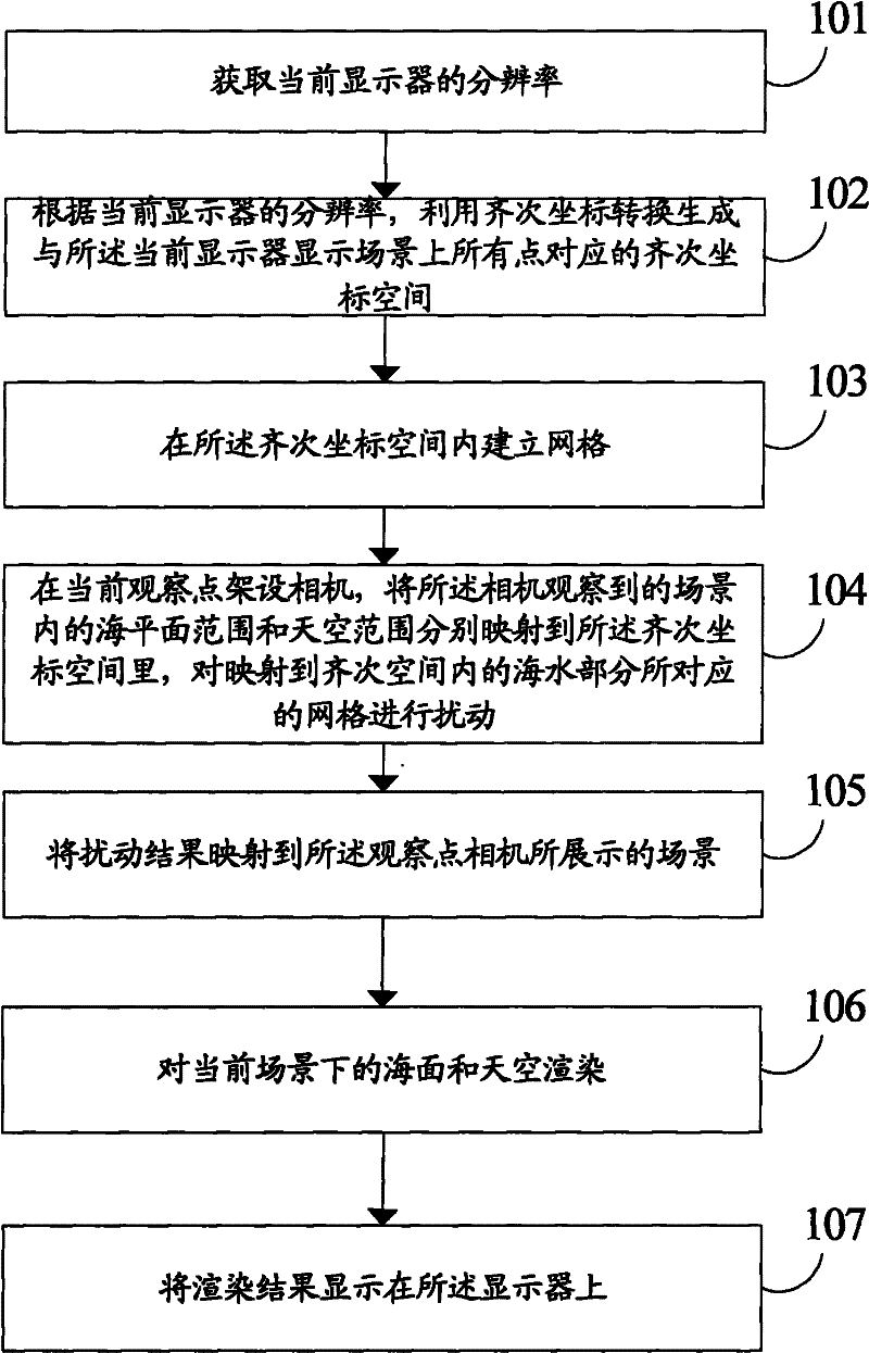
[0031] Please see figure 1 As shown, the present invention provides a method for real-time simulation of sea-sky contact, which includes:
[0032] Step 101, acquire the resolution of the current display.
[0033] Step 102, according to the resolution of the current display, use homogeneous coordinate transformation to generate a homogeneous coordinate space corresponding to all points on the sea level displayed on the current display.
[0034] In a specific embodiment, the step of using homogeneous coordinate transformation to generate a homogeneous coordinate space corresponding to all points on the sea level displayed on the current display includes:
[0035] Establish the coordinate value (x, y) of each pixel in the orthogonal coordinate system;
[0036] Generate a two-dimensional space [x, y] for each pixel; and
[0037] Generates a two-dimensional homogeneous space [x, y, w] where 0<=w<=1.
[0038] The volume of the homogeneous space generated in this way will be rela...
PUM
 Abstract
Description
Claims
Application Information
 - Generate Ideas
- Intellectual Property
- Life Sciences
- Materials
- Tech Scout
- Unparalleled Data Quality
- Higher Quality Content
- 60% Fewer Hallucinations
Browse by: Latest US Patents, China's latest patents, Technical Efficacy Thesaurus, Application Domain, Technology Topic, Popular Technical Reports.
© 2025 PatSnap. All rights reserved.Legal|Privacy policy|Modern Slavery Act Transparency Statement|Sitemap|About US| Contact US: help@patsnap.com


