Method for generating approximate kernel line of satellite stereo image pairs based on projection reference surface
A technology of stereoscopic image and approximate epipolar line, applied in the field of surveying and mapping science, can solve the problems of increasing the complexity of epipolar line resampling and lack of versatility, etc.
- Summary
- Abstract
- Description
- Claims
- Application Information
AI Technical Summary
Problems solved by technology
Method used
Image
Examples
Embodiment Construction
[0063] The present invention will be described in further detail below in conjunction with the accompanying drawings. In summary, the implementation of this method can be divided into four steps:
[0064] Step 1: Define the object space coordinate system and projection datum plane.
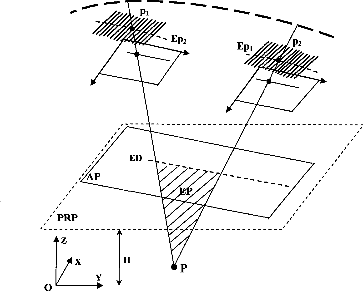
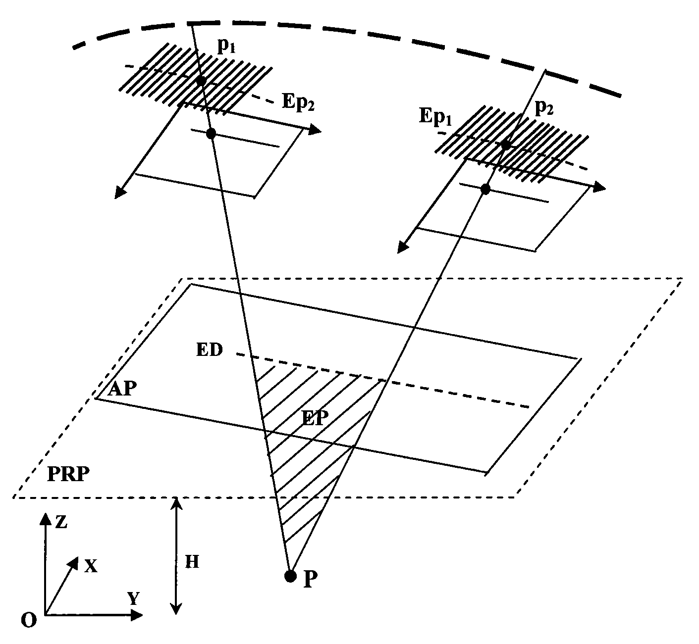
[0065] as attached figure 1 As shown in , the local Cartesian coordinate system o_XYZ is established with any point within the ground coverage area of the satellite stereo image pair on the reference ellipsoid as the origin. The projection reference plane PRP (Projection Reference Plane) is the average elevation surface defined in the local Cartesian coordinate system, and the elevation is H;
[0066] make p 1 and p 2 are the image points of the object point P on the left and right original images respectively, let the curve EP 1 and Ep 2 are image point p 1 and p 2 Epipolar lines defined based on projected locus method. According to the relative stability of the flight trajectory durin...
PUM
 Abstract
Description
Claims
Application Information
 - R&D Engineer
- R&D Manager
- IP Professional
- Industry Leading Data Capabilities
- Powerful AI technology
- Patent DNA Extraction
Browse by: Latest US Patents, China's latest patents, Technical Efficacy Thesaurus, Application Domain, Technology Topic, Popular Technical Reports.
© 2024 PatSnap. All rights reserved.Legal|Privacy policy|Modern Slavery Act Transparency Statement|Sitemap|About US| Contact US: help@patsnap.com


