Eureka AIR delivers breakthrough ideas for toughest innovation challenges, trusted by R&D personnel around the world.

Map data simplifying method oriented to mobile equipment

A technology for map data and mobile devices, which is used in electrical digital data processing, special data processing applications, instruments, etc. It can solve the problem of large amount of map data transmitted, and achieve the effect of high rendering performance and small data amount.

Inactive Publication Date: 2009-04-01
PEKING UNIV
View PDF0 Cites 23 Cited by
  • Summary
  • Abstract
  • Description
  • Claims
  • Application Information

AI Technical Summary

Problems solved by technology

[0008] In order to solve the problem that the amount of transmitted map data is too large in the current mobile map service, we propose a map data reduction method

Method used


Image

  • Map data simplifying method oriented to mobile equipment
  • Map data simplifying method oriented to mobile equipment
  • Map data simplifying method oriented to mobile equipment

Examples


Embodiment Construction

[0062] The implementation steps of this invention are further introduced through an example of map data reduction. The original map data is the map data of the whole area of ​​Beijing in GML format. The specific original data is shown in Table 1.

[0063] Adopt the present invention to streamline raw data as follows:

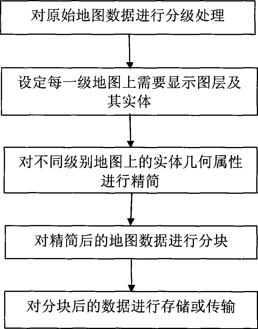
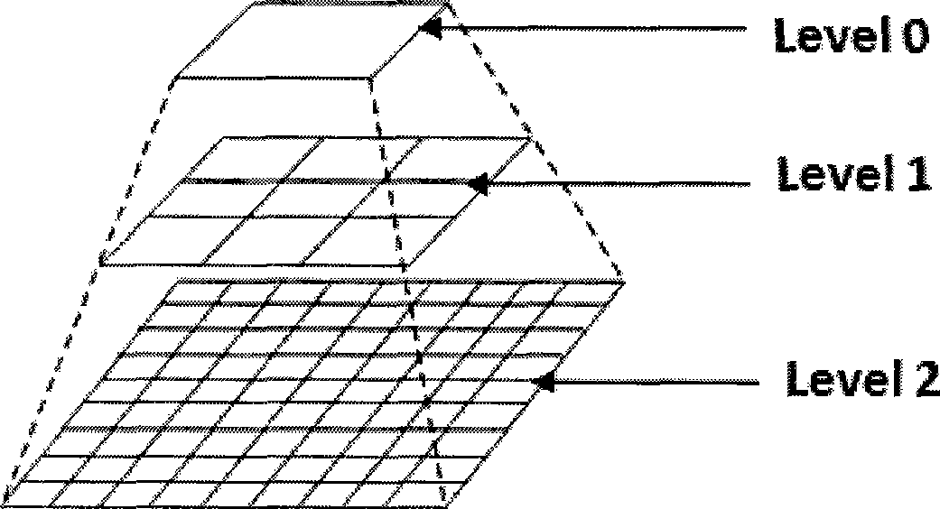
[0064] (1) Grading. Here only the map data is divided into two levels, Level1 and Level0. Level0 entities come from the following layers: land use (including green land and water), administrative landmarks, and main roads in the road layer (here, the meaning of main roads is: the attribute value of the road level is "highway" or "street" , and the width of the road is greater than 20m); Level1 entities come from the following layers: plots, land use (including green land and water), administrative landmarks, general landmarks, roads and POIs.

[0065] (2) Use the line smoothing algorithm to simplify the geometric properties of the entity. The simplified para...


PUM


Abstract

The invention discloses a map data compaction method facing to mobile devices, belonging to the map service field facing to the mobile device. The method comprises: 1) according to the requirement of map display in mobile application, determining map display levels facing to the mobile device; 2) according to the map display level, setting map layers and entity thereof to be displayed on the corresponding level map; 3) simplifying geometric attributes of the displayed entity on each level of the map; 4) partitioning the displayed map of the simplified map on each level, wherein the size of the partition is fixed as 255 coordinate unit*255 coordinate unit, the side of the partitioned coordinate unit of the data partition in different levels can be adjustable; 5) adopting binary data flow to storing and transmitting the partitioned map data. Compared with the prior art, the invention has small data volume and high plotting performance on the basis of ensuring better map display effect.

Description

technical field [0001] The invention relates to a mobile device-oriented map data reduction method, which belongs to the field of mobile device-oriented map services. Background technique [0002] Mobile Map Service (Mobile Map Service) was mainly used in vehicle navigation systems in the early days, and most of the map data was pre-installed locally. With the rapid development of mobile device hardware and wireless communication capabilities, mobile map services are gradually moving to handheld devices, such as PDA (Personal Digital Assistant), SmartPhone and mobile phones, and map data is also gradually shifting from pre-installation to on-demand downloading through wireless networks. Way - mobile online map service (Mobile On-line MapService). However, although mobile terminal equipment has greatly improved in terms of storage space and CPU processing efficiency, there are still great limitations; at the same time, the transmission bandwidth of wireless networks is far s...

Claims


Application Information

Patent Timeline
Patent Type & Authority Applications(China)
IPC IPC(8): H04W72/12H04L12/54G01C21/32G06F17/30H04L29/08
Inventor 罗英伟汪小林庞潇王海波
Owner PEKING UNIV
Why Eureka
Eureka Blog
Learn More