
Visual localization support system

Active Publication Date: 2020-08-06
IBM CORP
View PDF0 Cites 4 Cited by
  • Summary
  • Abstract
  • Description
  • Claims
  • Application Information

AI Technical Summary

Benefits of technology

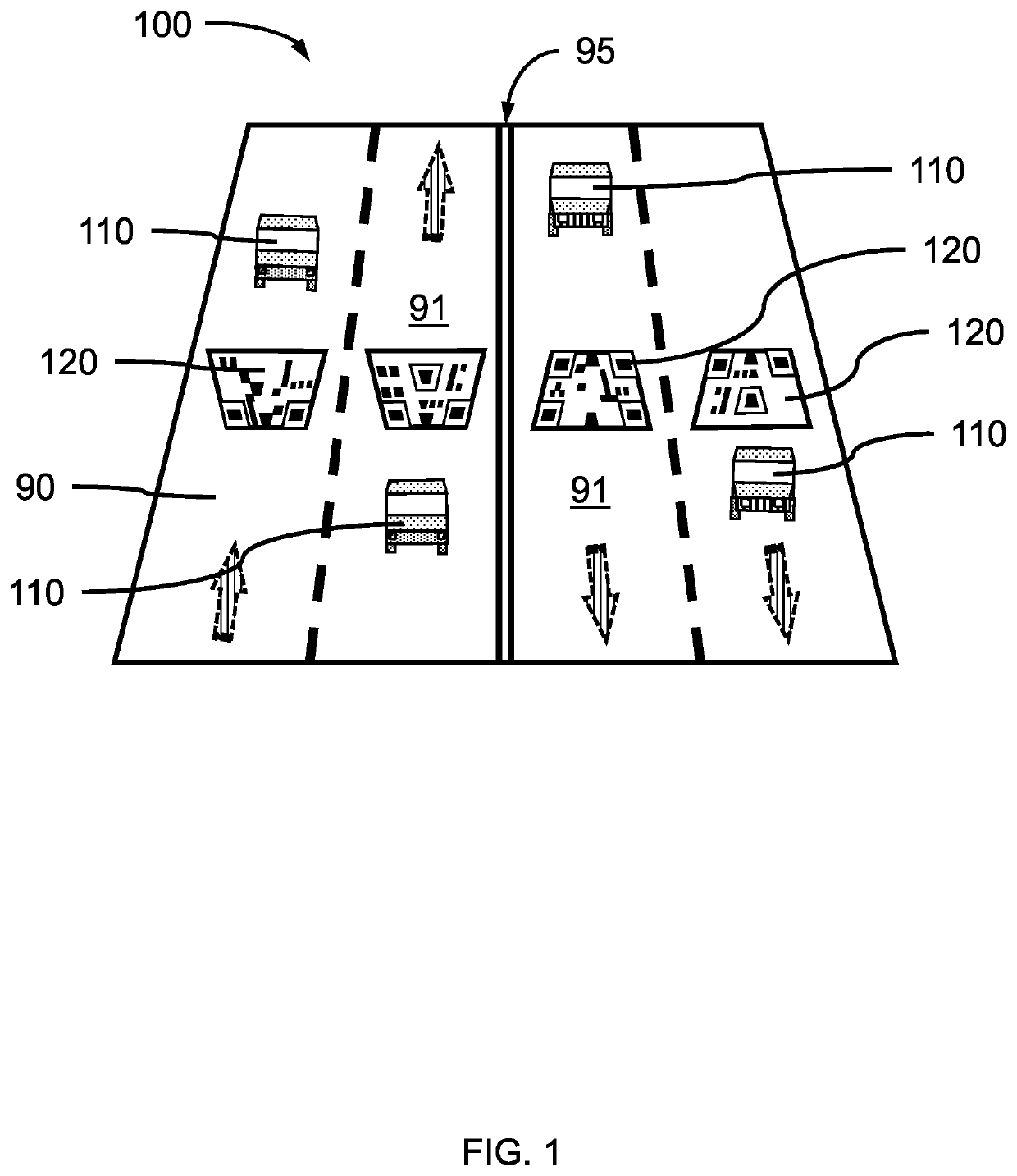
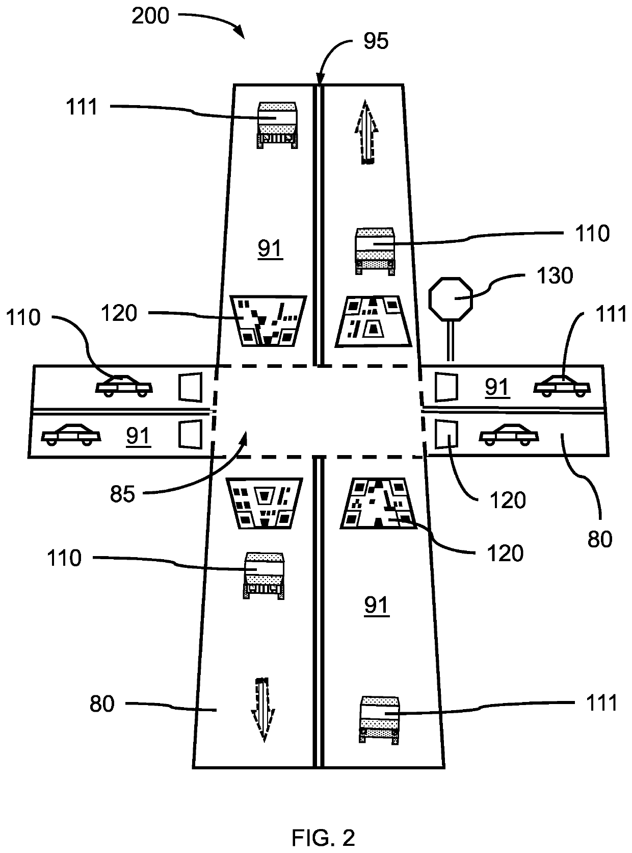
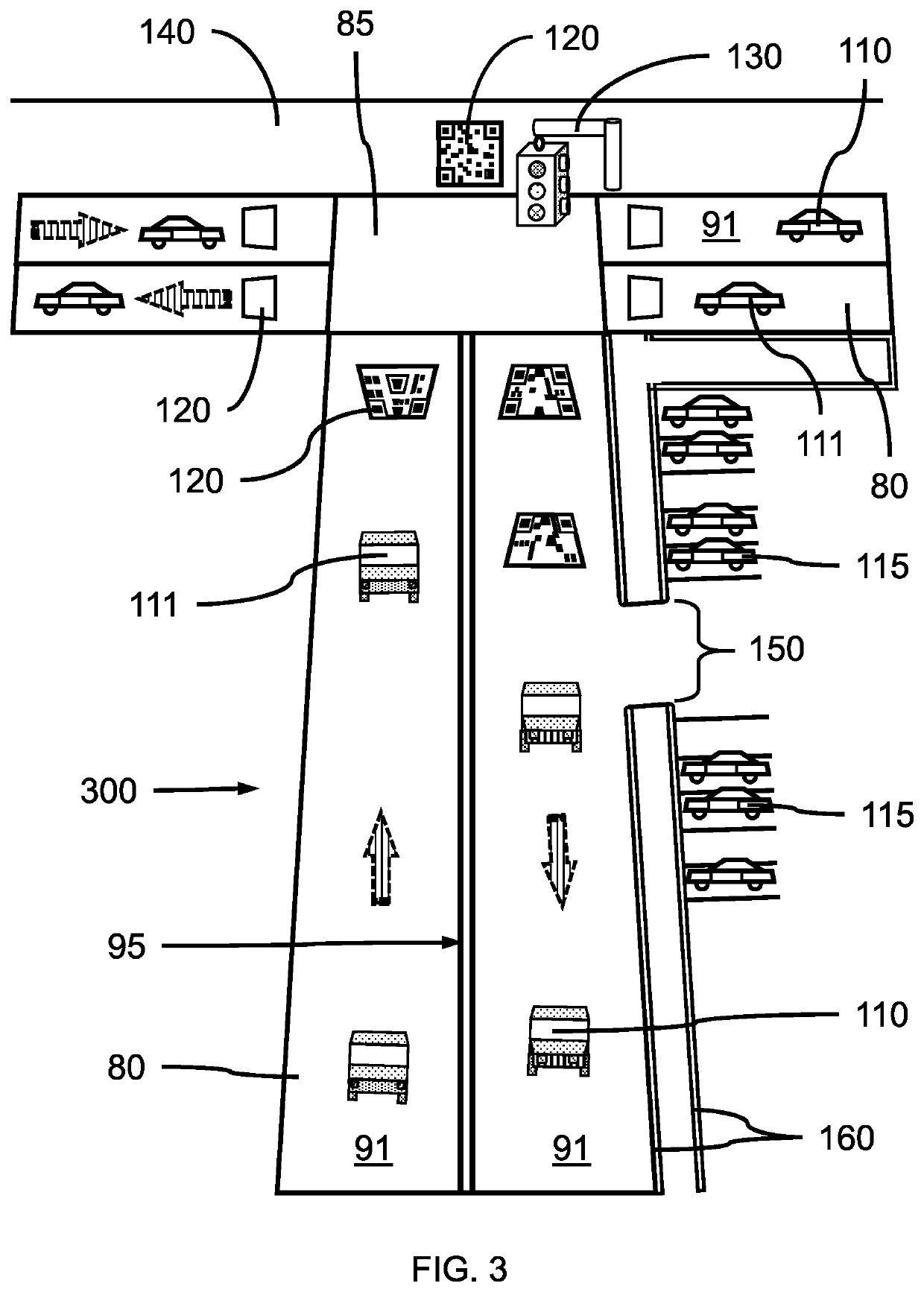
The present invention provides a visual localization support system for helping vehicles navigate through roadways. This system includes guidance indicators placed on the road surface, which have a unique matrix barcode that identifies their location based on latitude, longitude, and altitude. The barcode also describes the shape of the guidance indicator. The system also includes a camera and an autonomous driving system that can capture images of the guidance indicator and use them to determine the location of the vehicle. Overall, this invention helps vehicles navigate more accurately and efficiently through roadways.

Problems solved by technology

In robotic mapping and navigation, simultaneous localization and mapping (SLAM) is the computational problem of constructing or updating a map of an unknown environment while simultaneously keeping track of an agent's location within it.

Method used


Image

  • Visual localization support system
  • Visual localization support system
  • Visual localization support system

Examples


Embodiment Construction

[0020]Embodiments of the present invention provide a visual localization support system for driving assistance systems, where a graphic containing a matrix barcode can be placed on a roadway or other observable surface to uniquely identify an exact location. The driving assistance system can interpret the graphic to identify the location of a vehicle, where the graphic can be integrated into a map.

[0021]Embodiments of the present invention provide a visual localization support system having a graphic containing a matrix barcode placed on or along a roadway at accurately known, predetermined locations, where the matrix barcodes identify the high definition coordinates (i.e., much more accurate than a GPS coordinate location) of the specific location. A driving assistance system can use the high definition coordinates to specifically place a vehicle at a location on one or maps (e.g., a highly detailed and semantically-defined (HDSD) map, a GIS map, etc.) such that the high definition...


PUM


Abstract

A visual localization support system is provided. The visual localization support system includes one or more guidance indicators place on a road surface of a roadway, wherein the one or more guidance indicators each include a matrix barcode that uniquely identifies a location by latitude, longitude, and altitude, and describes an affine shape of the guidance indicator.

Description

BACKGROUNDTechnical Field[0001]The present invention generally relates to visual localization support systems, and more particularly to driving assistance systems with simultaneous localization and mapping (SLAM).Description of the Related Art[0002]In robotic mapping and navigation, simultaneous localization and mapping (SLAM) is the computational problem of constructing or updating a map of an unknown environment while simultaneously keeping track of an agent's location within it.[0003]A Geographic Information System (GIS) is a specific type of mapping technology that allows you to layer data tied to geographic points. A data element that can be tied to a latitude and longitude can be mapped (i.e., associated with that geographic point). Satellite and aerial imagery can be used as a starting point for high definition (HD) maps.[0004]Driving assistance systems with simultaneous localization and mapping (SLAM) with sensors / cameras need highly detailed and semantically-defined (HDSD) ...

Claims


Application Information

Patent Timeline
IPC IPC(8): G05D1/02G06K19/06G05D1/00G08G1/09
CPCG08G1/092G05D1/0234G06K19/06037G05D2201/0213G05D1/0088G05D1/0278G06K7/1443G08G1/096783G08G1/09623Y10S260/99819G06T2207/30256G06K19/06056G06K19/06065B32B2590/00E01F9/00G06T3/02
Inventor TATSUBORI, MICHIAKIVINAYAVEKHIN, PHONGTHARIN
Owner IBM CORP
Learn More