
Digital map having user-defined zoom areas

a zoom area and digital map technology, applied in computing, instruments, electric digital data processing, etc., can solve the problems of not affording a user the ability to display one or more “zoomed” areas, and devices are unable to provide dynamic and user-controlled multiple levels of detail

Inactive Publication Date: 2010-09-02
IBM CORP
View PDF11 Cites 58 Cited by
  • Summary
  • Abstract
  • Description
  • Claims
  • Application Information

AI Technical Summary

Benefits of technology

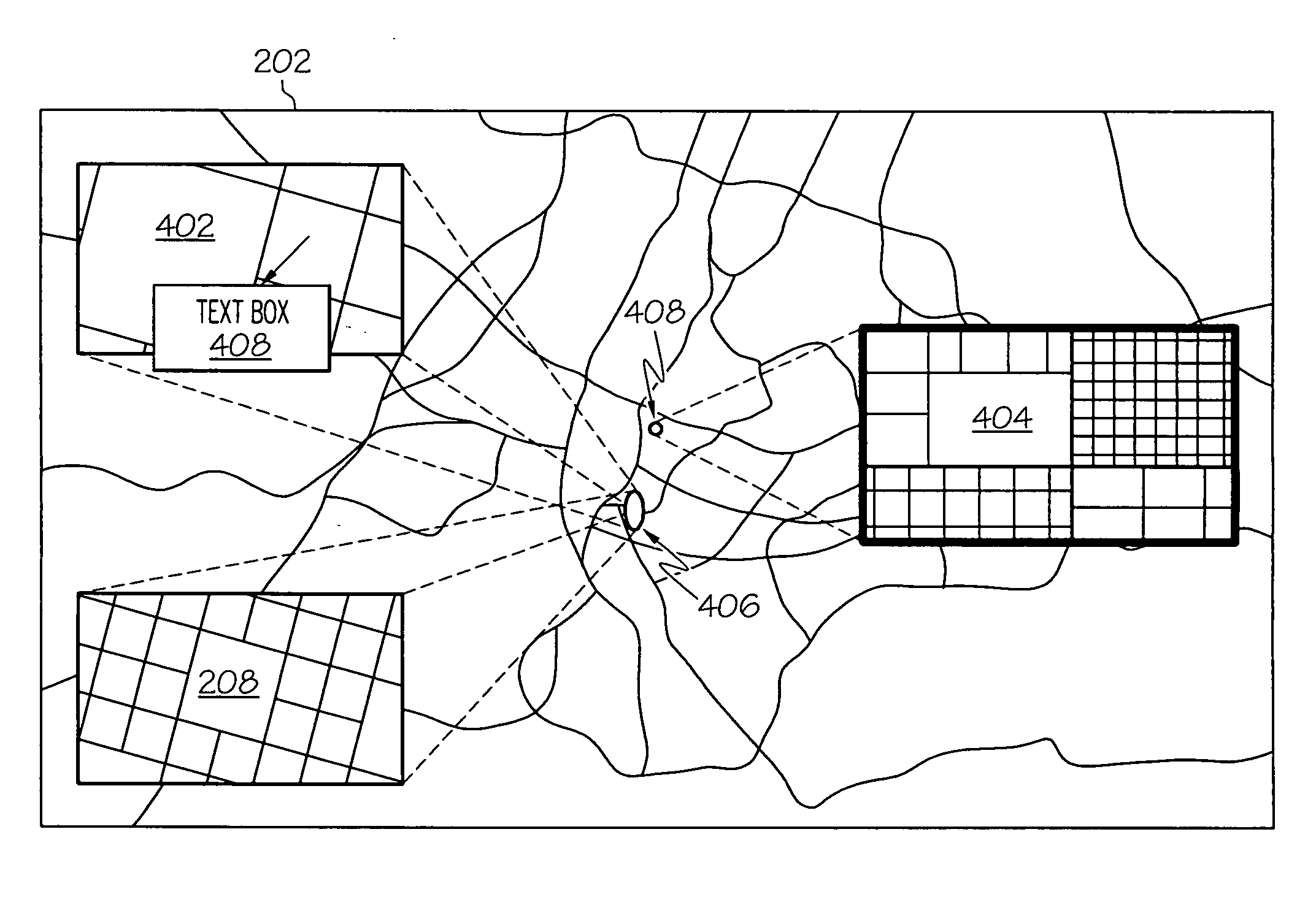
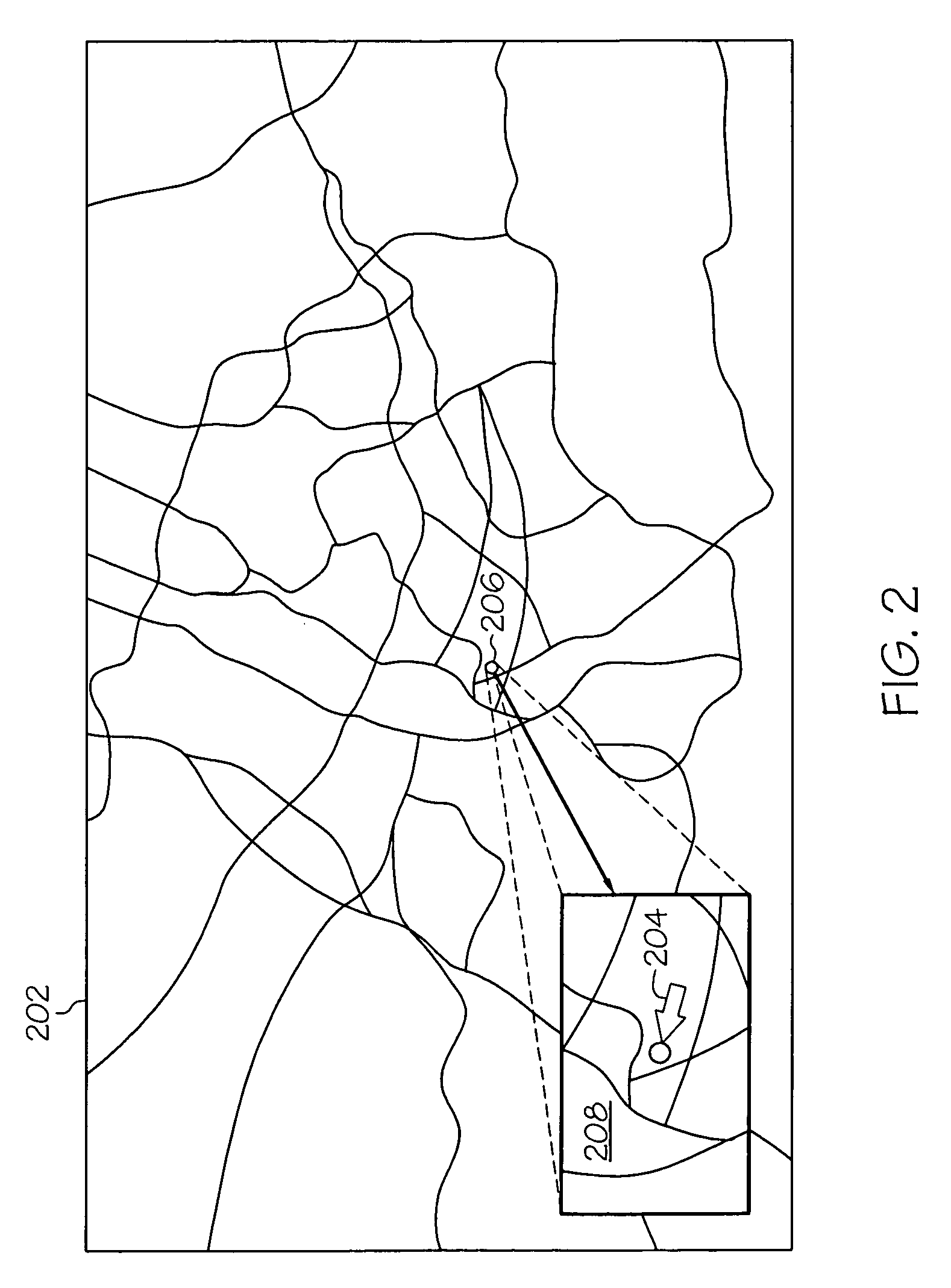
[0005]To address the above described issue, a digital map that affords user-controlled “zooming” of one or more areas of the digital map is presented. A processor detects that a user has selected a specific point or ...

Problems solved by technology

While useful in providing either high-level or detailed views of a particular geographical area, such devices are unable to provide dynamic and user-controlled multiple levels of detail.
That is, current maps allow a user to “zoom” in or out to different levels of resolution for an entire map, but do not afford a user the ability to display one or more “zoomed” areas, particularly areas that can be overlaid on top of the main map.

Method used


Image

  • Digital map having user-defined zoom areas
  • Digital map having user-defined zoom areas
  • Digital map having user-defined zoom areas

Examples


Embodiment Construction

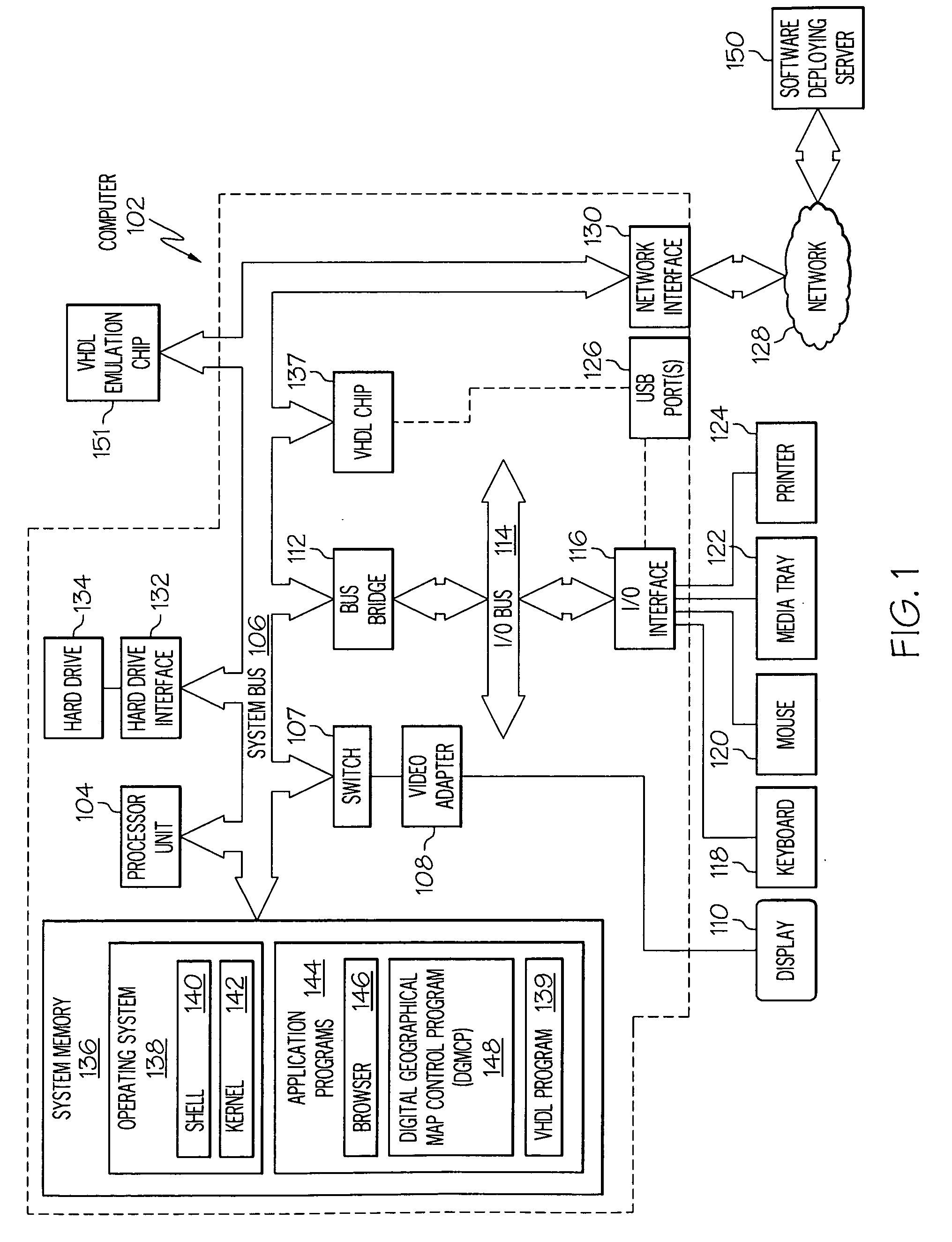
[0013]With reference now to the figures, and in particular to FIG. 1, there is depicted a block diagram of an exemplary computer 102, which may be utilized by the present invention. Note that some or all of the exemplary architecture shown for computer 102 may be utilized by software deploying server 150.

[0014]Computer 102 includes a processor unit 104 that is coupled to a system bus 106. Processor unit 104 may utilize one or more processors, each of which has one or more processor cores. A video adapter 108, which drives / supports a display 110, is also coupled to system bus 106. In one embodiment, a switch 107 couples the video adapter 108 to the system bus 106. Alternatively, the switch 107 may couple the video adapter 108 to the display 110. In either embodiment, the switch 107 is a switch, preferably mechanical, that allows the display 110 to be coupled to the system bus 106, and thus to be functional, only upon execution of instructions (e.g., Digital Geographical Map Control P...


PUM


Abstract

A digital geographic map affords a user the ability to selectively and simultaneously zoom in on multiple areas of the map. These zoomed areas are displayed as zoom windows, which are overlaid over the initial map.

Description

BACKGROUND OF THE INVENTION[0001]1. Technical Field[0002]The present disclosure relates to the field of computers, and specifically to computer-generated maps. Still more particularly, the present disclosure relates to persistently modifying a display of a computer-generated map.[0003]2. Description of the Related Art[0004]Digital maps are useful tools for physical land navigation. Such maps are found on websites (using Internet mapping software) and dedicated electronic devices, including cell phones, Global Positioning System (GPS) navigational devices, etc. While useful in providing either high-level or detailed views of a particular geographical area, such devices are unable to provide dynamic and user-controlled multiple levels of detail. That is, current maps allow a user to “zoom” in or out to different levels of resolution for an entire map, but do not afford a user the ability to display one or more “zoomed” areas, particularly areas that can be overlaid on top of the main ...

Claims


Application Information

Patent Timeline
IPC IPC(8): G06F3/048
CPCG06F3/0481G06F2203/04806
Inventor BENNETT, VALERIE MONKCYRUS, JR., JOSEPH ROBERTMERRILL, ETHAN KARYJAIN, MOHIT
Owner IBM CORP
Learn More