Eureka AIR delivers breakthrough ideas for toughest innovation challenges, trusted by R&D personnel around the world.

Vehicle position recognition device and vehicle position recognition program

Active Publication Date: 2009-01-01
AISIN AW CO LTD
View PDF3 Cites 122 Cited by
  • Summary
  • Abstract
  • Description
  • Claims
  • Application Information

AI Technical Summary

Benefits of technology

[0011]Accordingly, an object of the present invention is to provide a vehicle location recognition apparatus capable of accurately determining links traveled by a vehicle from among a plurality of links branching at a branch point, particularly a narrow-angle branch point.

Problems solved by technology

At a narrow-angle branch point at which a road divides into branch roads at a relatively small angle, however, the vehicle may be located on a road different from the road where the vehicle is actually located due to an error in the satellite or autonomous navigation.
When the navigation apparatus superimposes the vehicle location on a road map display, if the displayed vehicle location is different from the actual vehicle location, the driver may become confused.
In determining such a virtual destination area, if the route includes a branch point, it is difficult to predict for setting the virtual destination area ahead of the branch point.
However, the disclosed high-accuracy location measurement unit is expensive, and thus substantially increases the cost of the entire navigation apparatus.
Further, the technique uses vehicle information different from that based on receipt of satellite signals or autonomous navigation and the operation of the navigation apparatus is thereby complicated.
Further, the necessity of such map matching is not recognized.
Thus, the issue of map matching at a narrow-angle branch point still remains unresolved.
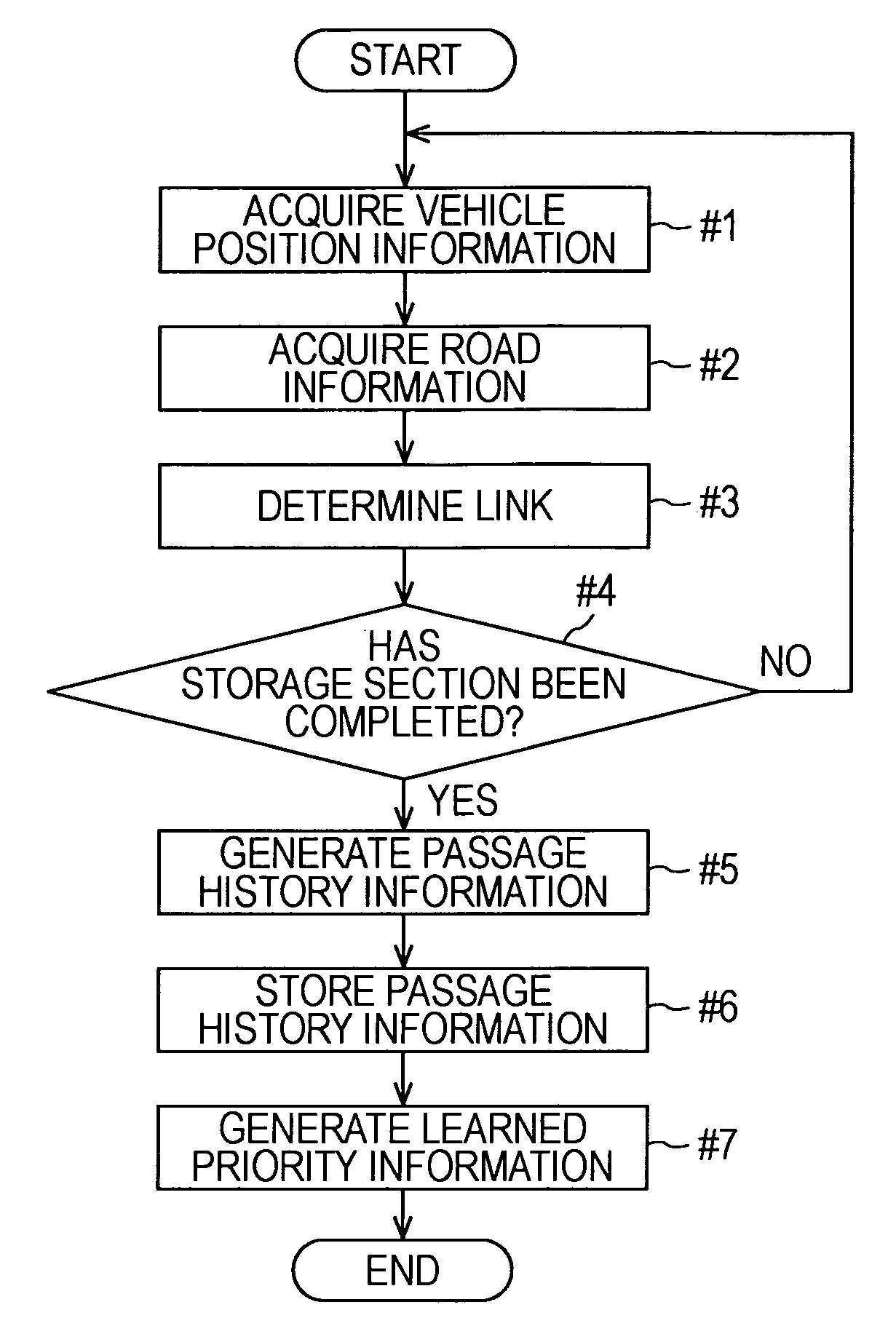
Further, in the vehicle location recognition apparatus the history information generation unit may limit storage of data for the route of the links determined by the link determination unit to a predetermined distance (route section) extending from the branch point.
If data for an unnecessarily long route section is stored, the amount of data for the travel history information is unnecessarily increased, and thus the history information storage unit requires a large capacity.
The terminology “narrow-angle branch point”, as used herein, refers to a branch point where a road branches and the branches extend from the branch point with a small angle therebetween, which makes it difficult for a direction sensor to determine which branch has been taken from the branch point, e.g., a branch point having an angle of 45 degrees or less.
If the road (links) section is set unnecessarily long, the amount of data of the travel history information is unnecessarily increased, and the history information storage unit requires an unnecessarily large capacity.
If the storage section is set to be unnecessarily long, the amount of travel history information (data) is thereby increased, and the history information storage unit requires a large capacity.

Method used


Image

  • Vehicle position recognition device and vehicle position recognition program
  • Vehicle position recognition device and vehicle position recognition program
  • Vehicle position recognition device and vehicle position recognition program

Examples


Embodiment Construction

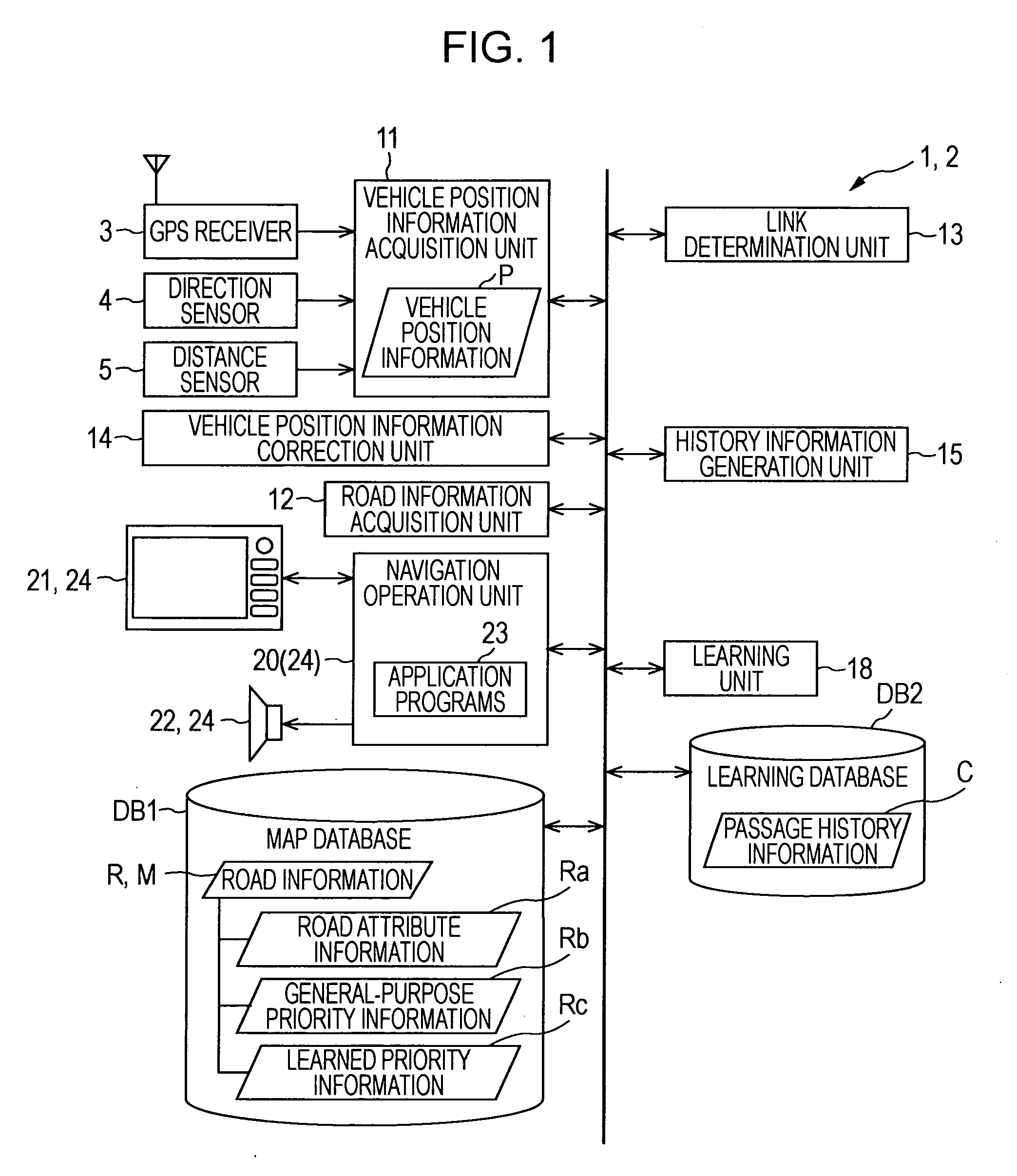
[0043]An embodiment of the present invention will now be described with reference to the drawings. FIG. 1 shows a navigation apparatus 1 as including a vehicle location recognition apparatus 2 in accordance with the present invention. The vehicle location recognition apparatus 2 provides a determination of which road, among a plurality of roads branching at a branch point, particularly a narrow-angle branch point, is traveled by the vehicle in departing the branch point and provides correction of vehicle location information P. On the basis of the corrected vehicle location information P, the navigation apparatus 1 executes navigation routines including route guidance.

[0044]The navigation apparatus 1 illustrated in FIG. 1 includes the functional units of the vehicle location recognition apparatus 2 such as a vehicle location information acquisition unit 11, a road information acquisition unit 12, a link determination unit 13, a vehicle location information correction unit 14, a hist...


PUM


Abstract

A vehicle location recognition apparatus includes a link determination unit which accurately determines a link traveled by a vehicle from among a plurality of links meeting at a narrow-angle branch point, on the basis of vehicle location information and road information, travel history information representing a route traveled by the vehicle at the branch point. The vehicle location recognition apparatus includes a history information generation unit for generating travel history information for the determined link. The travel history information is stored in a learning database. On the basis of the travel history information, a learning unit generates learned priority information representing the priorities of the respective links meeting at a branch point and used in the determination by the link determination unit.

Description

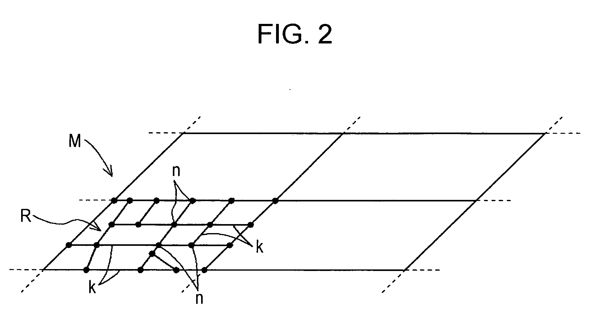
INCORPORATION BY REFERENCE[0001]The disclosure of Japanese Patent Application No. 2007-171891 filed on Jun. 29, 2007, including the specification, drawings and abstract thereof, is incorporated herein by reference in its entirety.BACKGROUND[0002]1. Related Technical Fields[0003]Related technical fields include a vehicle location recognition device for use in a navigation device or the like.[0004]2. Description of the Related Art[0005]Known navigation devices perform operations such as the display of vehicle location and guidance along a route to the destination by using road map data for actual roads. Such road map data is usually in the form of digital road network data for a combination of nodes and links. “Node” generally refers to a coordinate point representing an intersection or a curve in a road or the like. The respective nodes are connected by the links. Such connections of a plurality of links form a road network. Link information representing the attributes of the link is...

Claims


Application Information

Patent Timeline
IPC IPC(8): G01C21/34
CPCG01C21/30
Inventor NAKAO, KOICHINAKAMURA, MASAKIISHIKAWA, TOMOAKIKANBA, MOTOKIAISAKA, OSAMU
Owner AISIN AW CO LTD
Why Eureka
Eureka Blog
Learn More