Method for realizing digital city system using virtual artificial comprehensive image and text information interaction
A technology of virtual simulation and information interaction, which is applied in transmission systems, image data processing, image data processing, etc., and can solve problems such as applications that cannot be easily used and popularized
- Summary
- Abstract
- Description
- Claims
- Application Information
AI Technical Summary
Problems solved by technology
Method used
Image
Examples
Embodiment Construction
[0022] The specific implementation manners of the present invention will be described in detail below in conjunction with the accompanying drawings.
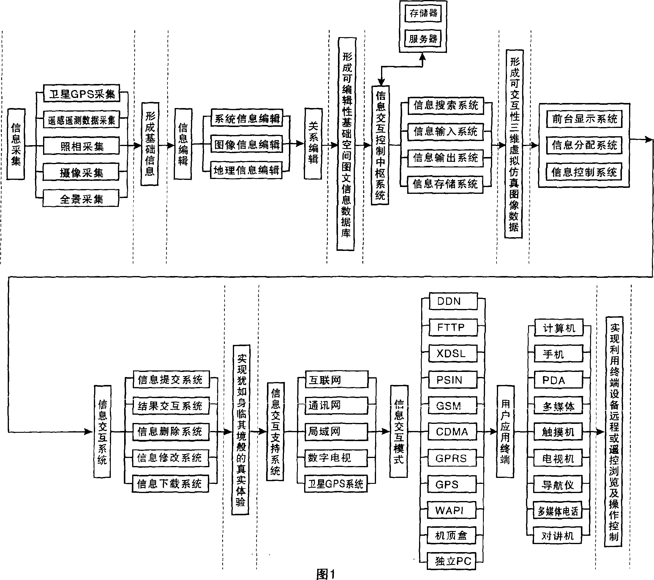
[0023] Given by Fig. 1, the present invention is:
[0024] 1. Use the "information collection module" composed of satellite GPS collection (geographical information collection), remote sensing and telemetry data collection, photographic collection, camera collection and panorama collection to collect specific information such as streets, businesses, units, communities, and families in the city. Comprehensive graphic information data, form basic data;
[0025] The computer (microcomputer) establishes an editable basic spatial graphic information database through information classification (including system information classification, graphic information classification, and geographic information classification); the editable digital images collected, based on surveying and mapping measurement data Combining digital elevation mod...
PUM
 Abstract
Description
Claims
Application Information
 - R&D Engineer
- R&D Manager
- IP Professional
- Industry Leading Data Capabilities
- Powerful AI technology
- Patent DNA Extraction
Browse by: Latest US Patents, China's latest patents, Technical Efficacy Thesaurus, Application Domain, Technology Topic, Popular Technical Reports.
© 2024 PatSnap. All rights reserved.Legal|Privacy policy|Modern Slavery Act Transparency Statement|Sitemap|About US| Contact US: help@patsnap.com


