Optimizing design method of 3D seismic observation system based on geologic geophysical model
A geophysical model, three-dimensional seismic technology, applied in geophysical measurement, seismology, measurement devices, etc., can solve problems such as inability to obtain seismic imaging, wrong seismic imaging results, and inapplicability
- Summary
- Abstract
- Description
- Claims
- Application Information
AI Technical Summary
Problems solved by technology
Method used
Image
Examples
Embodiment Construction
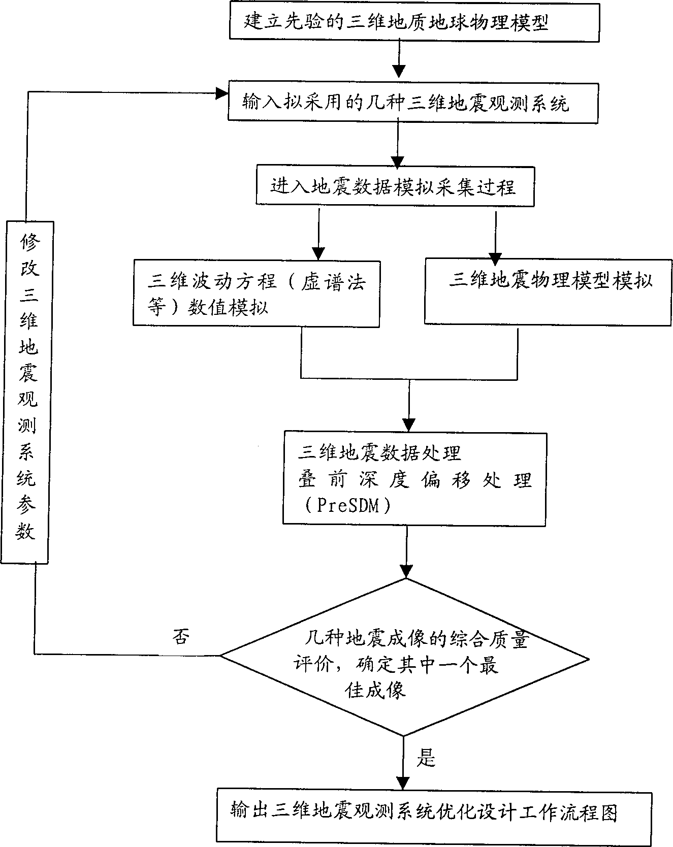
[0016] The Key Laboratory of Geophysical Prospecting of China National Petroleum Corporation began to explore a new 3D acquisition technology design method based on CRP seismic imaging for the specific complex geological structure of the exploration area since 1996. The workflow of this method is as follows figure 1 Shown.
[0017] First, establish a priori geological geophysical model based on the existing exploration results (complex geological structure and complex geological body morphology and its geophysical parameters) in the exploration area, usually establish the seismic velocity model of the underground medium; the second step is based on the above-mentioned geological geophysical The model is the exploration target, and two or more observation systems for 3D seismic data acquisition are designed; the third step is to use the model as the 3D seismic observation object, and simulate the field seismic data in the laboratory according to the technical parameters and constru...
PUM
 Abstract
Description
Claims
Application Information
 - R&D
- Intellectual Property
- Life Sciences
- Materials
- Tech Scout
- Unparalleled Data Quality
- Higher Quality Content
- 60% Fewer Hallucinations
Browse by: Latest US Patents, China's latest patents, Technical Efficacy Thesaurus, Application Domain, Technology Topic, Popular Technical Reports.
© 2025 PatSnap. All rights reserved.Legal|Privacy policy|Modern Slavery Act Transparency Statement|Sitemap|About US| Contact US: help@patsnap.com


