Graphical display method and system for civil administration place name division
A technology of graphical display and administrative division, applied in geographic information database, structured data retrieval, network data browsing optimization, etc.
- Summary
- Abstract
- Description
- Claims
- Application Information
AI Technical Summary
Problems solved by technology
Method used
Image
Examples
Embodiment 1
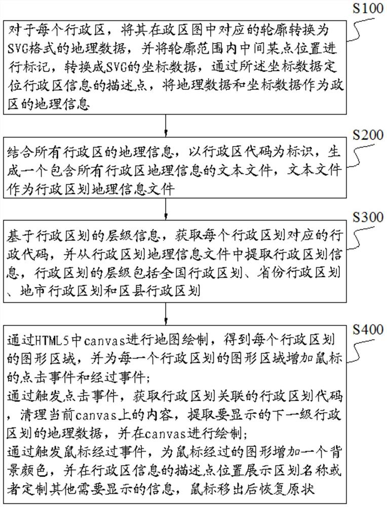
[0064] The present invention is a graphical display method of civil administration geographical names divisions, based on the logical relationship between geospatial data and administrative divisions, a graphical display of civil administration geographical names divisions, the method comprises the following steps:
[0065] S100, for each administrative region, the corresponding outline in the political district map is converted into geographical data in SVG format, and the location of a point in the middle of the contour range is marked, converted into SVG coordinate data, and the description point of administrative district information is located through coordinate data, and the geographic data and coordinate data are used as geographical information of administrative districts;
[0066] S200, combined with the geographic information of all administrative regions, with the administrative district code as the identifier, generate a text file containing geographic information of a...
PUM
 Abstract
Description
Claims
Application Information
 - R&D
- Intellectual Property
- Life Sciences
- Materials
- Tech Scout
- Unparalleled Data Quality
- Higher Quality Content
- 60% Fewer Hallucinations
Browse by: Latest US Patents, China's latest patents, Technical Efficacy Thesaurus, Application Domain, Technology Topic, Popular Technical Reports.
© 2025 PatSnap. All rights reserved.Legal|Privacy policy|Modern Slavery Act Transparency Statement|Sitemap|About US| Contact US: help@patsnap.com

