Unmanned aerial vehicle routing inspection line planning method for distributed photovoltaic power station
A distributed photovoltaic and photovoltaic power station technology, applied in the direction of three-dimensional position/channel control, etc., can solve the problems of inability to reduce the labor intensity of the staff, slow inspection line speed, and inability to handle itself, so as to achieve fewer errors, improve quality, and improve speed effect
- Summary
- Abstract
- Description
- Claims
- Application Information
AI Technical Summary
Problems solved by technology
Method used
Image
Examples
Embodiment 1
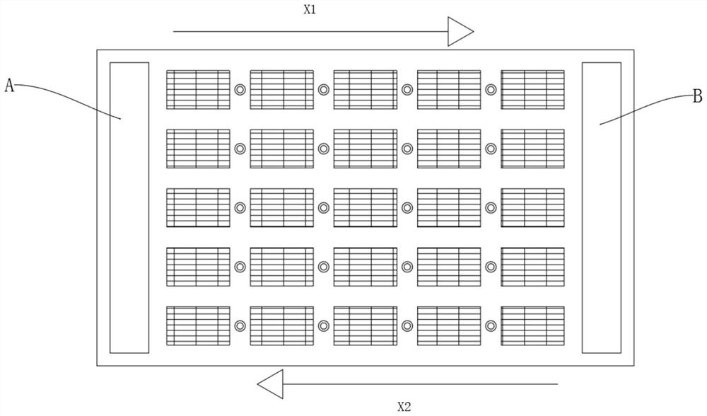
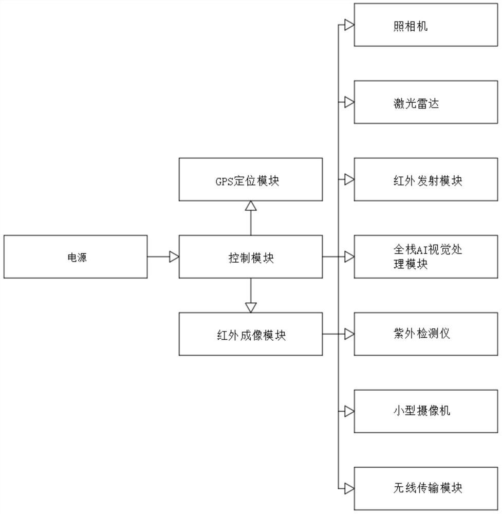
[0037] Example 1: Please refer to Figure 1-5
[0038] Distributed photovoltaic power station drone inspection route planning method, including the construction of drone site A, the construction of drone site B, the construction of photovoltaic solar panels, the construction of infrared sensors and the use of drones:
[0039] Step 1: With the goal of covering all photovoltaic power stations, scan photovoltaic power stations, and build drone site A, drone site B, photovoltaic solar panels and infrared sensors according to the terrain;
[0040] Step 2: Install multiple identical photovoltaic solar panels in the middle of the photovoltaic power station, and adjust the angle of the photovoltaic solar panels to complete;
[0041] Step 3: Fixedly install infrared sensors between multiple photovoltaic solar panels;
[0042] Step 4: Build a UAV site A on the left side of the photovoltaic power station;
[0043] Step 5: A UAV site B is built on the right side of the photovoltaic pow...
Embodiment 2
[0061] Example 2: Please refer to Figure 1-5
[0062] Distributed photovoltaic power station drone inspection route planning method, including the construction of drone site A, the construction of drone site B, the construction of photovoltaic solar panels, the construction of infrared sensors and the use of drones:
[0063] Step 1: With the goal of covering all photovoltaic power stations, scan photovoltaic power stations, and build drone site A, drone site B, photovoltaic solar panels and infrared sensors according to the terrain;
[0064] Step 2: Install multiple identical photovoltaic solar panels in the middle of the photovoltaic power station, and adjust the angle of the photovoltaic solar panels to complete;
[0065] Step 3: Fixedly install infrared sensors between multiple photovoltaic solar panels;
[0066] Step 4: Build a UAV site A on the left side of the photovoltaic power station;
[0067] Step 5: A UAV site B is built on the right side of the photovoltaic pow...
Embodiment 3
[0085] Example 3: Please refer to Figure 1-5
[0086] Distributed photovoltaic power station drone inspection route planning method, including the construction of drone site A, the construction of drone site B, the construction of photovoltaic solar panels, the construction of infrared sensors and the use of drones:
[0087] Step 1: With the goal of covering all photovoltaic power stations, scan photovoltaic power stations, and build drone site A, drone site B, photovoltaic solar panels and infrared sensors according to the terrain;
[0088] Step 2: Install multiple identical photovoltaic solar panels in the middle of the photovoltaic power station, and adjust the angle of the photovoltaic solar panels to complete;
[0089] Step 3: Fixedly install infrared sensors between multiple photovoltaic solar panels;
[0090] Step 4: Build a UAV site A on the left side of the photovoltaic power station;
[0091] Step 5: A UAV site B is built on the right side of the photovoltaic pow...
PUM
 Abstract
Description
Claims
Application Information
 - R&D Engineer
- R&D Manager
- IP Professional
- Industry Leading Data Capabilities
- Powerful AI technology
- Patent DNA Extraction
Browse by: Latest US Patents, China's latest patents, Technical Efficacy Thesaurus, Application Domain, Technology Topic, Popular Technical Reports.
© 2024 PatSnap. All rights reserved.Legal|Privacy policy|Modern Slavery Act Transparency Statement|Sitemap|About US| Contact US: help@patsnap.com


