Method and device for determining shallow erosion datum plane and electronic equipment
A datum, shallow technology, applied in measurement devices, electrical digital data processing, instruments, etc., can solve problems such as the inability to provide coverage-type karst morphology analysis methods
- Summary
- Abstract
- Description
- Claims
- Application Information
AI Technical Summary
Problems solved by technology
Method used
Image
Examples
Embodiment 1
[0033] In order to facilitate the understanding of this embodiment, firstly, an electronic device for implementing a method for determining a shallow erosion reference plane disclosed in the embodiment of the present application is introduced in detail.
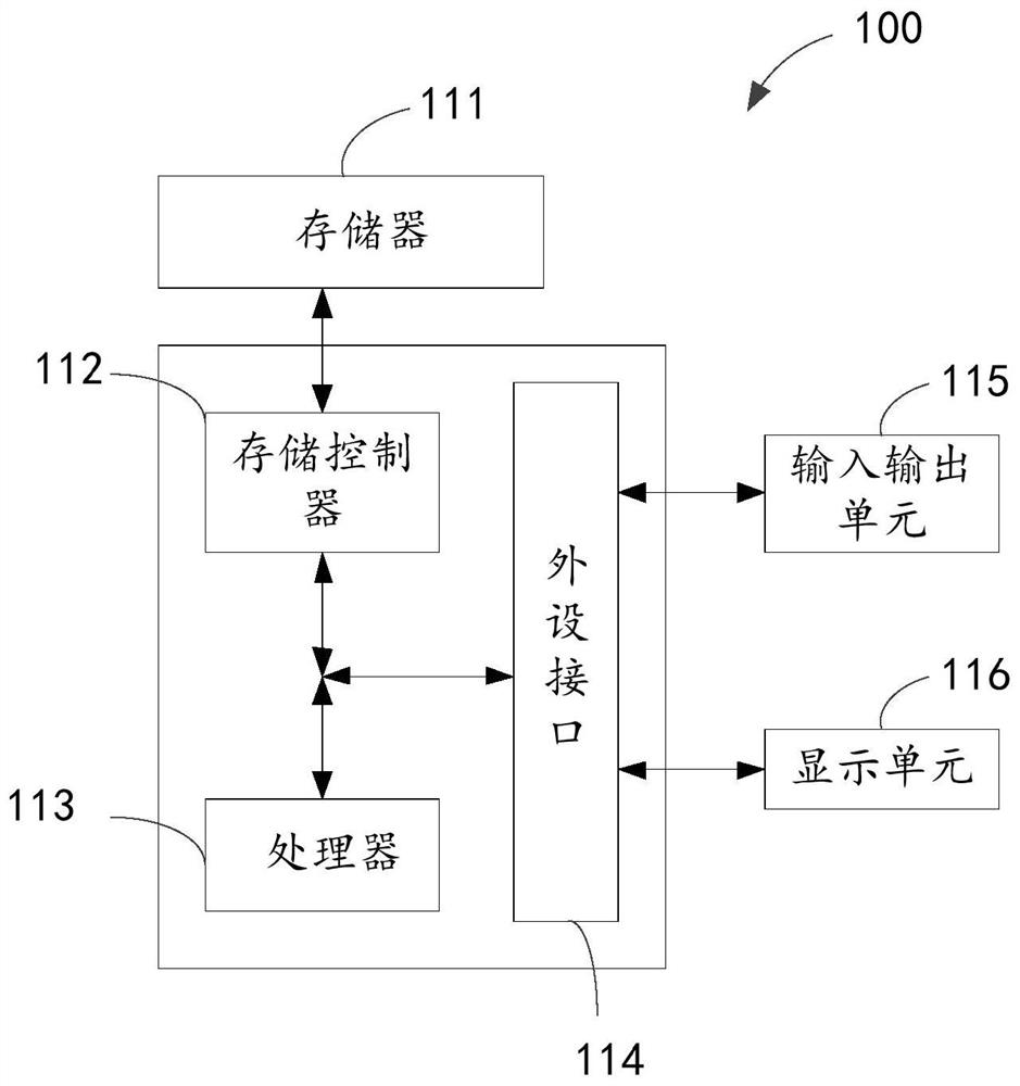
[0034] Such as figure 1 Shown is a block diagram of the electronic device. The electronic device 100 may include a memory 111 , a storage controller 112 , a processor 113 , a peripheral interface 114 , an input and output unit 115 , and a display unit 116 . Those of ordinary skill in the art can understand that, figure 1The shown structure is only for illustration, and does not limit the structure of the electronic device 100 . For example, the electronic device 100 may also include a ratio figure 1 more or fewer components than shown in, or with figure 1 Different configurations are shown.
[0035] The memory 111 , storage controller 112 , processor 113 , peripheral interface 114 , input / output unit 115 and display unit...
Embodiment 2
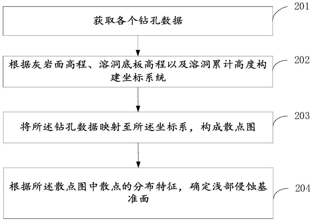
[0043] see figure 2 , is a flow chart of the method for determining the shallow erosion datum level provided by the embodiment of the present application. The following will be figure 2 The specific process shown will be described in detail.
[0044] In step 201, each drilling data is acquired, and the drilling data includes: limestone surface elevation parameters, cave floor elevation parameters, and cave cumulative height parameters.
[0045] Optionally, before obtaining each drilling data, the drilling depth is determined according to the bearing capacity of the engineering object and the requirements of the survey specifications, and the final drilling is performed after the drilling depth meets the final hole requirements to obtain the drilling data.
[0046] Optionally, the final borehole should also meet the exploration requirements for engineering geology in karst areas.
[0047] For example, the exploration requirements of engineering geology can be set as follow...
Embodiment 3
[0076]Based on the same inventive concept, the embodiment of the present application also provides a device for determining the shallow erosion datum level. Since the problem-solving principle of the device in the embodiment of the present application is similar to the aforementioned embodiment of the method for determining the shallow erosion datum level, this implementation For the implementation of the device in the example, reference may be made to the descriptions in the embodiments of the above method, and repeated descriptions will not be repeated.
[0077] see Figure 6 , is a schematic diagram of the functional modules of the device for determining the shallow erosion datum level provided by the embodiment of the present application. The device for determining the shallow erosion datum level provided by the embodiment of the present application includes: an acquisition module 301 , a construction module 302 , a mapping module 303 and a determination module 304 .
[0...
PUM
 Abstract
Description
Claims
Application Information
 - R&D Engineer
- R&D Manager
- IP Professional
- Industry Leading Data Capabilities
- Powerful AI technology
- Patent DNA Extraction
Browse by: Latest US Patents, China's latest patents, Technical Efficacy Thesaurus, Application Domain, Technology Topic, Popular Technical Reports.
© 2024 PatSnap. All rights reserved.Legal|Privacy policy|Modern Slavery Act Transparency Statement|Sitemap|About US| Contact US: help@patsnap.com


