A 3D deformation monitoring method for coal mining area using UAV images

A technology of three-dimensional deformation and unmanned aerial vehicles, which is applied in the directions of measuring devices, surveying and navigation, computer components, etc., to achieve the effects of high precision, expanded application fields, and easy realization

Active Publication Date: 2021-12-28
CHINA UNIV OF MINING & TECH
View PDF0 Cites 0 Cited by
  • Summary
  • Abstract
  • Description
  • Claims
  • Application Information

AI Technical Summary

Problems solved by technology

[0004] The technical problem to be solved by the present invention is to provide a method for three-dimensional deformation monitoring of coal mining areas using UAV images, which solves the problem of dependence of image-based mining area deformation monitoring on SAR images, and has the advantages of low cost, high precision, and wide monitoring range , easy to realize and other advantages

Method used


Image

  • A 3D deformation monitoring method for coal mining area using UAV images
  • A 3D deformation monitoring method for coal mining area using UAV images
  • A 3D deformation monitoring method for coal mining area using UAV images

Examples


Embodiment Construction

[0040] Embodiments of the invention are described in detail below, examples of which are illustrated in the accompanying drawings. The embodiments described below by referring to the figures are exemplary only for explaining the present invention and should not be construed as limiting the present invention.

[0041] Such as figure 1 As shown, the present invention provides a method for monitoring three-dimensional deformation of a coal mining area using unmanned aerial vehicle images, including the following steps:

[0042] a Obtain UAV image I1 and UAV image I2 of different phases covering the same mining area;

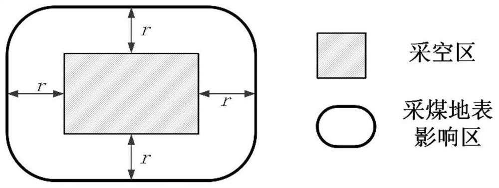
[0043] The flight direction of the UAV is basically parallel or perpendicular to the direction of the mining trend. The acquired UAV images I1 and I2 are orthophoto images. Avoid using oblique photography to obtain the UAV images I1 and I2, otherwise complex image processing is required The method transforms the oblique photographic image into an orthophoto image,...


PUM


Abstract

The invention discloses a method for monitoring three-dimensional deformation of a coal mining area using UAV images. Extract the same-name points from the UAV images corresponding to the coal mining surface influence area, and eliminate the mismatched point pairs; determine the horizontal movement of the surface between two times according to the extracted same-name points, and perform spatial interpolation to obtain the continuous level in the image space Movement; according to the extracted horizontal movement, combined with the relationship between subsidence and horizontal movement in the coal mining subsidence model, the two-time phase surface subsidence value is calculated; the horizontal movement is reprojected to the direction parallel and perpendicular to the mining direction, and the fusion Horizontal movement and sinking values ​​yield 3D deformation values ​​for the surface. The invention utilizes multi-temporal UAV images to realize three-dimensional deformation monitoring in coal mining areas, solves the problem of dependence of image-based mining area deformation monitoring on SAR images, and has a good effect on three-dimensional deformation monitoring in coal mining areas.

Description

technical field [0001] The invention relates to a three-dimensional deformation monitoring method of a coal mine area using drone images, and belongs to the field of coal mine deformation monitoring. Background technique [0002] After the local ore body is mined, a cavity is formed inside the rock mass, and the original stress balance state around it is destroyed, causing the stress to redistribute until a new balance is reached. This is a very complicated physical and mechanical change process. , is also the process of rock formation movement and destruction, this process or phenomenon is called rock formation movement. When the area of ​​the goaf expands to a certain range, the movement of the rock stratum develops to the surface, causing the surface to move and deform. This process and phenomenon is called surface movement. From the perspective of the surface movement process, the movement state of the surface point can be described by the vertical movement component an...

Claims


Application Information

Patent Timeline
Patent Type & Authority Patents(China)
IPC IPC(8): G01B11/16G01C5/00G06K9/00
CPCG01B11/16G01C5/00G06V20/00
Inventor 庄会富范洪冬邓喀中姚国标谭志祥张宏贞王萌萌
Owner CHINA UNIV OF MINING & TECH
Why Eureka
Try Eureka