Method and device for providing service information
A technology of service information and content information, applied in the field of geographic location application, can solve problems such as inconsistent geographic fences and inappropriate push service information, and achieve the effect of improving retrieval efficiency and accuracy, improving result accuracy, and increasing effectiveness
- Summary
- Abstract
- Description
- Claims
- Application Information
AI Technical Summary
Problems solved by technology
Method used
Image


Examples
Embodiment 1
[0062] see figure 2 , is a flow chart of the method for providing service information provided by Embodiment 1 of the present invention, and is a method for providing service information described from the perspective of the server side, such as figure 2 As shown, the method may include the following steps:
[0063] S201: Determine the first geographic data of the current geographic location of the user equipment;
[0064] Firstly, the first geographic data of the current geographic location of the user equipment may be determined. The first geographic data may be generated by the client device and sent to the server, or calculated and obtained by the server based on the data of the user equipment. For example, when the first geographical data is represented by the geocoding information in a preset format, the positioning module in the client device may generate positioning data, which may include the latitude and longitude information of the current geographic location, an...
Embodiment 2
[0110] Embodiment 2 of the present application provides a method of providing service information, corresponding to the method of providing service information described in Embodiment 1 from the server end, and Embodiment 2 of the present application provides a method of providing service information for the client The method described by the end point of view. Such as Figure 4 As shown, the method may include the following steps:
[0111] S401: Determine the current geographic location information of the user equipment, and send the geographic location information to the server;
[0112] The client device can generate positioning data through the positioning module, which can include the latitude and longitude information of the current geographic location. The client device can generate corresponding geocoding information according to the latitude and longitude information, and send the geocoding information to the server, and then the server The geocoding information is ...
Embodiment 3
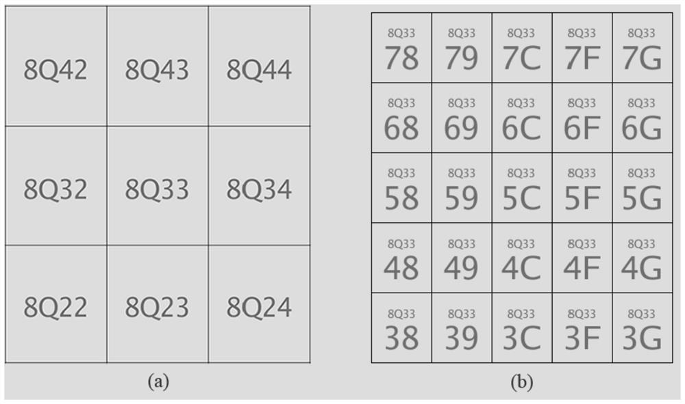
[0119] Embodiment 3 of the present application provides a method for providing services. For an information service platform that includes multiple services, using location-based services, different services can be implemented based on different retrieval scopes and retrieval precisions. For example, the platform provides two delivery services: one service specifies a geographical range within 2 kilometers of delivery; the other service is based on the user's location as the center within a range of 25 kilometers. For different business distribution requirements, it can be implemented under different precision geogrid codes based on geofence technology. For different service businesses, the precision information can be determined first, so that the server can provide services according to the specified precision. The server can include data service content with different precisions, determine the target data service content according to the specified precision, and then provid...
PUM
 Abstract
Description
Claims
Application Information
 - R&D
- Intellectual Property
- Life Sciences
- Materials
- Tech Scout
- Unparalleled Data Quality
- Higher Quality Content
- 60% Fewer Hallucinations
Browse by: Latest US Patents, China's latest patents, Technical Efficacy Thesaurus, Application Domain, Technology Topic, Popular Technical Reports.
© 2025 PatSnap. All rights reserved.Legal|Privacy policy|Modern Slavery Act Transparency Statement|Sitemap|About US| Contact US: help@patsnap.com