
A data-driven path planning method for underwater unmanned vehicles

An unmanned vehicle and path planning technology, applied in the field of underwater unmanned vehicle data-driven path planning, can solve problems such as low efficiency and lack of decision-making ability of the area traversal algorithm, and achieve the effect of improving time efficiency

Active Publication Date: 2022-04-29
OCEAN UNIV OF CHINA
View PDF5 Cites 0 Cited by
  • Summary
  • Abstract
  • Description
  • Claims
  • Application Information

AI Technical Summary

Problems solved by technology

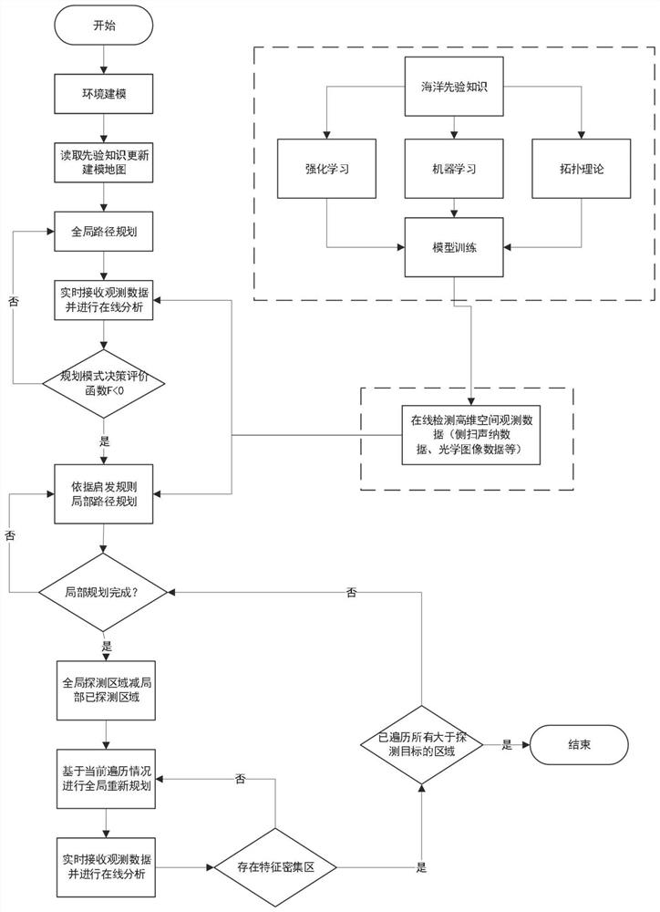
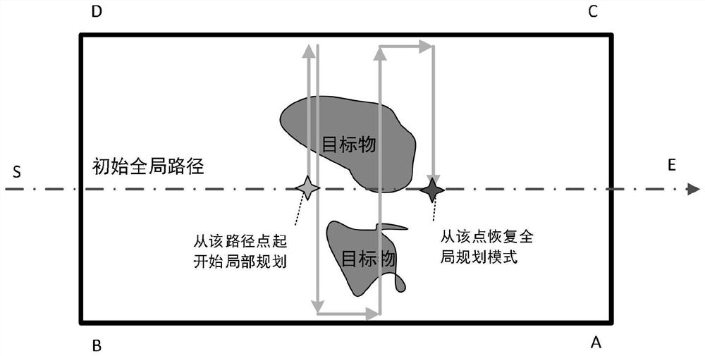
[0006] In order to solve the problem that existing area traversal algorithms generally lack decision-making ability and low efficiency, the present invention proposes a data-driven path planning method for underwater unmanned vehicles, which can use real-time high-dimensional space observation data to perform global and local path planning Mode switching, and according to the shape characteristics of the target, select the most appropriate local traversal method, and refer to the heuristic search rules to optimize the local path planning, thereby improving efficiency

Method used


Image

  • A data-driven path planning method for underwater unmanned vehicles
  • A data-driven path planning method for underwater unmanned vehicles
  • A data-driven path planning method for underwater unmanned vehicles

Examples


Embodiment Construction

[0086] In order to understand the above-mentioned purpose, features and advantages of the present invention more clearly, the present invention will be further described below in conjunction with the accompanying drawings and embodiments. Many specific details are set forth in the following description to facilitate a full understanding of the present invention. However, the present invention can also be implemented in other ways than those described here. Therefore, the present invention is not limited to the specific embodiments disclosed below.

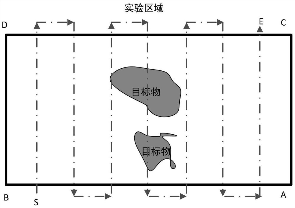
[0087]UUV (Underwaterunmannedvehicle, underwater unmanned vehicle) works on the bottom of the water, and its attitude is greatly affected by ocean currents, which may affect the detection effect. Therefore, in order to improve the target detection effect and correspond to global planning and local planning, this scheme proposes the concept of rough scanning and fine scanning. Converted to known; fine scanning can also be called fin...


PUM


Abstract

The present invention proposes a data-driven path planning method for underwater unmanned vehicles, which is mainly applied to the path planning of underwater area traversal tasks; Update the modeling map, and use the initial map information to generate the initial global path; during the execution of the mission, detect and receive observation data in real time, conduct online path planning analysis, and make decisions on the global planning mode and the local planning mode based on the planning mode decision evaluation function F, If you switch to the local planning mode, perform local planning according to the heuristic rule set, and return to the initial global planning path after traversing the local feature-intensive area; this scheme conducts online guidance and decision-making based on real-time underwater high-dimensional space observation data, based on real-time detection. The decision-making of global and local planning can be applied to more complex environments by switching the planning mode and selecting an adaptive planning strategy, and achieve a significant improvement in time efficiency.

Description

technical field [0001] The invention relates to the field of underwater navigation, in particular to a data-driven path planning method for an underwater unmanned vehicle. Background technique [0002] Since the deep-sea environment may have many unpredictable dangers and is relatively difficult to approach, in actual underwater operations, autonomous underwater robots can operate independently and complete many tasks without human intervention, such as autonomous navigation, autonomous avoidance, etc. barriers and autonomous work. Therefore, in situations that are not suitable for divers, underwater unmanned vehicles play an important role in both military and commercial applications, such as deep-sea work platforms, ocean exploration sampling, underwater measurement, and other research applications. Human underwater robot just can embody huge superiority. [0003] Path planning technology is an important technology for underwater robots to complete marine tasks. There ar...

Claims


Application Information

Patent Timeline
Patent Type & Authority Patents(China)
IPC IPC(8): G01C21/20
CPCG01C21/20
Inventor 何波张意晓沈钺严天宏
Owner OCEAN UNIV OF CHINA
Learn More