A Calculation Method of Maximum Development Scale of Waterway Based on River Phase Relationship
A technology of river phase relationship and calculation method, applied in the direction of geometric CAD, special data processing applications, etc., can solve problems such as cumbersome processes, and achieve the effects of credible conclusions, clear physical concepts, and convenient methods
- Summary
- Abstract
- Description
- Claims
- Application Information
AI Technical Summary
Problems solved by technology
Method used
Image
Examples
Embodiment 1
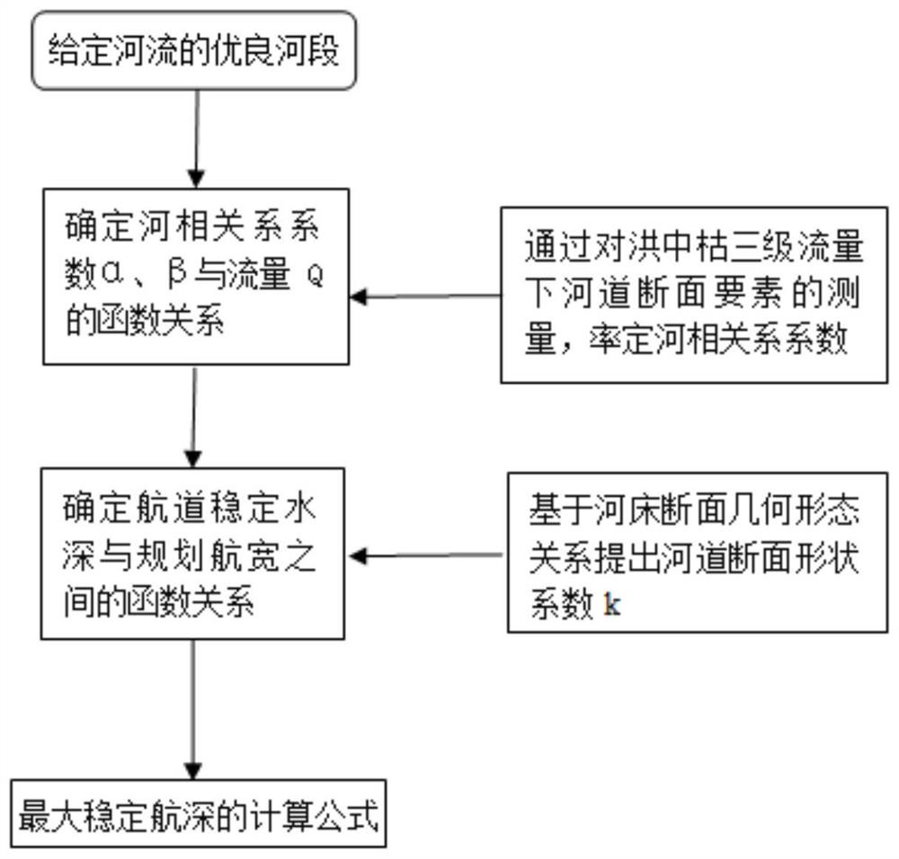
[0047] see figure 1 , this embodiment discloses a method for calculating the maximum development scale of a waterway based on river correlation, including the following steps:
[0048] 1) Determine the excellent river section of the natural river course. The excellent river section is a reference model for waterway improvement projects, and it is a section of a natural river that has no obstacles to navigation. The river correlation relationship of the excellent river section is intended to describe the most suitable cross-sectional shape of the river bed after the river has been improved in the natural state.
[0049] 2) It is assumed that the cross-section of the channel after the completion of regulation is similar to the cross-section shape of the excellent river section. Establish the characteristic flow rate (in this embodiment, select the design minimum navigable guaranteed flow rate), and the cross-section of the excellent river section has a correlation relationship...
Embodiment 2
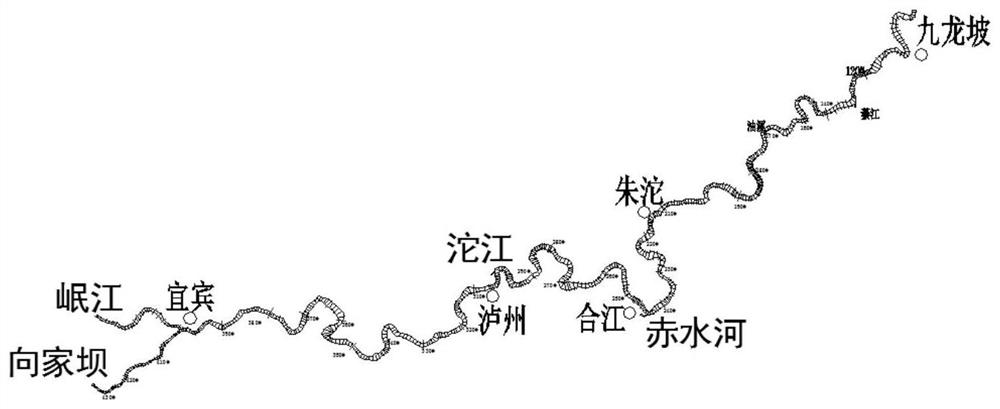
[0073] In this embodiment, the Xuyu-Chongqing section of the upper reaches of the Yangtze River is taken as an example to explore the maximum development scale of the waterway section. see figure 2 The section from Yibin Hejiangmen (upstream waterway mileage 1044km) to Chongqing Jiulongpo (upstream waterway mileage 681km) in the upper reaches of the Yangtze River is referred to as the Xuyu section, with a total length of 363km. The Xuyu section straddles Sichuan and Chongqing, and the water flows from west to east across the southeastern edge of the Sichuan Basin. The riverbed in the interval is mostly composed of bedrock, pebbles or sand mixed with pebbles, and its flow conditions and riverbed are generally stable.
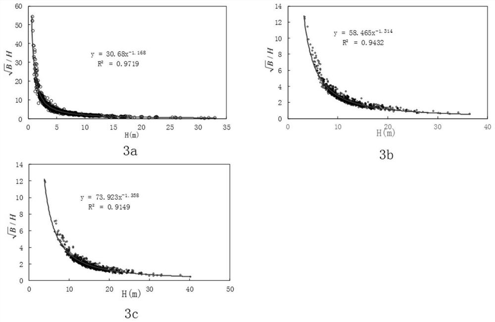
[0074] 1) According to the navigation map of the dry season channel measured by the Yangtze River Waterway Bureau, 739 excellent cross-sections were selected in the section of the Syria-Chongqing section, and the natural river width at the third-level water leve...
PUM
 Abstract
Description
Claims
Application Information
 - Generate Ideas
- Intellectual Property
- Life Sciences
- Materials
- Tech Scout
- Unparalleled Data Quality
- Higher Quality Content
- 60% Fewer Hallucinations
Browse by: Latest US Patents, China's latest patents, Technical Efficacy Thesaurus, Application Domain, Technology Topic, Popular Technical Reports.
© 2025 PatSnap. All rights reserved.Legal|Privacy policy|Modern Slavery Act Transparency Statement|Sitemap|About US| Contact US: help@patsnap.com


