Thematic map sheet planning method
A technology of thematic maps and map sheets, which is applied in the field of thematic map map sheet planning, can solve the problems that map sheet planning methods are not easy to quantify, and the results of map sheet specifications are different, etc., to achieve strong practicability, strong versatility, and high efficiency Effect
- Summary
- Abstract
- Description
- Claims
- Application Information
AI Technical Summary
Problems solved by technology
Method used
Image
Examples
Embodiment 1
[0048] A thematic map requires coverage, that is, the target geographic scope, covering the entire territory of Jinan City, the southern part of Zhangqiu City, the northern part of Tai'an City, the entire territory of Laiwu City, and the southern part of Zibo City in Shandong Province. The small area between the lines. The required drawing width is 81cm.
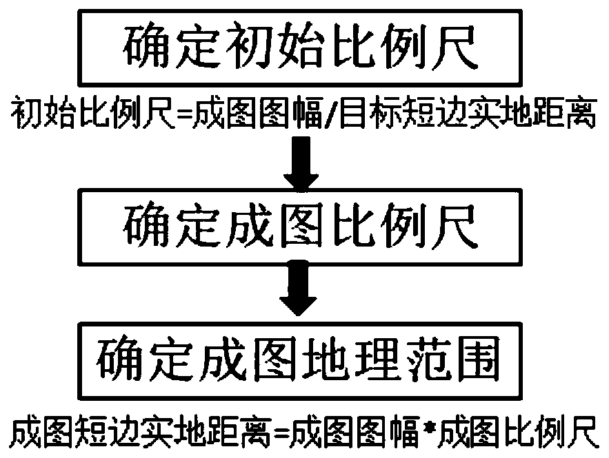
[0049] Adopt a map-based plan, such as figure 1 shown, including the following steps:
[0050] Step 1: Determine the initial scale
[0051] According to the target geographical range, draw an initial rectangle to include the administrative divisions in the thematic information; measure the actual distance of the short side of the target corresponding to the initial rectangle to be 74.9km, according to the definition of the scale, divide the actual distance of the short side of 74.9km by the map The map size is 81cm, and the calculated initial scale is 1:92469;
[0052] Step 2: Determine the scale of the drawing
[0053]...
Embodiment 2
[0057] A thematic map requires that the main streets of the city can be distinguished, and the geographical span of the short side of the map is less than 20 kilometers. The thematic information is a 52-kilometer designed railway, and the scale of the drawing is required to be 1:25000.
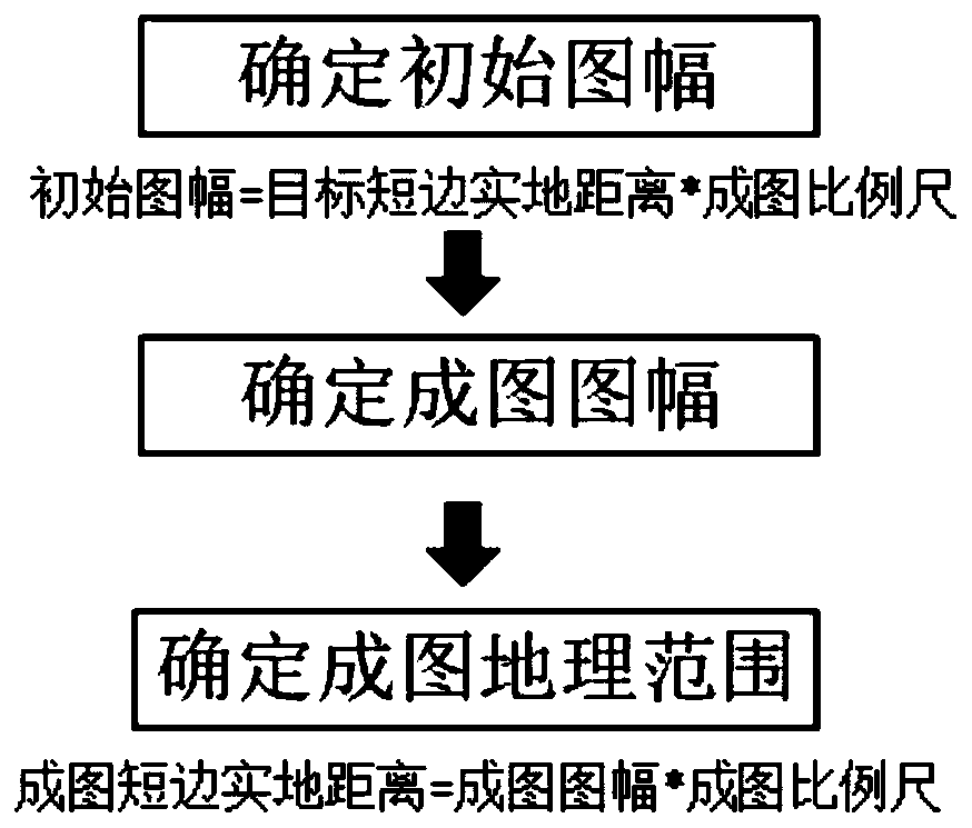
[0058] In this thematic map, the controlling thematic information is a graphic effect, and the scale-based planning is adopted, such as figure 2 shown, including the following steps:
[0059] Step a: Determine the initial map frame
[0060] According to the control conditions combined with the scale of the map to determine the reference geographical range, draw the initial rectangle to determine the target geographical range, measure the actual distance of the short side of the target to 18.5km, multiply the actual distance of the short side of the target to 18.5km and multiply the scale of the map to 1:25000 to obtain an initial map size of 74cm ;
[0061] Step b: Determine the map size ...
Embodiment 3
[0066] The thematic information in a thematic map in Eastern Europe is distributed in continuous strips, and the thematic information is required to be evenly distributed and the distance from the map's surroundings should not be too large.
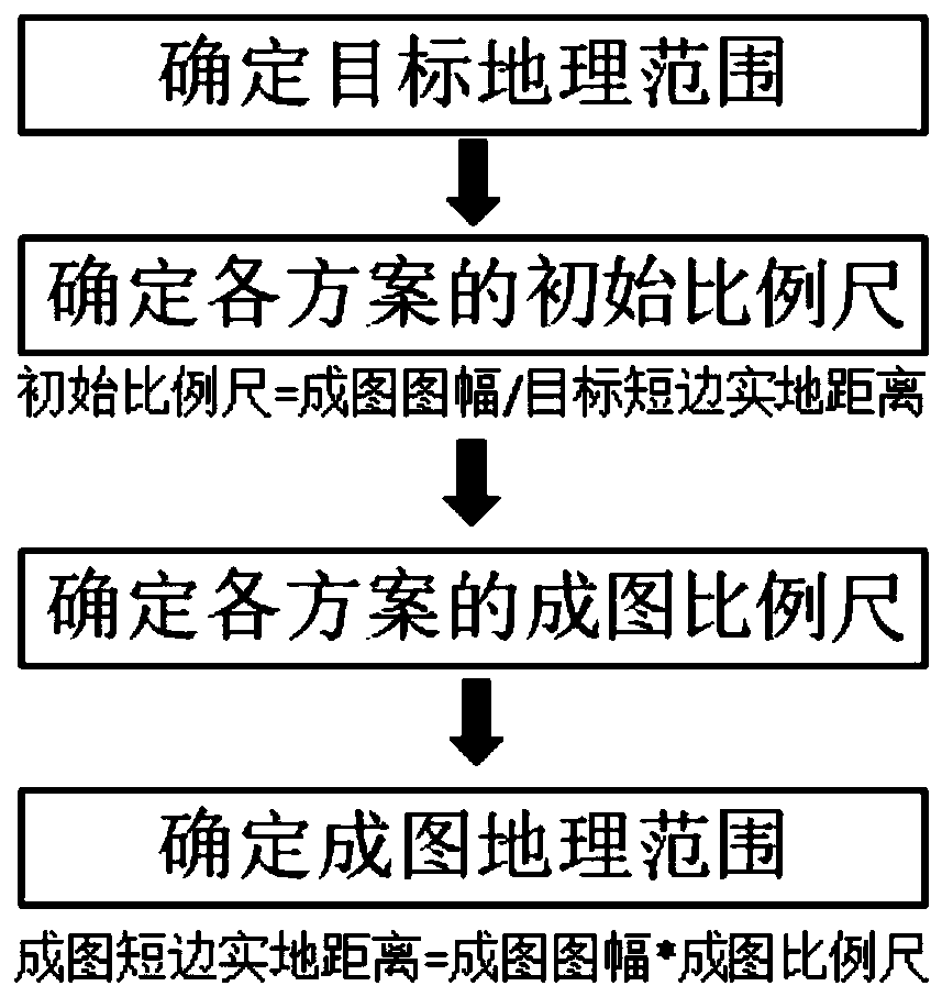
[0067] Adopting a plan based on thematic information, including the following steps:
[0068] Step A: Determine the target geographic scope
[0069] Draw the initial rectangle with the continuous strip-shaped thematic information as the control factor, ensure that the thematic information is centered in the initial rectangle and the strip-like direction is parallel to the long side, determine the target geographical range, and measure the actual distance of the short side of the target corresponding to the initial rectangle to be 436km , and the distance on the long side of the target is 951km;
[0070] Step B: Determine the initial scale for each scenario
[0071] Select two target map frames, which are 81cm and 108cm respectively, and...
PUM
 Abstract
Description
Claims
Application Information
 - R&D
- Intellectual Property
- Life Sciences
- Materials
- Tech Scout
- Unparalleled Data Quality
- Higher Quality Content
- 60% Fewer Hallucinations
Browse by: Latest US Patents, China's latest patents, Technical Efficacy Thesaurus, Application Domain, Technology Topic, Popular Technical Reports.
© 2025 PatSnap. All rights reserved.Legal|Privacy policy|Modern Slavery Act Transparency Statement|Sitemap|About US| Contact US: help@patsnap.com


