
Method of autonomous flight along road for multi-rotor unmanned aerial vehicle in combination with road detection

A multi-rotor UAV and road detection technology, applied in three-dimensional position/course control, vehicle position/route/height control, non-electric variable control, etc., can solve problems such as difficult to ensure flight, to ensure stable flight, The effect of reducing labor costs and avoiding collisions

Active Publication Date: 2020-06-19
CHONGQING UNIV OF POSTS & TELECOMM
View PDF13 Cites 0 Cited by
  • Summary
  • Abstract
  • Description
  • Claims
  • Application Information

AI Technical Summary

Problems solved by technology

However, it does not explain how the UAV autonomously finds the nearest road, and it does not include the GPS of the road and the GPS value of the UAV as verification standards and correction conditions. In the case of detection failure, it is difficult to guarantee its flight.

Method used


Image

  • Method of autonomous flight along road for multi-rotor unmanned aerial vehicle in combination with road detection
  • Method of autonomous flight along road for multi-rotor unmanned aerial vehicle in combination with road detection
  • Method of autonomous flight along road for multi-rotor unmanned aerial vehicle in combination with road detection

Examples


Embodiment Construction

[0046] Embodiments of the present invention are described below through specific examples, and those skilled in the art can easily understand other advantages and effects of the present invention from the content disclosed in this specification. The present invention can also be implemented or applied through other different specific implementation modes, and various modifications or changes can be made to the details in this specification based on different viewpoints and applications without departing from the spirit of the present invention. It should be noted that the diagrams provided in the following embodiments are only schematically illustrating the basic concept of the present invention, and the following embodiments and the features in the embodiments can be combined with each other in the case of no conflict.

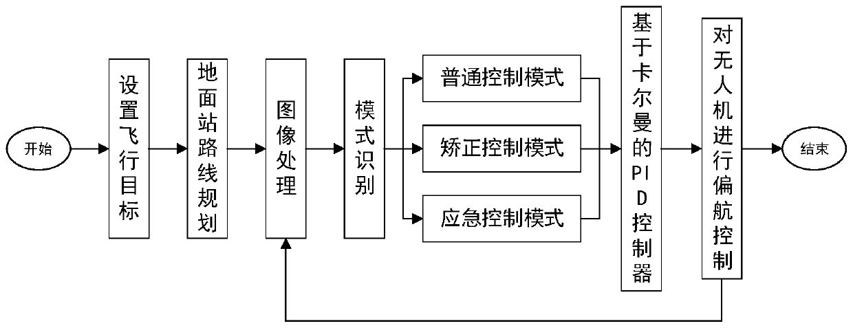
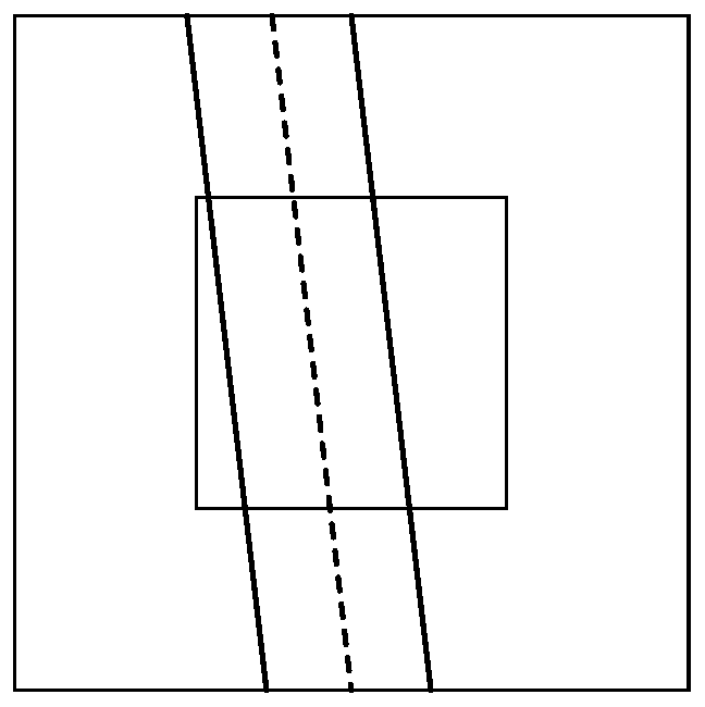
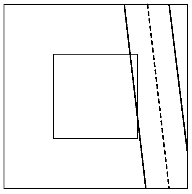
[0047] see Figure 1 to Figure 6 , is a method for autonomous flight of multi-rotor UAVs combined with road detection to realize autonomous control of UAVs f...


PUM


Abstract

The invention relates to a method of autonomous flight along the road for a multi-rotor unmanned aerial vehicle in combination with road detection, which belongs to the field of unmanned aerial vehicle flight control. The method comprises the following steps of S1, acquiring video information of a road right under the unmanned aerial vehicle, S2, transmitting the acquired video information to a ground station through a 4G link, S3, performing road detection on the obtained video image through the ground station, and extracting a position and an angle of a road center line in the whole video image, S4, utilizing the extracted relationship between the unmanned aerial vehicle and the road center line l and a judgment box R, selecting a mode, in combination with GPS information returned by theunmanned aerial vehicle and a road GPS data set, inputting the information to an eight-direction PID strategy controller based on Kalman filtering, acquiring a yaw control quantity, sending a controlinstruction to the unmanned aerial vehicle through the ground station, firstly controlling the unmanned aerial vehicle to fly to the position above a road firstly, and then controlling the unmanned aerial vehicle to fly along the road autonomously. The unmanned aerial vehicle can accurately and autonomously fly along the road, and collision with the surrounding environment is avoided to a large extent.

Description

technical field [0001] The invention belongs to the field of unmanned aerial vehicle flight control, and relates to a method for precise positioning and fusion control of a multi-rotor unmanned aerial vehicle based on Kalman filter. Background technique [0002] At present, civilian drones are mostly controlled by radio frequency remote controllers. The control distance is short and the signal is easily blocked by obstacles. Under today's communication conditions, 4G networks have been able to spread throughout the main areas of major cities and can meet the needs of most users. , such inherent advantages not only make personal communication very convenient, but also provide excellent conditions for solving the communication distance limitation problem encountered by the long-distance communication technology of civilian drones. Therefore, the remote control of drones is realized through 4G network communication. Control has become an important direction for the development ...

Claims


Application Information

Patent Timeline
Patent Type & Authority Applications(China)
IPC IPC(8): G05D1/10
CPCG05D1/101
Inventor 杨路杨嘉耕段思睿杨磊
Owner CHONGQING UNIV OF POSTS & TELECOMM
Learn More