Irrigation water effective utilization coefficient measuring and calculating method based on remote sensing
A technology of utilization coefficient and irrigation water, applied in the field of farmland water conservancy research, it can solve the problems of large influence of measurement results, limited manual monitoring range, difficulty in selecting typical fields, etc., and achieve high efficiency.
- Summary
- Abstract
- Description
- Claims
- Application Information
AI Technical Summary
Problems solved by technology
Method used
Image
Examples
Embodiment
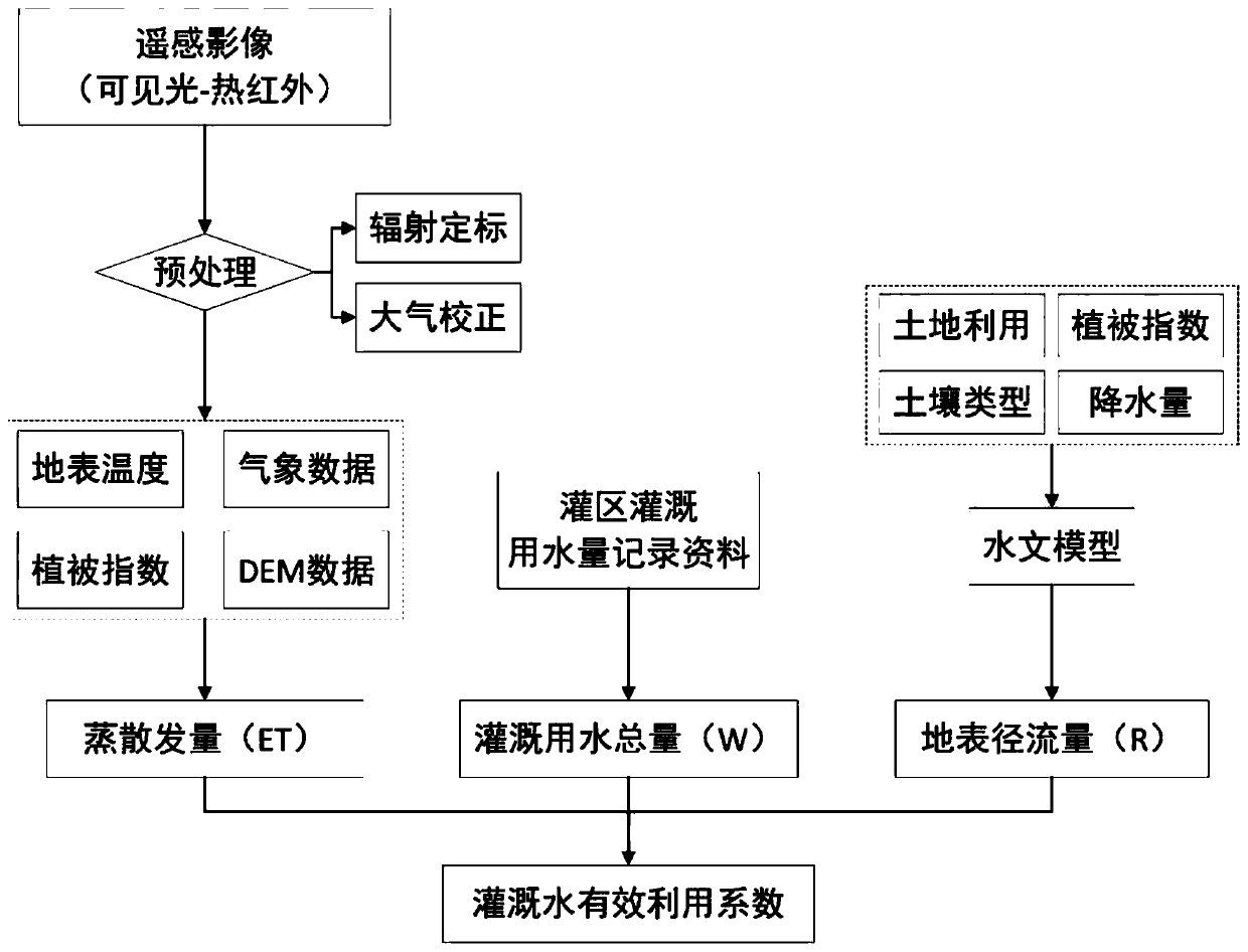
[0065] Such as figure 1 As shown, this embodiment provides a method for calculating the effective utilization coefficient of irrigation water based on remote sensing. The method is based on data such as remote sensing images, irrigation water consumption records in irrigation areas, soil type data, land use data, vegetation data, and precipitation. The calculation of effective utilization coefficient of irrigation water can be realized. Specifically, this embodiment takes Guangzhou City, China as an example, to describe in detail the process of measuring and calculating the effective utilization coefficient of irrigation water using the method of the present invention. according to figure 1 Shown method flowchart, method comprises steps:
[0066] S1: Obtain remote sensing images containing visible light and thermal infrared bands, and perform preprocessing.
[0067] The remote sensing images can mainly use MODIS satellite images and Landsat series satellite images, and the ...
PUM
 Abstract
Description
Claims
Application Information
 - R&D
- Intellectual Property
- Life Sciences
- Materials
- Tech Scout
- Unparalleled Data Quality
- Higher Quality Content
- 60% Fewer Hallucinations
Browse by: Latest US Patents, China's latest patents, Technical Efficacy Thesaurus, Application Domain, Technology Topic, Popular Technical Reports.
© 2025 PatSnap. All rights reserved.Legal|Privacy policy|Modern Slavery Act Transparency Statement|Sitemap|About US| Contact US: help@patsnap.com


