Land use classification method, storage medium and computing equipment based on remote sensing images
A technology of remote sensing images and classification methods, applied in the fields of computing, computer parts, character and pattern recognition, etc., can solve the problems of waste of large financial resources, material resources, insufficiency, poor timeliness, etc., and achieve good timeliness, accurate and rapid land use. The effect of categorical, accurate and rapid land use classification
- Summary
- Abstract
- Description
- Claims
- Application Information
AI Technical Summary
Problems solved by technology
Method used
Image

Examples
Embodiment 1
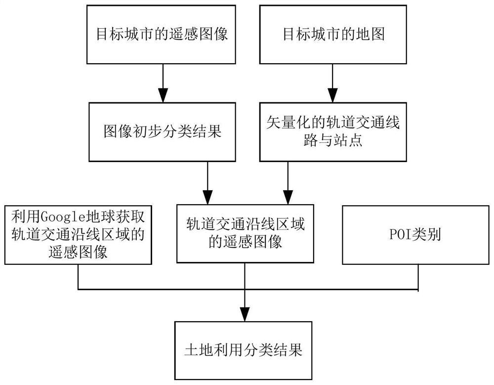
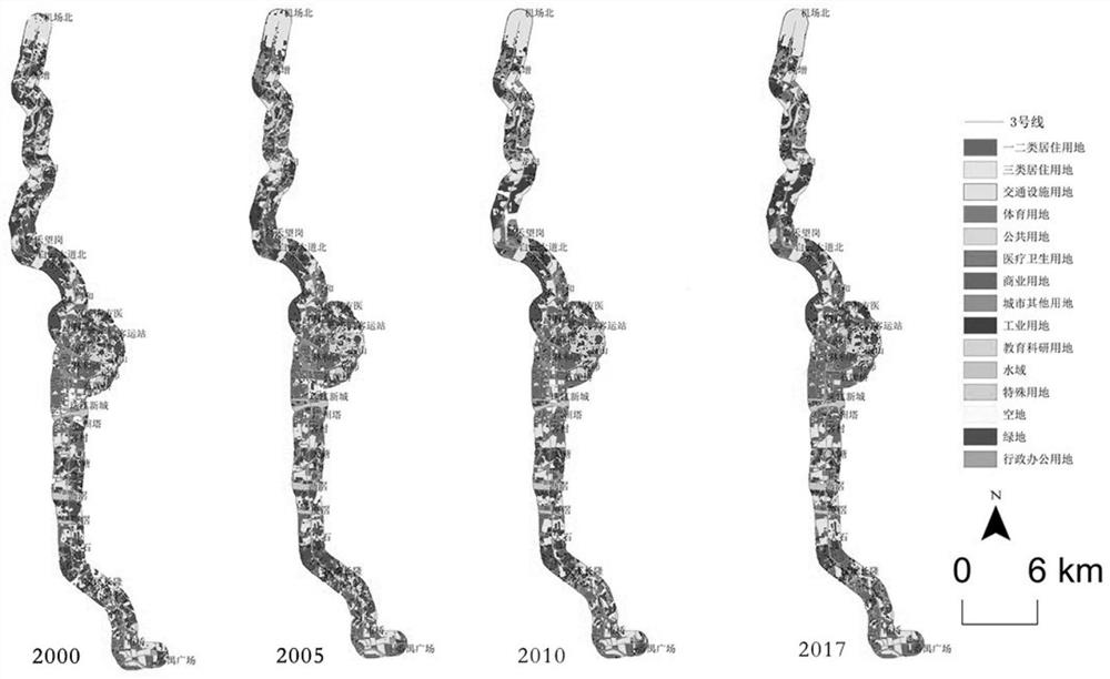
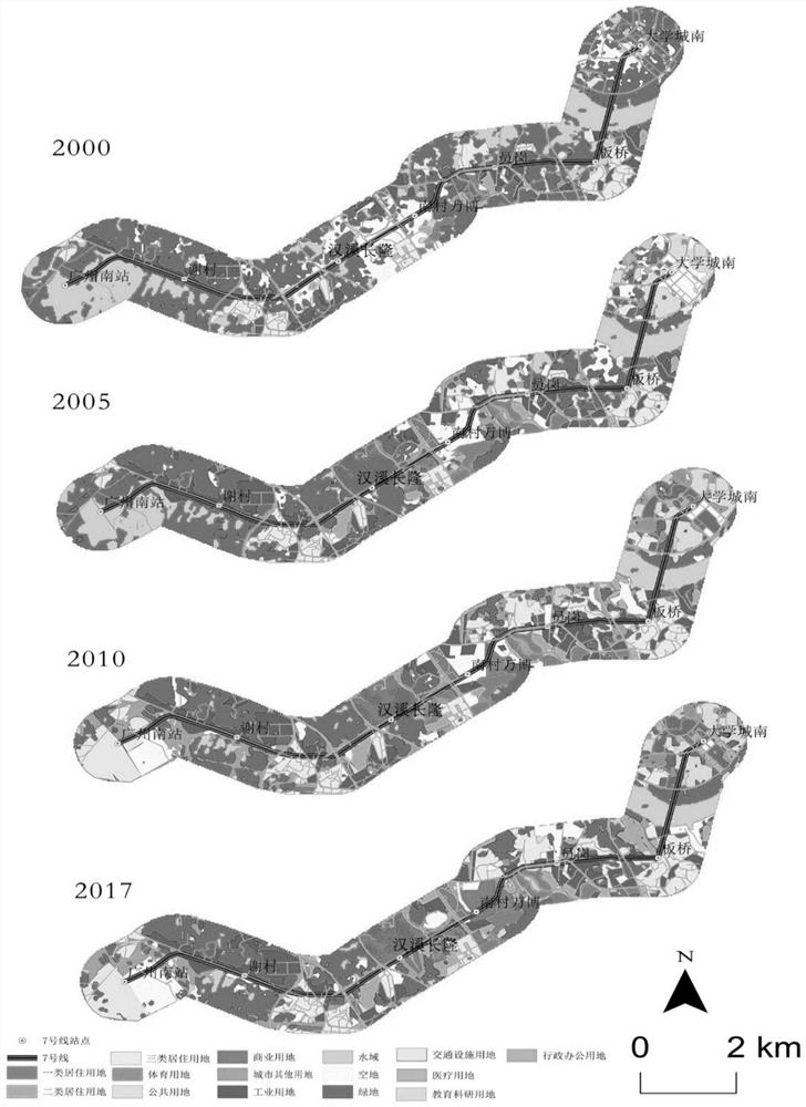
[0046] The invention discloses a land use classification method based on remote sensing images, such as figure 1 shown, including:
[0047] Step 1. Obtain the remote sensing image of the target city; in this embodiment, the remote sensing image of the target city is downloaded through the geospatial data cloud website, and the resolution of the downloaded remote sensing image is 30m.
[0048] In this embodiment, acquiring the remote sensing image of the target city also includes preprocessing the remote sensing image of the target city, and the preprocessing includes image stretching enhancement and band combination, wherein,
[0049] Image stretching refers to the adjustment and transformation of the density and tone of remote sensing images, which is used to improve the visual quality of remote sensing images, highlight the features of ground features in remote sensing images, and improve the performance and effect of remote sensing image interpretation.
[0050] Band combi...
Embodiment 2
[0097] The invention discloses a storage medium, which stores a program. When the program is executed by a processor, the land use classification method based on remote sensing images described in Embodiment 1 is implemented, specifically as follows:
[0098] Obtain remote sensing images of the target city;
[0099] Preliminary interpretation of the remote sensing image of the target city is carried out, and the preliminary classification result of the image is obtained; the preliminary classification result includes four basic categories of green space, water area, open space and building land;
[0100] Obtain the map of the target city, vector extract the rail transit lines and stations in the map, and obtain the vectorized rail transit lines and stations;
[0101] For the area along the rail transit area to be classified by land use, the vectorized rail transit lines and stations are used to crop the remote sensing image, and the remote sensing image of the area along the r...
Embodiment 3
[0107] The invention discloses a computing device, which includes a processor and a memory for storing executable programs of the processor. When the processor executes the program stored in the memory, the remote sensing image-based land use classification method described in Embodiment 1 is realized. ,details as follows:
[0108] Obtain remote sensing images of the target city;
[0109] Preliminary interpretation of the remote sensing image of the target city is carried out, and the preliminary classification result of the image is obtained; the preliminary classification result includes four basic categories of green space, water area, open space and building land;
[0110] Obtain the map of the target city, vector extract the rail transit lines and stations in the map, and obtain the vectorized rail transit lines and stations;
[0111] For the area along the rail transit area to be classified by land use, the vectorized rail transit lines and stations are used to crop the...
PUM
 Abstract
Description
Claims
Application Information
 - R&D
- Intellectual Property
- Life Sciences
- Materials
- Tech Scout
- Unparalleled Data Quality
- Higher Quality Content
- 60% Fewer Hallucinations
Browse by: Latest US Patents, China's latest patents, Technical Efficacy Thesaurus, Application Domain, Technology Topic, Popular Technical Reports.
© 2025 PatSnap. All rights reserved.Legal|Privacy policy|Modern Slavery Act Transparency Statement|Sitemap|About US| Contact US: help@patsnap.com