Method for extracting stratum boundary line to carry out three-dimensional modeling by utilizing exploration line profile
A technology of 3D modeling and exploration lines, which is applied in the field of 3D modeling by extracting stratigraphic boundaries from exploration line profiles, and can solve problems such as difficulties in 3D geological modeling
- Summary
- Abstract
- Description
- Claims
- Application Information
AI Technical Summary
Problems solved by technology
Method used
Image
Examples
Embodiment
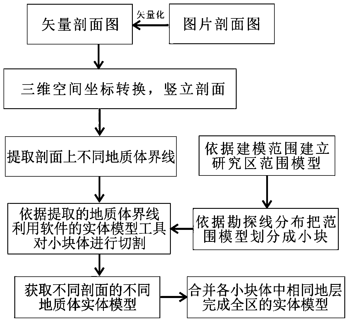
[0051] A technical method for extracting geological boundaries and developing three-dimensional modeling using the exploration line profile is proposed. The specific technical process is as follows figure 1 As shown, it mainly includes the following steps: Step S1: Basic data preparation and processing; Step S2: Extract the boundary of the geological body on the profile; Step S3: Use the boundary of the geological body to establish a three-dimensional geological model.
[0052] Step 1 includes the following operations:
[0053] Generally, the original data accumulated for different exploration levels in the study area are different, and the methods of 3D modeling based on different data bases are also different. The method described here is to carry out 3D geological modeling based on the exploration line profile data.
[0054] Step S11: Use the profile view for 3D modeling. First of all, make sure that the profile view you get is a vector diagram. If it is a picture format that requi...
PUM
 Abstract
Description
Claims
Application Information
 - R&D
- Intellectual Property
- Life Sciences
- Materials
- Tech Scout
- Unparalleled Data Quality
- Higher Quality Content
- 60% Fewer Hallucinations
Browse by: Latest US Patents, China's latest patents, Technical Efficacy Thesaurus, Application Domain, Technology Topic, Popular Technical Reports.
© 2025 PatSnap. All rights reserved.Legal|Privacy policy|Modern Slavery Act Transparency Statement|Sitemap|About US| Contact US: help@patsnap.com


