Level for geological survey
A technology for geological survey and leveling, which is applied to instruments, height/level measurement, measuring devices, etc., can solve the problems of short time-consuming, affecting the work process, and the leveling being unable to work normally, so as to achieve the effect of shortening time-consuming and improving work efficiency.
- Summary
- Abstract
- Description
- Claims
- Application Information
AI Technical Summary
Problems solved by technology
Method used
Image
Examples
Embodiment Construction
[0035] The embodiments of the present invention will be described in detail below with reference to the accompanying drawings, but the present invention can be implemented in many different ways defined and covered by the claims.
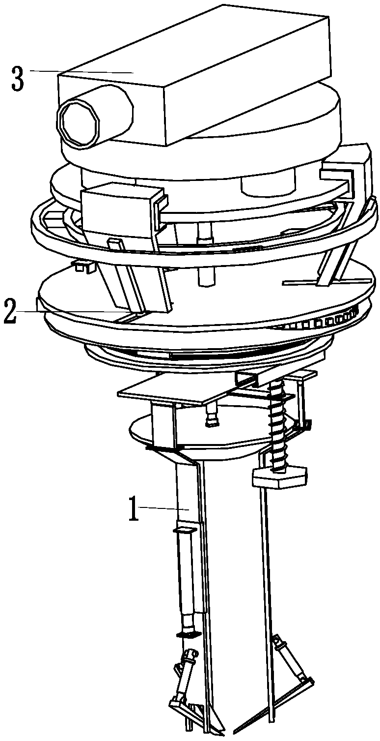
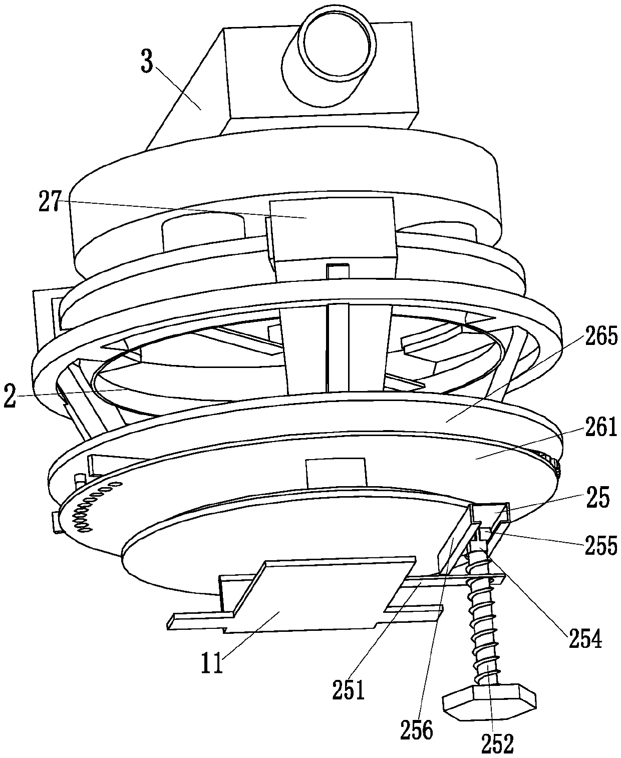
[0036] Such as Figure 1 to Figure 5 As shown, a level for geological survey includes a support bracket 1, an adjustment device 2 and a level body 3. The upper end of the support bracket 1 is equipped with an adjustment device 2, and the upper end of the adjustment device 2 is provided with a level body 3.
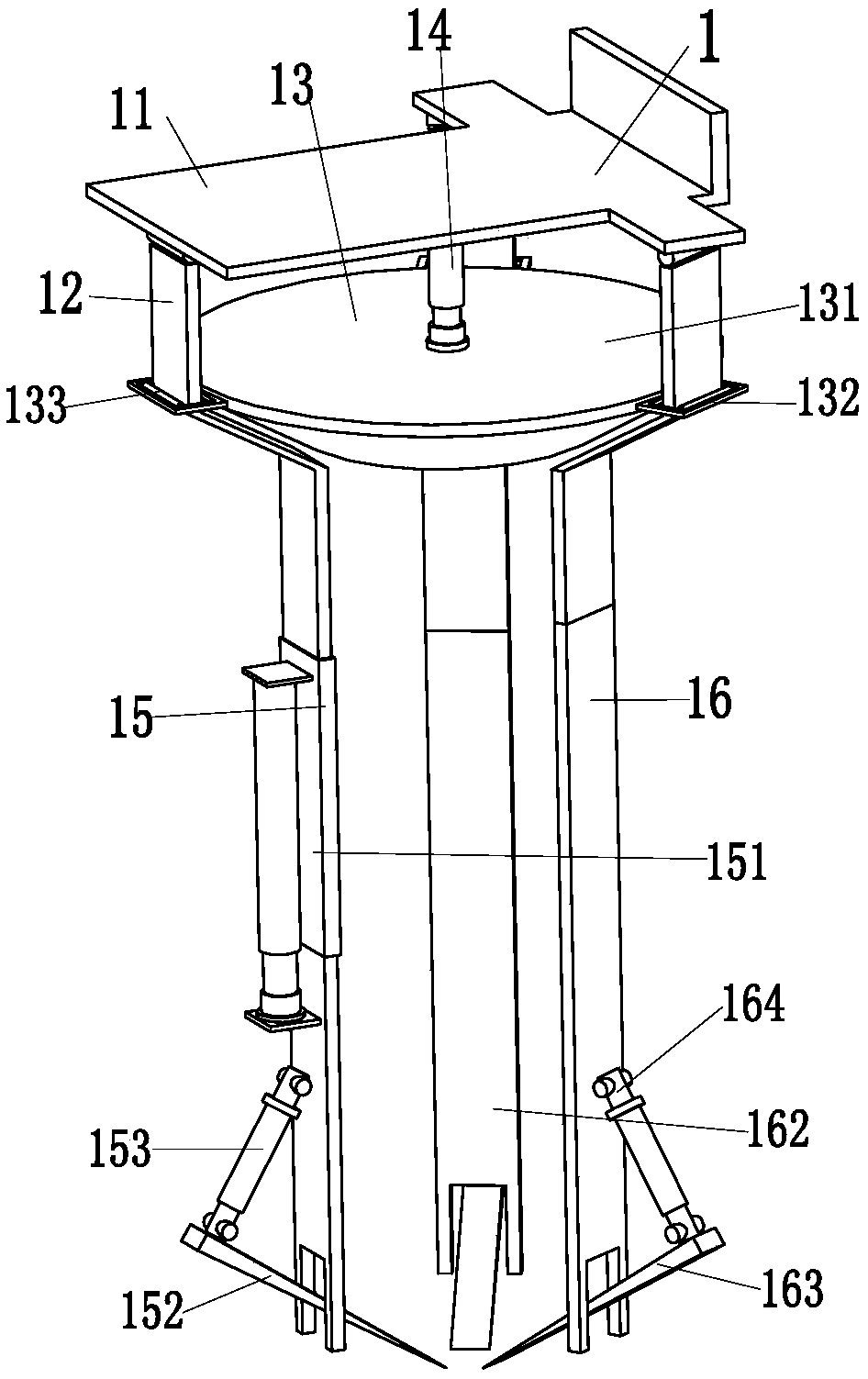
[0037] The support bracket 1 includes a connecting frame 11, three adjusting rods 12, an extruding block 13, an extruding cylinder 14, a telescopic bracket 15 and two supporting brackets 16, and the lower end of the connecting frame 11 is uniformly equipped with three adjusting rods through a hinge. 12. An extruding cylinder 14 is installed in the middle of the connecting frame 11, and the top of the extruding cylinder 14 is installed on the ext...
PUM
 Abstract
Description
Claims
Application Information
 - Generate Ideas
- Intellectual Property
- Life Sciences
- Materials
- Tech Scout
- Unparalleled Data Quality
- Higher Quality Content
- 60% Fewer Hallucinations
Browse by: Latest US Patents, China's latest patents, Technical Efficacy Thesaurus, Application Domain, Technology Topic, Popular Technical Reports.
© 2025 PatSnap. All rights reserved.Legal|Privacy policy|Modern Slavery Act Transparency Statement|Sitemap|About US| Contact US: help@patsnap.com


