
Method and system for obtaining positioning and navigation information

A positioning navigation and acquisition method technology, applied in the field of positioning and navigation information acquisition, can solve problems such as losing direction, delaying game time, and being unable to obtain map data

Active Publication Date: 2020-04-17
BEIJING FOREVER TECH
View PDF7 Cites 0 Cited by
  • Summary
  • Abstract
  • Description
  • Claims
  • Application Information

AI Technical Summary

Problems solved by technology

In the process of orienteering, the most serious problem is getting lost in the direction. For example, when going off-road in the mountains and forests, the most taboo is to take a "shortcut" in a hurry before finding out the degree of direction error and the correct direction of travel. , this is likely to result in going around in circles and delaying the game time
[0003] However, the currently commonly used mobile phone map software does not provide detailed maps of outdoors, forests, villages, etc., and cannot provide accurate positioning. Moreover, most of the orienteering sites are in areas with poor network conditions, and it is impossible to access them from the network in real time. terminal to obtain map data
At present, there is no positioning and navigation solution for large and complex areas and outdoor scenes such as orienteering venues

Method used


Image

  • Method and system for obtaining positioning and navigation information
  • Method and system for obtaining positioning and navigation information
  • Method and system for obtaining positioning and navigation information

Examples


Embodiment Construction

[0028] The technical solutions in the embodiments of the present invention will be clearly and completely described below with reference to the accompanying drawings in the embodiments of the present invention. Obviously, the described embodiments are only a part of the embodiments of the present invention, but not all of the embodiments. Based on the embodiments of the present invention, all other embodiments obtained by those of ordinary skill in the art without creative efforts shall fall within the protection scope of the present invention.

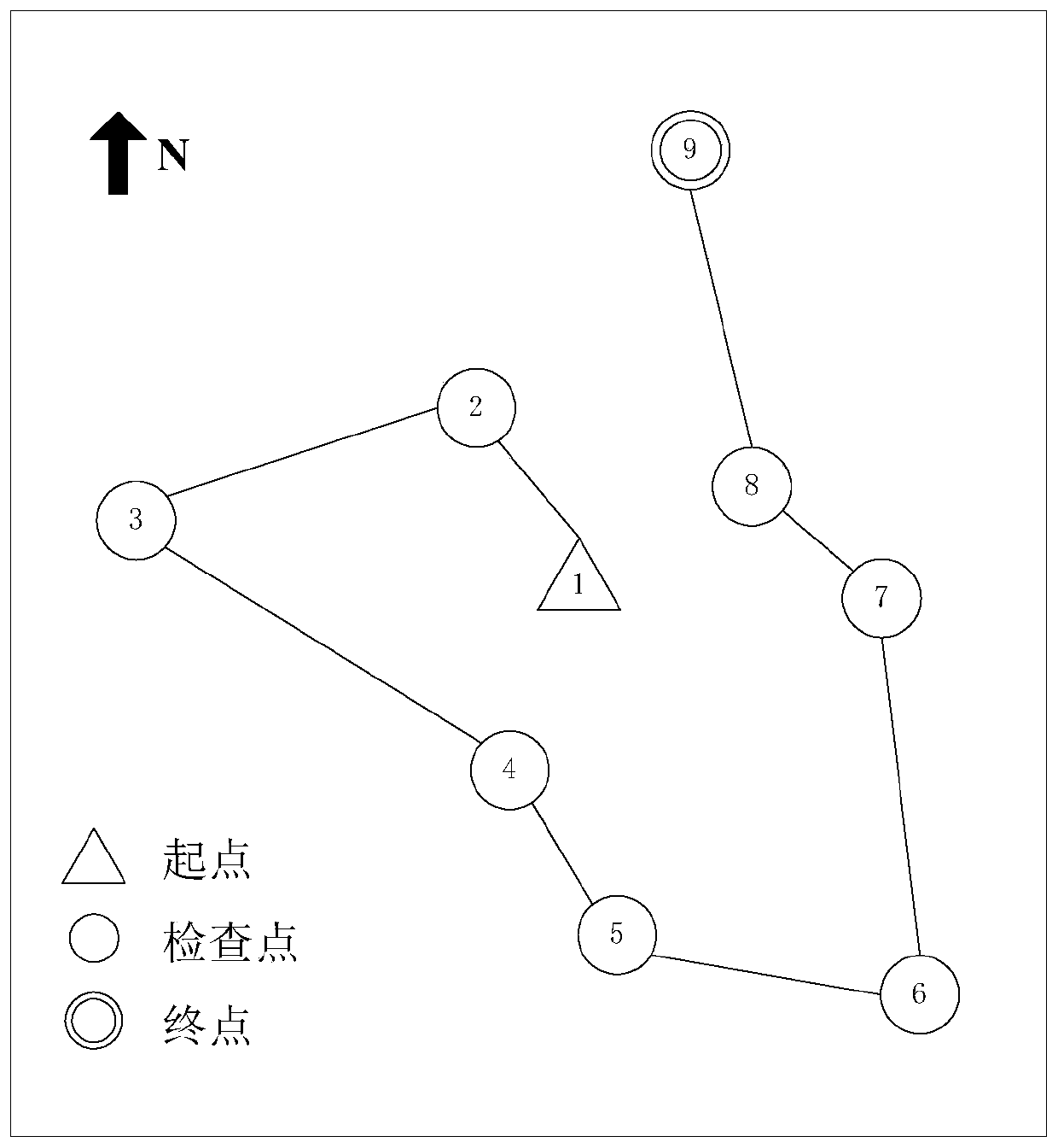
[0029] The method and system for obtaining positioning and navigation information provided by the present invention can be applied to scenarios such as directional off-road, large and complex areas (especially areas with poor network conditions) and outdoor data collection, for example, tourist attractions, large construction sites, industrial parks, etc. . The embodiments provided in this application mainly take an orienteering scene...


PUM


Abstract

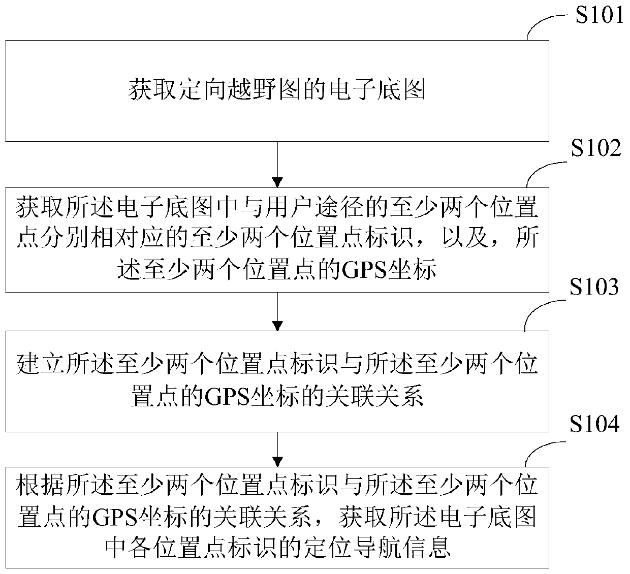
The invention provides a method and system for acquiring positioning and navigation information. An electronic base map of an orienteering map is acquired, and at least two position point identifiers,corresponding to at least two position points through which a user passes, in the electronic base map and GPS coordinates of the at least two position points are acquired; the incidence relation between the at least two position point coordinates and the GPS coordinates of the at least two position points is established; the positioning and navigation information of all the position point identifiers in the electronic base map is acquired according to the incidence relation between the at least two position point coordinates and the GPS coordinates of the at least two position points. Positioning and navigation functions of orienteering sites and other large complex regions and outdoor scenes are achieved.

Description

technical field [0001] The present invention relates to the field of information processing, and more particularly, to a method and system for acquiring positioning and navigation information. Background technique [0002] Orienteering as a new sport is attracting more and more people all over the world. In the process of orienteering, the most serious problem is the loss of direction. For example, when going off-road in the mountains and forests, the most taboo is to rush to take a "shortcut" before the degree of directional error and the correct direction of travel have not yet been identified. , this is likely to cause circles in place and delay the game time. [0003] However, the currently commonly used mobile phone map software does not provide detailed maps of the outdoors, forests, villages, etc., and cannot provide accurate positioning. Moreover, most of the orienteering sites are in areas with poor network conditions, and it is impossible to access the network in ...

Claims


Application Information

Patent Timeline
Patent Type & Authority Patents(China)
IPC IPC(8): G01C21/20
CPCG01C21/20
Inventor 陈晓龙江春华罗新伟陈显龙魏威
Owner BEIJING FOREVER TECH
Learn More