Three-dimensional geological modeling meshless method
A three-dimensional geological, gridless method, applied in the field of gridless method of three-dimensional geological modeling, can solve the problems of difficult modeling, uneven geological body, low model accuracy, etc., which is conducive to data transmission, Conducive to the effect of modeling reconstruction and speeding up modeling
- Summary
- Abstract
- Description
- Claims
- Application Information
AI Technical Summary
Problems solved by technology
Method used
Image
Examples
Embodiment Construction
[0024] The preferred embodiment 1 of the present invention is given below in conjunction with the accompanying drawings to describe the technical solution of the present invention in detail, but the present invention is not limited to the scope of the described embodiment 1.
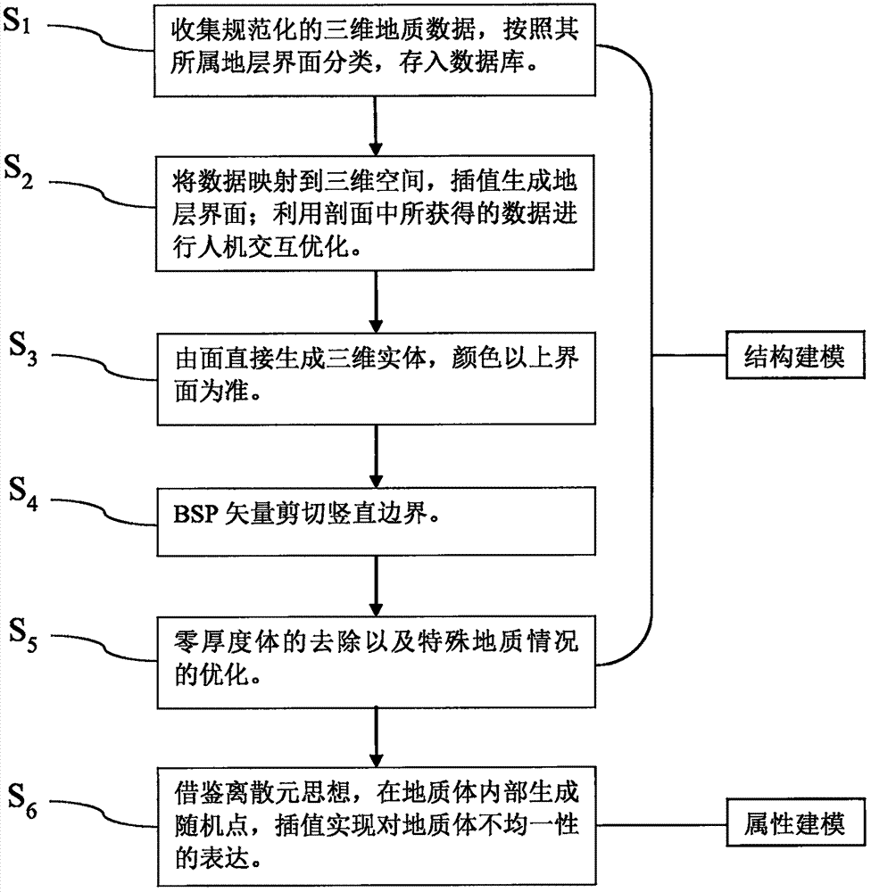
[0025] Such as figure 1 As shown, the gridless method of the three-dimensional geological modeling of embodiment 1 of the present invention comprises the following steps:
[0026] S 1 1. Collect the available normalized data of the modeling scope class, classify and organize these data, and import them into the database. The data mentioned are not necessarily borehole data, and standardized and unified data from other sources (remote sensing data, seismic data, etc.) can also be used. Data classification is to judge the interface position of different formations according to the borehole, and then store the position information on the same interface in the same table of the database in the form of thre...
PUM
 Abstract
Description
Claims
Application Information
 - R&D
- Intellectual Property
- Life Sciences
- Materials
- Tech Scout
- Unparalleled Data Quality
- Higher Quality Content
- 60% Fewer Hallucinations
Browse by: Latest US Patents, China's latest patents, Technical Efficacy Thesaurus, Application Domain, Technology Topic, Popular Technical Reports.
© 2025 PatSnap. All rights reserved.Legal|Privacy policy|Modern Slavery Act Transparency Statement|Sitemap|About US| Contact US: help@patsnap.com


