Three-dimensional forest fire spreading simulation method and system
A technology of forest fire spread and simulation method, applied in the field of 3D-based forest fire spread simulation method and system, can solve problems such as low prediction accuracy and limited application of fire spread model, and achieve high-precision effects
- Summary
- Abstract
- Description
- Claims
- Application Information
AI Technical Summary
Problems solved by technology
Method used
Image


Examples
Embodiment 1
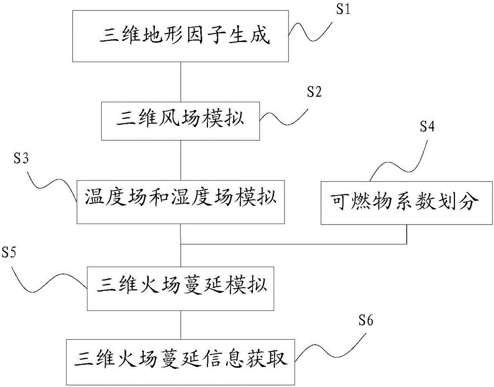
[0043] Such as figure 1 As shown, a kind of method for simulating forest fire spread based on three-dimensional that the present embodiment provides, comprises the following steps:
[0044] S1: 3D terrain factor generation:
[0045] Three-dimensional spatial analysis of the digital elevation model is carried out on the GIS platform to obtain slope and aspect maps.
[0046] Among them, the GIS platform preferably uses Arcgis, which has a spatial analysis module that can automatically analyze a digital elevation model (DEM, Digital Elevation Model). A 3D map with slope and aspect data is obtained. In addition, Arcgis contains a large number of programmable components, which improves the scalability of GIS platform applications.
[0047] S2: 3D wind field simulation:
[0048] Based on the data of the digital elevation model, the wind speed and direction are simulated to obtain the wind field data on the three-dimensional terrain;
[0049] The simulation of wind speed and win...
Embodiment 2
[0077] Such as figure 2 As shown, the present embodiment provides a three-dimensional forest fire spread simulation system for implementing the method described in Embodiment 1. The system includes the following functional modules:
[0078] The three-dimensional terrain factor generation module 101 is used to perform three-dimensional space analysis on the digital elevation model on the GIS platform, and obtain slope and slope aspect maps;
[0079] The three-dimensional wind field simulation module 102 is used to simulate wind speed and wind direction on the basis of digital elevation model data, and obtain wind field data on the three-dimensional terrain;
[0080] The temperature field and humidity field simulation module 103 is used for interpolation processing based on discrete temperature, humidity and digital elevation model data; this module is specifically used for:
[0081] Based on the discrete temperature, humidity and digital elevation model data, eliminate the al...
PUM
 Abstract
Description
Claims
Application Information
 - R&D
- Intellectual Property
- Life Sciences
- Materials
- Tech Scout
- Unparalleled Data Quality
- Higher Quality Content
- 60% Fewer Hallucinations
Browse by: Latest US Patents, China's latest patents, Technical Efficacy Thesaurus, Application Domain, Technology Topic, Popular Technical Reports.
© 2025 PatSnap. All rights reserved.Legal|Privacy policy|Modern Slavery Act Transparency Statement|Sitemap|About US| Contact US: help@patsnap.com